Property Record
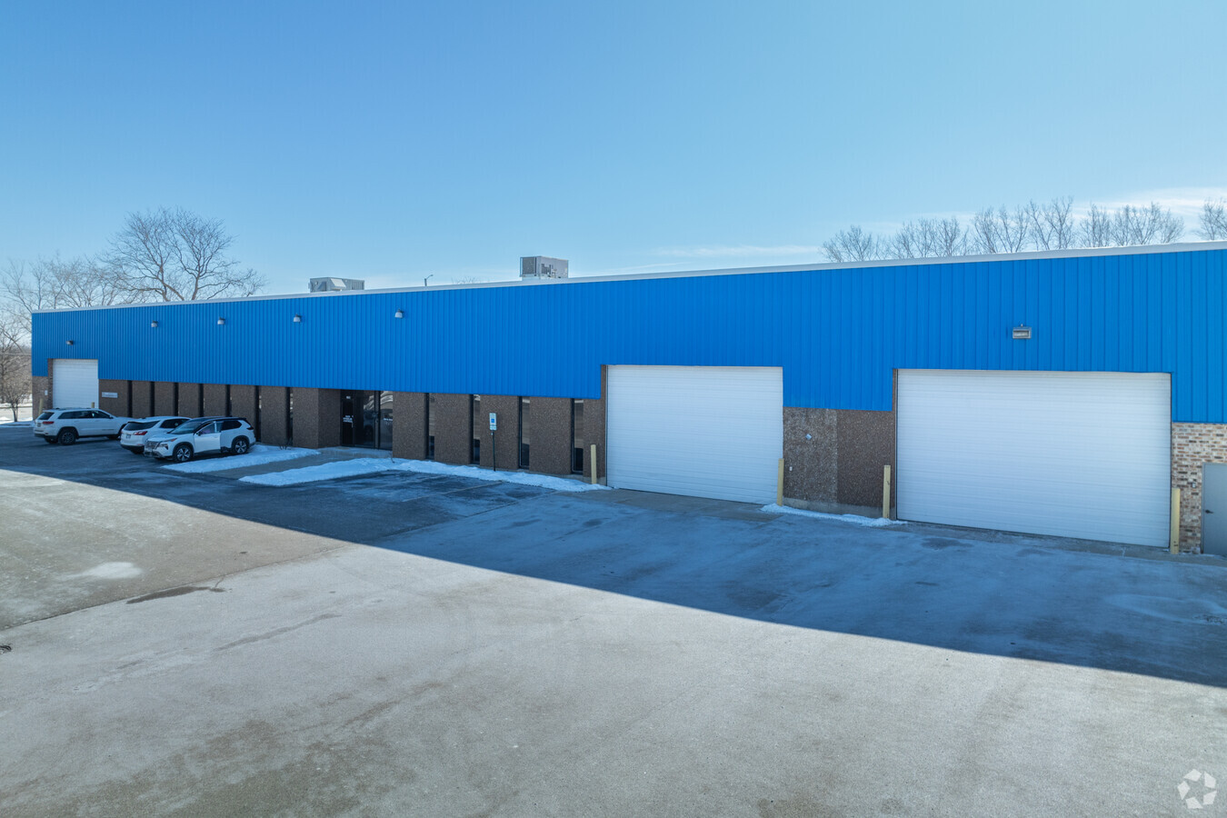
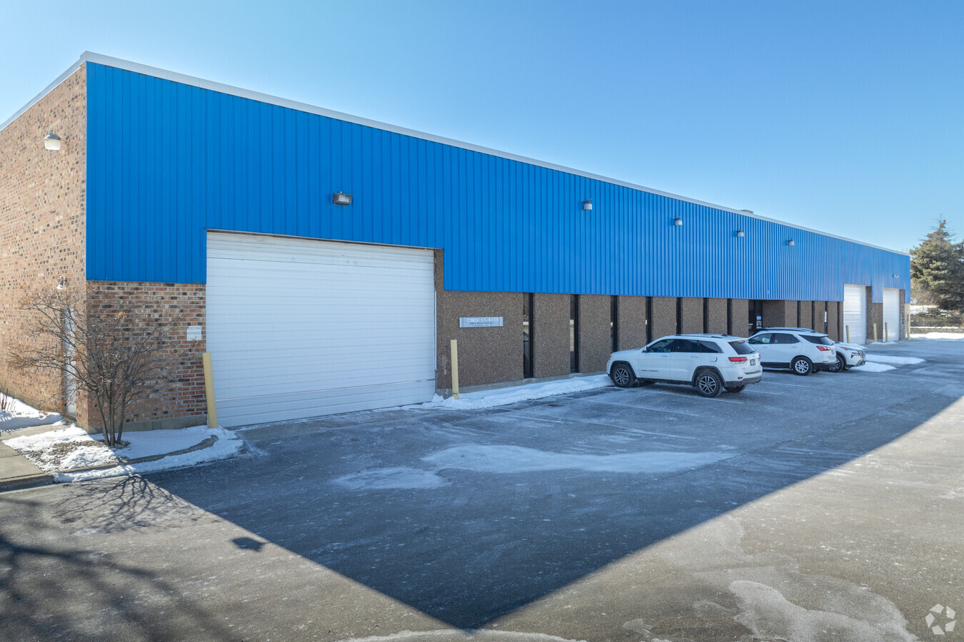
1700 S Butterfield Rd, Mundelein, IL 60060
Current Lease Availabilities
NEARBY LISTINGS FOR SALE OR LEASE
Property Detail
1700 S Butterfield Rd
Chicago-Naperville-Elgin, IL-IN-WI
Butterfield 60 Unit 3
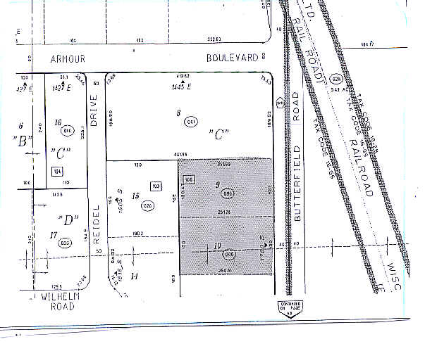
15-05-105-008
BUTTERFIELD 60 UNIT 3 LOT 9
Industrialgeneral
Lake
X
Illinois
17097C0251K
9
2022
1.01 AC
2023
South Lake County
864510
Chicago
DEMOGRAPHICS near 1700 S Butterfield Rd
1 Mile
3 Mile
5 Mile
2024 Total Population
15,941
65,080
134,180
2029 Population
16,131
64,825
133,551
Pop Growth 2024-2029
+ 1.19%
(0.39%)
(0.47%)
Average Age
39
40
41
2024 Total Households
6,391
23,695
48,732
HH Growth 2024-2029
+ 1.22%
(0.38%)
(0.46%)
Median Household Inc
$91,592
$108,948
$125,901
Avg Household Size
2.40
2.70
2.70
2024 Avg HH Vehicles
2.00
2.00
2.00
Median Home Value
$287,245
$349,081
$409,682
Median Year Built
1985
1983
1985
Nearby Places
- Restaurants
- Banks
- Shops
- Fitness
- Groceries
PUBLIC TRANSPORTATION
COMMUTER RAIL
Vernon Hills Station (North Central Service - Northeast Illinois Regional Commuter Railroad (Metra))
DRIVE
WALK
Distance
Vernon Hills Station (North Central Service - Northeast Illinois Regional Commuter Railroad (Metra))
3 min
1.8 mi
Mundelein Station (North Central Service - Northeast Illinois Regional Commuter Railroad (Metra))
DRIVE
WALK
Distance
Mundelein Station (North Central Service - Northeast Illinois Regional Commuter Railroad (Metra))
7 min
3.5 mi
AIRPORT
Chicago O'Hare International
DRIVE
WALK
Distance
Chicago O'Hare International
33 min
23.7 mi
Freight Ports
Port Milwaukee
DRIVE
WALK
Distance
Port Milwaukee
71 min
56.9 mi
Nearby Properties
Address
Land Use
TOTAL SIZE
Lot Size
Zoning
Address
Land Use
TOTAL SIZE
Lot Size
Zoning
Address
Land Use
TOTAL SIZE
Lot Size
Zoning
12.96 AC
Address
Land Use
TOTAL SIZE
Lot Size
Zoning
23.12 AC
Address
Land Use
TOTAL SIZE
Lot Size
Zoning
28.14 AC
Address
Land Use
TOTAL SIZE
Lot Size
Zoning
Address
Land Use
TOTAL SIZE
Lot Size
Zoning
Address
Land Use
TOTAL SIZE
Lot Size
Zoning
Address
Land Use
TOTAL SIZE
Lot Size
Zoning
Address
Land Use
TOTAL SIZE
Lot Size
Zoning
16.20 AC
Address
Land Use
TOTAL SIZE
Lot Size
Zoning
10.24 AC
Address
Land Use
TOTAL SIZE
Lot Size
Zoning
Address
Land Use
TOTAL SIZE
Lot Size
Zoning
43.14 AC
Address
Land Use
TOTAL SIZE
Lot Size
Zoning
22.16 AC
Address
Land Use
TOTAL SIZE
Lot Size
Zoning
13.39 AC
Address
Land Use
TOTAL SIZE
Lot Size
Zoning
10.80 AC
Address
Land Use
TOTAL SIZE
Lot Size
Zoning
12.65 AC
Address
Land Use
TOTAL SIZE
Lot Size
Zoning
22.58 AC
Address
Land Use
TOTAL SIZE
Lot Size
Zoning
Address
Land Use
TOTAL SIZE
Lot Size
Zoning
Address
Land Use
TOTAL SIZE
Lot Size
Zoning
10.07 AC
Address
Land Use
TOTAL SIZE
Lot Size
Zoning
9.25 AC
Address
Land Use
TOTAL SIZE
Lot Size
Zoning
Address
Land Use
TOTAL SIZE
Lot Size
Zoning
Address
Land Use
TOTAL SIZE
Lot Size
Zoning
Address
Land Use
TOTAL SIZE
Lot Size
Zoning
Address
Land Use
TOTAL SIZE
Lot Size
Zoning
12.57 AC
Address
Land Use
TOTAL SIZE
Lot Size
Zoning
21.11 AC
Address
Land Use
TOTAL SIZE
Lot Size
Zoning
Address
Land Use
TOTAL SIZE
Lot Size
Zoning
Address
Land Use
TOTAL SIZE
Lot Size
Zoning
The World's #1 Commercial Real Estate Marketplace
Connect with us
© 2025 CoStar Group
The information above has been obtained from sources believed reliable. While we do not doubt its accuracy we have not verified it and make no guarantee, warranty or representation about it. It is your responsibility to independently confirm its accuracy and completeness. Any projections, opinions, assumptions, or estimates used are for example only and do not represent the current or future performance of the property. The value of this transaction to you depends on tax and other factors which should be evaluated by your tax, financial, and legal advisors. You and your advisors should conduct a careful, independent investigation of the property to determine to your satisfaction the suitability of the property for your needs.