Property Record
1690 S 1700 S, San Mateo, CA 94402


Current Lease Availabilities
NEARBY LISTINGS FOR SALE OR LEASE
Property Detail
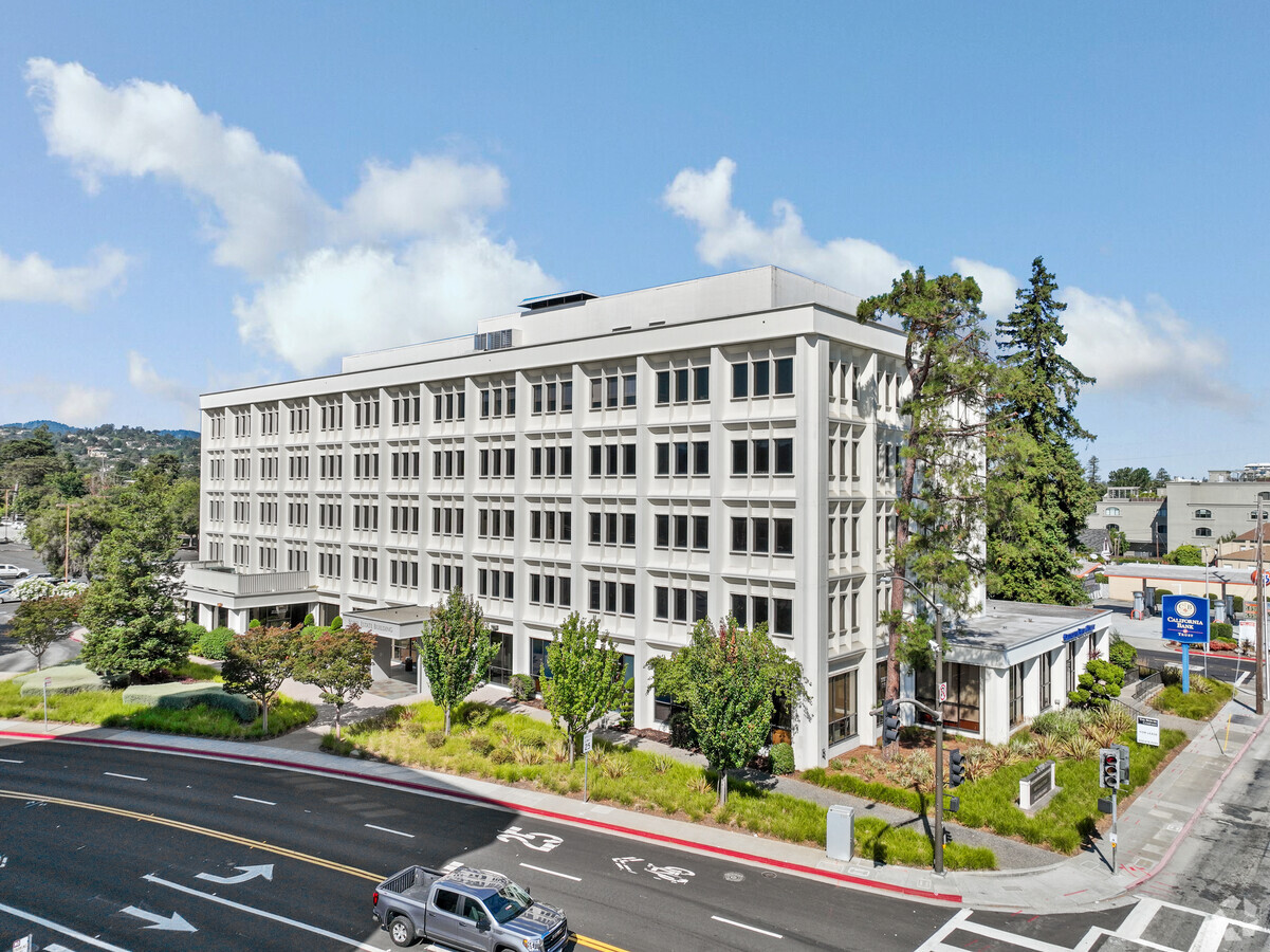
1690 S 1700 S
San Francisco-Redwood City-South San Francisco, CA
Grosvenor Park
039-012-010
PARCEL 1 3.0971 AC MOL PARCEL MAP VOL 68/32-33
Officebuilding
San Mateo
2024
California
2023
3.11 AC
606500
San Mateo
77,715 SF
San Francisco
DEMOGRAPHICS near 1690 S 1700 S
1 Mile
3 Mile
5 Mile
2024 Total Population
25,494
160,960
238,704
2029 Population
24,388
153,846
227,982
Pop Growth 2024-2029
(4.34%)
(4.42%)
(4.49%)
Average Age
42
41
42
2024 Total Households
10,032
61,188
90,659
HH Growth 2024-2029
(4.62%)
(4.61%)
(4.68%)
Median Household Inc
$131,425
$149,363
$157,252
Avg Household Size
2.40
2.50
2.60
2024 Avg HH Vehicles
2.00
2.00
2.00
Median Home Value
$1,132,423
$1,122,787
$1,128,203
Median Year Built
1962
1967
1968
Nearby Places
- Restaurants
- Banks
- Shops
- Fitness
- Groceries
PUBLIC TRANSPORTATION
COMMUTER RAIL
Hayward Park (Caltrain - Caltrain (Caltrain))
DRIVE
WALK
Distance
Hayward Park (Caltrain - Caltrain (Caltrain))
4 min
20 min
1.1 mi
San Mateo (Caltrain - Caltrain (Caltrain))
DRIVE
WALK
Distance
San Mateo (Caltrain - Caltrain (Caltrain))
4 min
1.4 mi
AIRPORT
San Francisco International
DRIVE
WALK
Distance
San Francisco International
14 min
8.2 mi
Metro Oakland International
DRIVE
WALK
Distance
Metro Oakland International
34 min
25.8 mi
Norman Y Mineta San Jose International
DRIVE
WALK
Distance
Norman Y Mineta San Jose International
35 min
27.1 mi
Freight Ports
Port of Redwood City
DRIVE
WALK
Distance
Port of Redwood City
15 min
10.0 mi
Nearby Properties
Address
Land Use
TOTAL SIZE
Lot Size
Zoning
Address
Land Use
TOTAL SIZE
Lot Size
Zoning
1,068,445 SF
39.91 AC
Address
Land Use
TOTAL SIZE
Lot Size
Zoning
8.65 AC
Address
Land Use
TOTAL SIZE
Lot Size
Zoning
239,107 SF
2.37 AC
Address
Land Use
TOTAL SIZE
Lot Size
Zoning
354,800 SF
6 AC
Address
Land Use
TOTAL SIZE
Lot Size
Zoning
5.73 AC
Address
Land Use
TOTAL SIZE
Lot Size
Zoning
277,784 SF
10.95 AC
Address
Land Use
TOTAL SIZE
Lot Size
Zoning
397,793 SF
10.48 AC
CL00C1
Address
Land Use
TOTAL SIZE
Lot Size
Zoning
215,318 SF
3.42 AC
Address
Land Use
TOTAL SIZE
Lot Size
Zoning
568,423 SF
16.07 AC
Address
Land Use
TOTAL SIZE
Lot Size
Zoning
311,952 SF
3.68 AC
Address
Land Use
TOTAL SIZE
Lot Size
Zoning
399,422 SF
5.99 AC
Address
Land Use
TOTAL SIZE
Lot Size
Zoning
260,547 SF
2.26 AC
Address
Land Use
TOTAL SIZE
Lot Size
Zoning
295,000 SF
4.02 AC
Address
Land Use
TOTAL SIZE
Lot Size
Zoning
547,306 SF
3.92 AC
Address
Land Use
TOTAL SIZE
Lot Size
Zoning
400,000 SF
4.38 AC
C10000
Address
Land Use
TOTAL SIZE
Lot Size
Zoning
219,318 SF
4.77 AC
Address
Land Use
TOTAL SIZE
Lot Size
Zoning
326,432 SF
10.27 AC
CL0C21
Address
Land Use
TOTAL SIZE
Lot Size
Zoning
337,459 SF
17.09 AC
EA0000
Address
Land Use
TOTAL SIZE
Lot Size
Zoning
245,260 SF
9.06 AC
Address
Land Use
TOTAL SIZE
Lot Size
Zoning
218,249 SF
2.15 AC
Address
Land Use
TOTAL SIZE
Lot Size
Zoning
395,010 SF
15.12 AC
R003S3
Address
Land Use
TOTAL SIZE
Lot Size
Zoning
192,054 SF
4.54 AC
Address
Land Use
TOTAL SIZE
Lot Size
Zoning
196,504 SF
1.98 AC
Address
Land Use
TOTAL SIZE
Lot Size
Zoning
233,788 SF
3.35 AC
Address
Land Use
TOTAL SIZE
Lot Size
Zoning
204,729 SF
2.70 AC
Address
Land Use
TOTAL SIZE
Lot Size
Zoning
5.47 AC
CBD000
Address
Land Use
TOTAL SIZE
Lot Size
Zoning
319,696 SF
3.12 AC
Address
Land Use
TOTAL SIZE
Lot Size
Zoning
188,303 SF
1.76 AC
Address
Land Use
TOTAL SIZE
Lot Size
Zoning
Address
Land Use
TOTAL SIZE
Lot Size
Zoning
The World's #1 Commercial Real Estate Marketplace
Connect with us
© 2025 CoStar Group
The information above has been obtained from sources believed reliable. While we do not doubt its accuracy we have not verified it and make no guarantee, warranty or representation about it. It is your responsibility to independently confirm its accuracy and completeness. Any projections, opinions, assumptions, or estimates used are for example only and do not represent the current or future performance of the property. The value of this transaction to you depends on tax and other factors which should be evaluated by your tax, financial, and legal advisors. You and your advisors should conduct a careful, independent investigation of the property to determine to your satisfaction the suitability of the property for your needs.