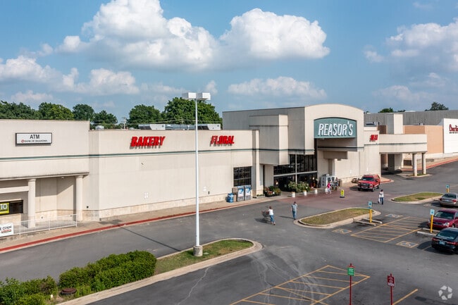
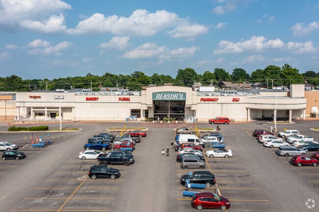
Property Record
1701 S Yale Ave, Tulsa, OK 74112
Property Detail
1701 S Yale Ave
99310-93-10-31880
PRT W/2 SW BEG 1318.81S & 50W NWC SW TH E941.64 S335.90 W941.86 N30 E223.50 N198 W223.50 N115.89 POB SEC 10 19 13 6.332ACS
Departmentstore
Tulsa
CH
Oklahoma
B and X Area of moderate flood hazard, usually the area between the limits of the 100-year and 500-year floods.
10.56 AC
2025
North Central Tulsa
2025
Tulsa
003800
Tulsa, OK
127,321 SF
NEARBY LISTINGS FOR SALE OR LEASE
DEMOGRAPHICS near 1701 S Yale Ave
1 mile
3 mile
5 mile
2025 Total Population
9,263
96,946
241,515
2030 Population
9,524
100,487
250,241
Pop Growth 2025-2030
+ 2.82%
+ 3.65%
+ 3.61%
Average Age
40
39
38
2025 Total Households
4,391
41,405
101,784
HH Growth 2025-2030
+ 2.94%
+ 3.81%
+ 3.78%
Median Household Inc
$69,426
$56,192
$54,745
Avg Household Size
2.00
2.20
2.20
2025 Avg HH Vehicles
2.00
2.00
2.00
Median Home Value
$184,894
$186,344
$184,359
Median Year Built
1953
1956
1964
Nearby Places
Map Layers
Map Styles
 Street
 Aerial
Layers
 Traffic
 Biking
Places
Listings with unknown addresses are not visible on the map
- Restaurants
- Banks
- Shops
- Fitness
- Groceries
PUBLIC TRANSPORTATION
AIRPORT
Tulsa International
Drive
Walk
Distance
Tulsa International
15 min
7.2 mi
Freight Ports
Drive
Walk
Distance
23 min
15.5 mi
Nearby Properties
Address
Land Use
TOTAL SIZE
Lot Size
Zoning
Address
Land Use
TOTAL SIZE
Lot Size
Zoning
1,303,210 SF
7.94 AC
OH
Address
Land Use
TOTAL SIZE
Lot Size
Zoning
1,604,892 SF
208.96 AC
AG
Address
Land Use
TOTAL SIZE
Lot Size
Zoning
1,673,798 SF
90.26 AC
NCU
Address
Land Use
TOTAL SIZE
Lot Size
Zoning
431,569 SF
39.02 AC
RM2
Address
Land Use
TOTAL SIZE
Lot Size
Zoning
247,806 SF
8.40 AC
RS3
Address
Land Use
TOTAL SIZE
Lot Size
Zoning
110,922 SF
1.59 AC
RM2
Address
Land Use
TOTAL SIZE
Lot Size
Zoning
114,791 SF
23.40 AC
RE
Address
Land Use
TOTAL SIZE
Lot Size
Zoning
238,884 SF
38.79 AC
RS2
Address
Land Use
TOTAL SIZE
Lot Size
Zoning
350,741 SF
28.01 AC
CS
Address
Land Use
TOTAL SIZE
Lot Size
Zoning
175,176 SF
1.57 AC
RM2
Address
Land Use
TOTAL SIZE
Lot Size
Zoning
230,620 SF
16.72 AC
RM2
Address
Land Use
TOTAL SIZE
Lot Size
Zoning
216,280 SF
41.17 AC
RS2
Address
Land Use
TOTAL SIZE
Lot Size
Zoning
46,859 SF
5.80 AC
CH
Address
Land Use
TOTAL SIZE
Lot Size
Zoning
66,541 SF
6.05 AC
CN
Address
Land Use
TOTAL SIZE
Lot Size
Zoning
146,538 SF
2.56 AC
CS
Address
Land Use
TOTAL SIZE
Lot Size
Zoning
1,264,325 SF
10.72 AC
CH
Address
Land Use
TOTAL SIZE
Lot Size
Zoning
108,416 SF
4.26 AC
OM
Address
Land Use
TOTAL SIZE
Lot Size
Zoning
45,191 SF
6.30 AC
CS
Address
Land Use
TOTAL SIZE
Lot Size
Zoning
60,320 SF
5.23 AC
NCU
Address
Land Use
TOTAL SIZE
Lot Size
Zoning
180,642 SF
5.14 AC
CS
Address
Land Use
TOTAL SIZE
Lot Size
Zoning
163,321 SF
10.74 AC
RS3
Address
Land Use
TOTAL SIZE
Lot Size
Zoning
63,384 SF
0.56 AC
OH
Address
Land Use
TOTAL SIZE
Lot Size
Zoning
46,610 SF
14.99 AC
RM2
Address
Land Use
TOTAL SIZE
Lot Size
Zoning
77,346 SF
8.59 AC
RS3
Address
Land Use
TOTAL SIZE
Lot Size
Zoning
51,539 SF
0.96 AC
RM2
Address
Land Use
TOTAL SIZE
Lot Size
Zoning
96,983 SF
5.42 AC
RM2
Address
Land Use
TOTAL SIZE
Lot Size
Zoning
66,276 SF
3.97 AC
IL
Address
Land Use
TOTAL SIZE
Lot Size
Zoning
105,620 SF
2.55 AC
RM2
Address
Land Use
TOTAL SIZE
Lot Size
Zoning
118,824 SF
38.79 AC
IM
Address
Land Use
TOTAL SIZE
Lot Size
Zoning
194,615 SF
18.68 AC
RS3
The World's #1 Commercial Real Estate Marketplace
Connect with us
© 2026 CoStar Group
The information above has been obtained from sources believed reliable. While we do not doubt its accuracy we have not verified it and make no guarantee, warranty or representation about it. It is your responsibility to independently confirm its accuracy and completeness. Any projections, opinions, assumptions, or estimates used are for example only and do not represent the current or future performance of the property. The value of this transaction to you depends on tax and other factors which should be evaluated by your tax, financial, and legal advisors. You and your advisors should conduct a careful, independent investigation of the property to determine to your satisfaction the suitability of the property for your needs.