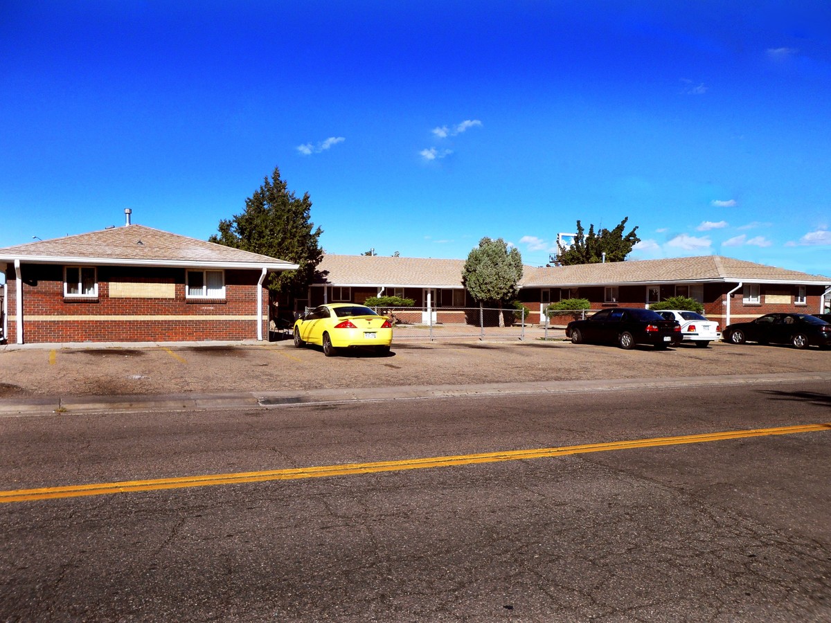
Property Record
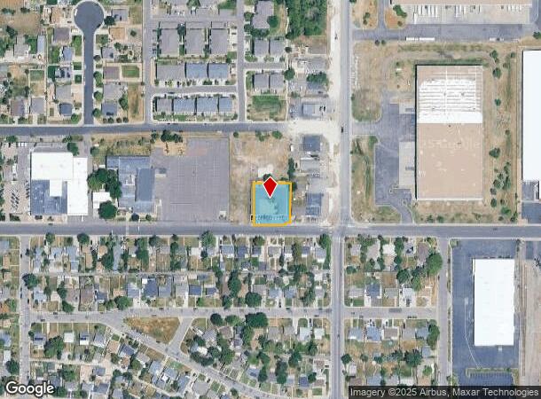
1707 W 52Nd Ave, Denver, CO 80221
NEARBY LISTINGS FOR SALE OR LEASE
Property Detail
1707 W 52Nd Ave
Denver-Aurora-Lakewood, CO
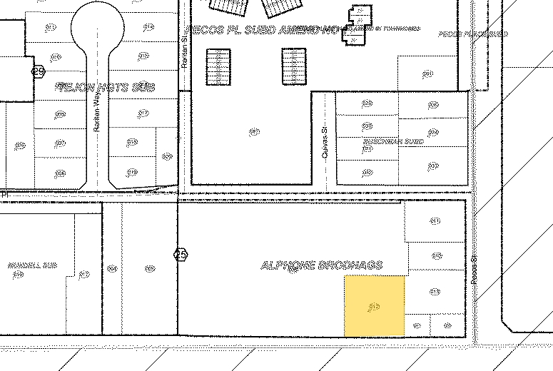
Alphonse Brodhags Of Blk 1 Greenwood
1825-16-2-25-012
SUB:ALPHONSE BRODHAGS OF BLK 1 GREENWOOD LOT:45 - LOT:49 DESC: AND VAC ALLEY
Multifamilydwelling
Adams
X
Colorado
08059C0220F
45
2023
0.43 AC
2024
North Denver
009752
Denver
5,972 SF
DEMOGRAPHICS near 1707 W 52Nd Ave
1 Mile
3 Mile
5 Mile
2024 Total Population
9,555
138,725
425,814
2029 Population
9,781
142,206
434,044
Pop Growth 2024-2029
+ 2.37%
+ 2.51%
+ 1.93%
Average Age
39
37
38
2024 Total Households
3,670
64,257
194,802
HH Growth 2024-2029
+ 2.13%
+ 2.46%
+ 1.89%
Median Household Inc
$82,053
$89,543
$75,974
Avg Household Size
2.50
2.10
2.10
2024 Avg HH Vehicles
2.00
2.00
2.00
Median Home Value
$482,590
$602,561
$492,908
Median Year Built
1957
1983
1971
Nearby Places
- Restaurants
- Banks
- Shops
- Fitness
- Groceries
PUBLIC TRANSPORTATION
COMMUTER RAIL
Pecos Junction Station Track 1 (Union Station to Westminster Station - Regional Transportation District, Union Station to Wheat Ridge Ward Station - Regional Transportation District)
DRIVE
WALK
Distance
Pecos Junction Station Track 1 (Union Station to Westminster Station - Regional Transportation District, Union Station to Wheat Ridge Ward Station - Regional Transportation District)
3 min
1.2 mi
Clear Creek - Federal Station Track 1 (Union Station to Wheat Ridge Ward Station - Regional Transportation District)
DRIVE
WALK
Distance
Clear Creek - Federal Station Track 1 (Union Station to Wheat Ridge Ward Station - Regional Transportation District)
5 min
2.1 mi
AIRPORT
Denver International
DRIVE
WALK
Distance
Denver International
30 min
23.7 mi
Freight Ports
Tulsa Port Of Catoosa
DRIVE
WALK
Distance
Tulsa Port Of Catoosa
727 min
709.3 mi
Nearby Properties
Address
Land Use
TOTAL SIZE
Lot Size
Zoning
Address
Land Use
TOTAL SIZE
Lot Size
Zoning
688,230 SF
0.94 AC
PUD
Address
Land Use
TOTAL SIZE
Lot Size
Zoning
150,202 SF
13.24 AC
T-MU-30
Address
Land Use
TOTAL SIZE
Lot Size
Zoning
1,563,630 SF
2.53 AC
D-C
Address
Land Use
TOTAL SIZE
Lot Size
Zoning
1,027,206 SF
2.44 AC
D-C
Address
Land Use
TOTAL SIZE
Lot Size
Zoning
321,759 SF
0.88 AC
PUD
Address
Land Use
TOTAL SIZE
Lot Size
Zoning
405,974 SF
1.78 AC
PUD
Address
Land Use
TOTAL SIZE
Lot Size
Zoning
492,926 SF
1.16 AC
PUD
Address
Land Use
TOTAL SIZE
Lot Size
Zoning
618,768 SF
1.23 AC
D-C
Address
Land Use
TOTAL SIZE
Lot Size
Zoning
515,064 SF
1.25 AC
D-LD
Address
Land Use
TOTAL SIZE
Lot Size
Zoning
888,385 SF
20.40 AC
I-A
Address
Land Use
TOTAL SIZE
Lot Size
Zoning
860,132 SF
68.50 AC
R-5
Address
Land Use
TOTAL SIZE
Lot Size
Zoning
424,862 SF
32.28 AC
G-MU-3
Address
Land Use
TOTAL SIZE
Lot Size
Zoning
409,752 SF
1.26 AC
D-LD
Address
Land Use
TOTAL SIZE
Lot Size
Zoning
449,651 SF
1.66 AC
C-MX-8
Address
Land Use
TOTAL SIZE
Lot Size
Zoning
370,529 SF
1.27 AC
D-LD
Address
Land Use
TOTAL SIZE
Lot Size
Zoning
689,700 SF
1.53 AC
D-C
Address
Land Use
TOTAL SIZE
Lot Size
Zoning
285,490 SF
0.62 AC
T-MU-30
Address
Land Use
TOTAL SIZE
Lot Size
Zoning
366,725 SF
1.36 AC
C-MX-5
Address
Land Use
TOTAL SIZE
Lot Size
Zoning
222,000 SF
2.98 AC
PUD-G
Address
Land Use
TOTAL SIZE
Lot Size
Zoning
381,044 SF
0.93 AC
D-LD
Address
Land Use
TOTAL SIZE
Lot Size
Zoning
425,117 SF
1.23 AC
PUD
Address
Land Use
TOTAL SIZE
Lot Size
Zoning
25,000 SF
40.42 AC
I-A
Address
Land Use
TOTAL SIZE
Lot Size
Zoning
3,188 SF
81.17 AC
I-B
Address
Land Use
TOTAL SIZE
Lot Size
Zoning
362,262 SF
1.39 AC
C-MX-5
Address
Land Use
TOTAL SIZE
Lot Size
Zoning
168,898 SF
44.89 AC
D-CPV-C
Address
Land Use
TOTAL SIZE
Lot Size
Zoning
921,863 SF
2.01 AC
C-MX
Address
Land Use
TOTAL SIZE
Lot Size
Zoning
334,682 SF
0.72 AC
D-LD
Address
Land Use
TOTAL SIZE
Lot Size
Zoning
411,501 SF
0.95 AC
D-C
Address
Land Use
TOTAL SIZE
Lot Size
Zoning
386,089 SF
0.79 AC
I-MX-8
Address
Land Use
TOTAL SIZE
Lot Size
Zoning
269,393 SF
0.58 AC
PUD
The World's #1 Commercial Real Estate Marketplace
Connect with us
© 2025 CoStar Group
The information above has been obtained from sources believed reliable. While we do not doubt its accuracy we have not verified it and make no guarantee, warranty or representation about it. It is your responsibility to independently confirm its accuracy and completeness. Any projections, opinions, assumptions, or estimates used are for example only and do not represent the current or future performance of the property. The value of this transaction to you depends on tax and other factors which should be evaluated by your tax, financial, and legal advisors. You and your advisors should conduct a careful, independent investigation of the property to determine to your satisfaction the suitability of the property for your needs.