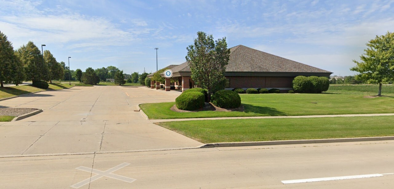
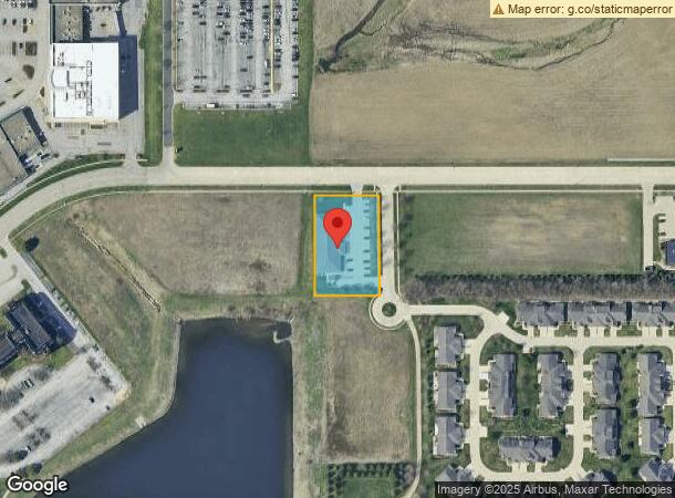
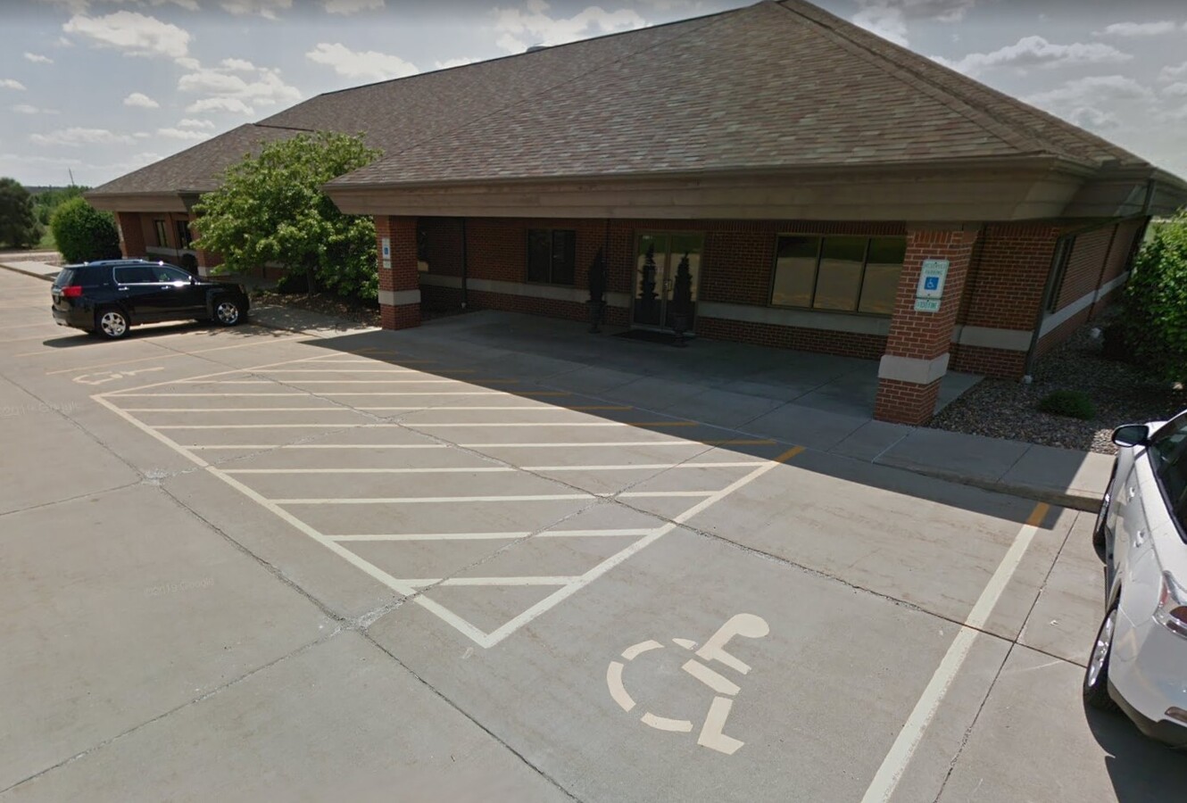
Property Record
1709 Jumer Dr, Bloomington, IL 61704
NEARBY LISTINGS FOR SALE OR LEASE
Property Detail
1709 Jumer Dr
Bloomington, IL
First Addition To Shirk Commercial Sub
14-26-403-002
SHIRK COMMERCIAL SUB 1ST ADD LT 6
Commercialnec
Mclean
X
Illinois
17113C0314E
6
2022
1.08 AC
2022
Bloomington/Normal
000504
Other Market Areas
18,848 SF
DEMOGRAPHICS near 1709 Jumer Dr
1 Mile
3 Mile
5 Mile
2024 Total Population
11,124
85,915
127,503
2029 Population
11,011
85,884
127,721
Pop Growth 2024-2029
(1.02%)
(0.04%)
+ 0.17%
Average Age
38
36
37
2024 Total Households
4,806
34,313
52,163
HH Growth 2024-2029
(1.04%)
(0.05%)
+ 0.19%
Median Household Inc
$69,685
$69,430
$66,045
Avg Household Size
2.30
2.20
2.20
2024 Avg HH Vehicles
2.00
2.00
2.00
Median Home Value
$184,812
$194,610
$182,318
Median Year Built
1979
1980
1981
Nearby Places
- Restaurants
- Banks
- Shops
- Fitness
- Groceries
PUBLIC TRANSPORTATION
COMMUTER RAIL
Bloomington-Normal (Lincoln Service - Amtrak, Lincoln Service Missouri River Runner - Amtrak, Texas Eagle - Amtrak)
DRIVE
WALK
Distance
Bloomington-Normal (Lincoln Service - Amtrak, Lincoln Service Missouri River Runner - Amtrak, Texas Eagle - Amtrak)
6 min
2.4 mi
AIRPORT
Central Il Regional/Bloomington-Normal
DRIVE
WALK
Distance
Central Il Regional/Bloomington-Normal
10 min
3.5 mi
Freight Ports
Port Milwaukee
DRIVE
WALK
Distance
Port Milwaukee
238 min
204.2 mi
SALE & LEASE HISTORY
LISTING DATE
SALE/LEASE

Jul 25, 2022
For Lease
Nearby Properties
Address
Land Use
TOTAL SIZE
Lot Size
Zoning
Address
Land Use
TOTAL SIZE
Lot Size
Zoning
1,867,780 SF
48.61 AC
Address
Land Use
TOTAL SIZE
Lot Size
Zoning
682,885 SF
44.48 AC
Address
Land Use
TOTAL SIZE
Lot Size
Zoning
562,852 SF
48.94 AC
Address
Land Use
TOTAL SIZE
Lot Size
Zoning
1,624,618 SF
54.32 AC
Address
Land Use
TOTAL SIZE
Lot Size
Zoning
493,944 SF
2.95 AC
R-3A
Address
Land Use
TOTAL SIZE
Lot Size
Zoning
154,502 SF
1.25 AC
Address
Land Use
TOTAL SIZE
Lot Size
Zoning
454,529 SF
19.25 AC
Address
Land Use
TOTAL SIZE
Lot Size
Zoning
445,676 SF
20.86 AC
Address
Land Use
TOTAL SIZE
Lot Size
Zoning
426,806 SF
20.93 AC
Address
Land Use
TOTAL SIZE
Lot Size
Zoning
127,569 SF
1.54 AC
Address
Land Use
TOTAL SIZE
Lot Size
Zoning
95,242 SF
7.52 AC
Address
Land Use
TOTAL SIZE
Lot Size
Zoning
414,270 SF
13.50 AC
Address
Land Use
TOTAL SIZE
Lot Size
Zoning
177,365 SF
11.75 AC
Address
Land Use
TOTAL SIZE
Lot Size
Zoning
123,016 SF
18.52 AC
C-2
Address
Land Use
TOTAL SIZE
Lot Size
Zoning
126,418 SF
1.06 AC
Address
Land Use
TOTAL SIZE
Lot Size
Zoning
423,526 SF
25.35 AC
B-1
Address
Land Use
TOTAL SIZE
Lot Size
Zoning
136,382 SF
9.53 AC
Address
Land Use
TOTAL SIZE
Lot Size
Zoning
16.79 AC
Address
Land Use
TOTAL SIZE
Lot Size
Zoning
388,851 SF
4.40 AC
Address
Land Use
TOTAL SIZE
Lot Size
Zoning
276,695 SF
12.68 AC
Address
Land Use
TOTAL SIZE
Lot Size
Zoning
122,112 SF
7.16 AC
Address
Land Use
TOTAL SIZE
Lot Size
Zoning
208,876 SF
20.87 AC
B-1
Address
Land Use
TOTAL SIZE
Lot Size
Zoning
231,077 SF
15.49 AC
Address
Land Use
TOTAL SIZE
Lot Size
Zoning
295,802 SF
14.99 AC
Address
Land Use
TOTAL SIZE
Lot Size
Zoning
141,694 SF
5.75 AC
Address
Land Use
TOTAL SIZE
Lot Size
Zoning
191,880 SF
3 AC
B-1
Address
Land Use
TOTAL SIZE
Lot Size
Zoning
281,134 SF
8.04 AC
R-3A
Address
Land Use
TOTAL SIZE
Lot Size
Zoning
223,726 SF
10.15 AC
Address
Land Use
TOTAL SIZE
Lot Size
Zoning
83.87 AC
Address
Land Use
TOTAL SIZE
Lot Size
Zoning
105,746 SF
8.17 AC
B-1
The World's #1 Commercial Real Estate Marketplace
Connect with us
© 2025 CoStar Group
The information above has been obtained from sources believed reliable. While we do not doubt its accuracy we have not verified it and make no guarantee, warranty or representation about it. It is your responsibility to independently confirm its accuracy and completeness. Any projections, opinions, assumptions, or estimates used are for example only and do not represent the current or future performance of the property. The value of this transaction to you depends on tax and other factors which should be evaluated by your tax, financial, and legal advisors. You and your advisors should conduct a careful, independent investigation of the property to determine to your satisfaction the suitability of the property for your needs.