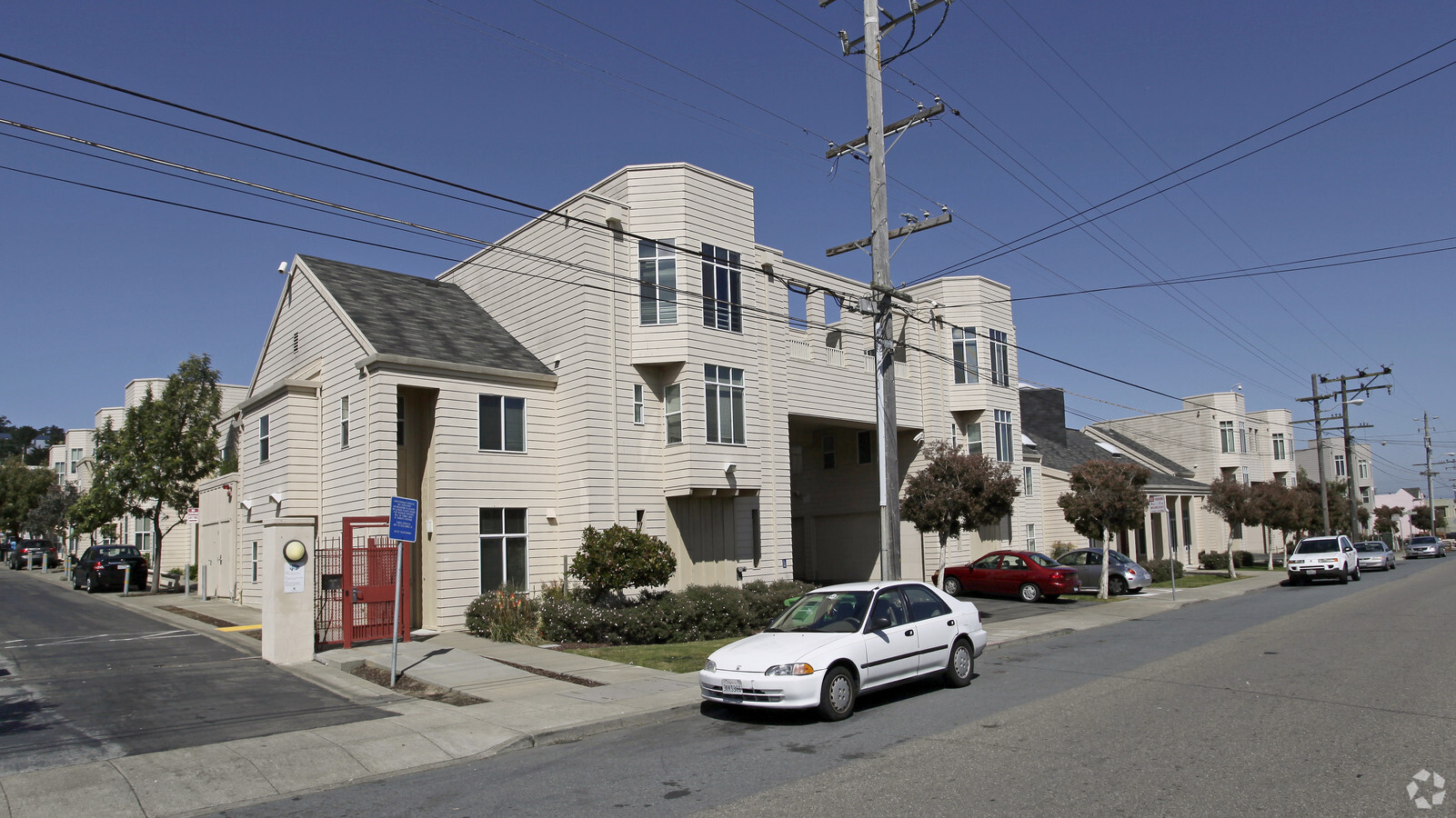
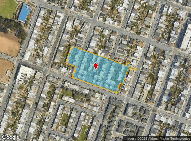
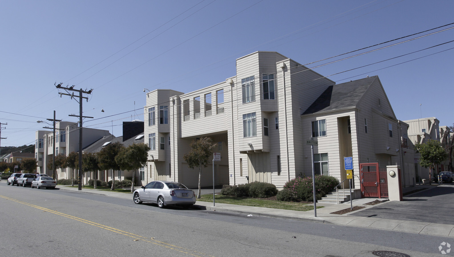
Property Record
171 Loehr St, San Francisco, CA 94134
NEARBY LISTINGS FOR SALE OR LEASE
Property Detail
171 Loehr St
San Francisco-Redwood City-South San Francisco, CA
Sunnyvale Hd Assn
6300-043
San Francisco
Apartment
California
0
43
2023
3.68 AC
025900
Visitacion Valley
95,469 SF
San Francisco
DEMOGRAPHICS near 171 Loehr St
1 Mile
3 Mile
5 Mile
2024 Total Population
32,057
246,915
657,581
2029 Population
29,307
225,683
610,260
Pop Growth 2024-2029
(8.58%)
(8.60%)
(7.20%)
Average Age
43
43
42
2024 Total Households
8,870
79,972
246,324
HH Growth 2024-2029
(9.06%)
(8.96%)
(7.55%)
Median Household Inc
$83,095
$118,033
$121,616
Avg Household Size
3.40
2.90
2.50
2024 Avg HH Vehicles
2.00
2.00
1.00
Median Home Value
$996,130
$1,059,627
$1,078,606
Median Year Built
1956
1950
1954
Nearby Places
- Restaurants
- Banks
- Shops
- Fitness
- Groceries
PUBLIC TRANSPORTATION
TRANSIT/SUBWAY
Sunnydale Station (T Third Street - San Francisco Municipal Railway (MUNI Metro))
DRIVE
WALK
Distance
Sunnydale Station (T Third Street - San Francisco Municipal Railway (MUNI Metro))
1 min
10 min
0.5 mi
Arleta Station (T Third Street - San Francisco Municipal Railway (MUNI Metro))
DRIVE
WALK
Distance
Arleta Station (T Third Street - San Francisco Municipal Railway (MUNI Metro))
2 min
15 min
0.8 mi
COMMUTER RAIL
Bayshore Caltrain Station (Local - Caltrain (Caltrain))
DRIVE
WALK
Distance
Bayshore Caltrain Station (Local - Caltrain (Caltrain))
3 min
19 min
1.0 mi
22Nd Street (Caltrain - Caltrain (Caltrain))
DRIVE
WALK
Distance
22Nd Street (Caltrain - Caltrain (Caltrain))
8 min
5.2 mi
AIRPORT
San Francisco International
DRIVE
WALK
Distance
San Francisco International
16 min
8.6 mi
Metro Oakland International
DRIVE
WALK
Distance
Metro Oakland International
37 min
24.6 mi
Freight Ports
Port of San Francisco
DRIVE
WALK
Distance
Port of San Francisco
13 min
7.4 mi
Nearby Properties
Address
Land Use
TOTAL SIZE
Lot Size
Zoning
Address
Land Use
TOTAL SIZE
Lot Size
Zoning
248,303 SF
4.35 AC
Address
Land Use
TOTAL SIZE
Lot Size
Zoning
346,710 SF
7.45 AC
RH2
Address
Land Use
TOTAL SIZE
Lot Size
Zoning
54,000 SF
1.66 AC
PDR2
Address
Land Use
TOTAL SIZE
Lot Size
Zoning
42.10 AC
Address
Land Use
TOTAL SIZE
Lot Size
Zoning
439,294 SF
5.43 AC
PDR2
Address
Land Use
TOTAL SIZE
Lot Size
Zoning
201,793 SF
5.66 AC
OA0000
Address
Land Use
TOTAL SIZE
Lot Size
Zoning
8.87 AC
OA0000
Address
Land Use
TOTAL SIZE
Lot Size
Zoning
183,284 SF
7.34 AC
PD0000
Address
Land Use
TOTAL SIZE
Lot Size
Zoning
143,920 SF
7.29 AC
PDR2
Address
Land Use
TOTAL SIZE
Lot Size
Zoning
28,300 SF
4.94 AC
M2
Address
Land Use
TOTAL SIZE
Lot Size
Zoning
100,655 SF
4.56 AC
Address
Land Use
TOTAL SIZE
Lot Size
Zoning
18,904 SF
0.93 AC
NC3
Address
Land Use
TOTAL SIZE
Lot Size
Zoning
160,983 SF
1.84 AC
NC2
Address
Land Use
TOTAL SIZE
Lot Size
Zoning
13,200 SF
3.54 AC
PDR2
Address
Land Use
TOTAL SIZE
Lot Size
Zoning
1.33 AC
M1
Address
Land Use
TOTAL SIZE
Lot Size
Zoning
31,400 SF
2.76 AC
PDR2
Address
Land Use
TOTAL SIZE
Lot Size
Zoning
279,560 SF
13.23 AC
M10000
Address
Land Use
TOTAL SIZE
Lot Size
Zoning
160,000 SF
1.27 AC
C2
Address
Land Use
TOTAL SIZE
Lot Size
Zoning
268,042 SF
15 AC
A00000
Address
Land Use
TOTAL SIZE
Lot Size
Zoning
6.87 AC
RH2
Address
Land Use
TOTAL SIZE
Lot Size
Zoning
107,362 SF
5.74 AC
M1
Address
Land Use
TOTAL SIZE
Lot Size
Zoning
2.62 AC
RH1
Address
Land Use
TOTAL SIZE
Lot Size
Zoning
73,966 SF
4 AC
M10000
Address
Land Use
TOTAL SIZE
Lot Size
Zoning
44,890 SF
1.48 AC
M1
Address
Land Use
TOTAL SIZE
Lot Size
Zoning
73.91 AC
Address
Land Use
TOTAL SIZE
Lot Size
Zoning
257,754 SF
1.37 AC
Address
Land Use
TOTAL SIZE
Lot Size
Zoning
14,876 SF
0.15 AC
NCT1
Address
Land Use
TOTAL SIZE
Lot Size
Zoning
67,432 SF
4.31 AC
CL00C1
Address
Land Use
TOTAL SIZE
Lot Size
Zoning
87,525 SF
1.65 AC
RM1
The World's #1 Commercial Real Estate Marketplace
Connect with us
© 2025 CoStar Group
The information above has been obtained from sources believed reliable. While we do not doubt its accuracy we have not verified it and make no guarantee, warranty or representation about it. It is your responsibility to independently confirm its accuracy and completeness. Any projections, opinions, assumptions, or estimates used are for example only and do not represent the current or future performance of the property. The value of this transaction to you depends on tax and other factors which should be evaluated by your tax, financial, and legal advisors. You and your advisors should conduct a careful, independent investigation of the property to determine to your satisfaction the suitability of the property for your needs.