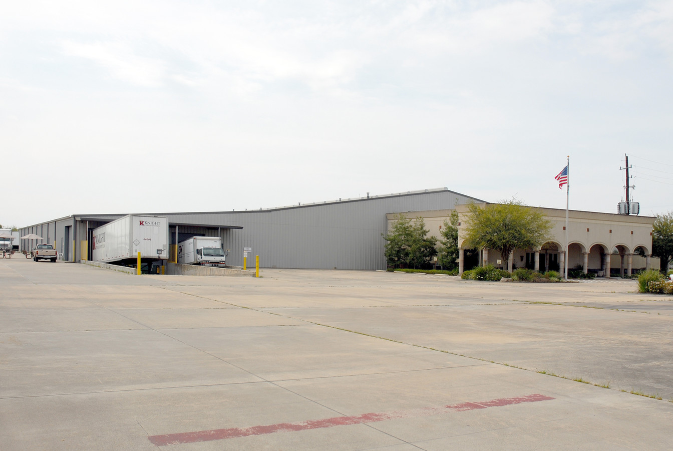
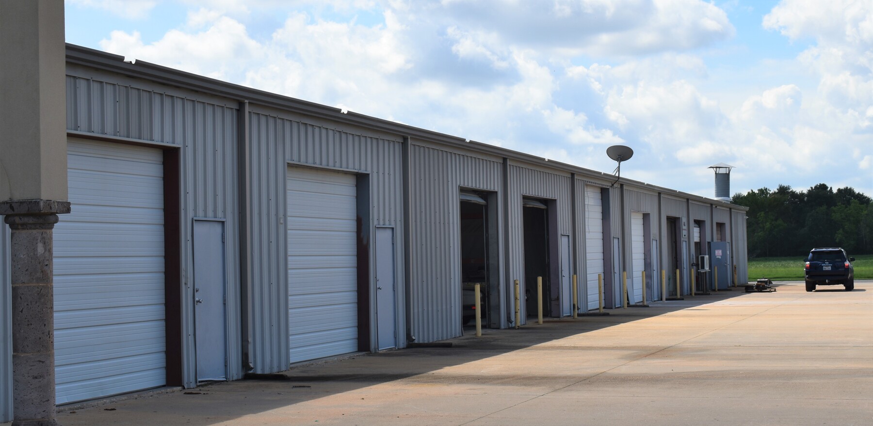
Property Record
17105 Groschke Rd, Houston, TX 77084
NEARBY LISTINGS FOR SALE OR LEASE
Property Detail
17105 Groschke Rd
0421200000011
Abst 259 P S Elgin
Warehouse
TR 1B ABST 259 P S ELGIN
X
Harris
48201C0610M
Texas
2023
6.33 AC
2023
Northwest Outliers
5417033003
Houston
64,040 SF
Houston-The Woodlands-Sugar Land, TX
DEMOGRAPHICS near 17105 Groschke Rd
1 Mile
3 Mile
5 Mile
2024 Total Population
1,647
74,864
273,138
2029 Population
1,657
76,192
277,762
Pop Growth 2024-2029
+ 0.61%
+ 1.77%
+ 1.69%
Average Age
35
36
36
2024 Total Households
435
25,247
91,369
HH Growth 2024-2029
+ 0.69%
+ 1.88%
+ 1.68%
Median Household Inc
$87,094
$73,398
$76,416
Avg Household Size
3.50
2.90
2.90
2024 Avg HH Vehicles
2.00
2.00
2.00
Median Home Value
$198,683
$208,158
$220,539
Median Year Built
2006
1993
1997
Nearby Places
- Restaurants
- Banks
- Shops
- Fitness
- Groceries
PUBLIC TRANSPORTATION
AIRPORT
George Bush Intcntl/Houston
DRIVE
WALK
Distance
George Bush Intcntl/Houston
43 min
31.7 mi
William P Hobby
DRIVE
WALK
Distance
William P Hobby
53 min
34.0 mi
Freight Ports
Port of Houston
DRIVE
WALK
Distance
Port of Houston
47 min
30.8 mi
SALE & LEASE HISTORY
LISTING DATE
SALE/LEASE

Aug 31, 2022
For Lease
Nearby Properties
Address
Land Use
TOTAL SIZE
Lot Size
Zoning
Address
Land Use
TOTAL SIZE
Lot Size
Zoning
1,045,896 SF
11.14 AC
Address
Land Use
TOTAL SIZE
Lot Size
Zoning
439,347 SF
13.50 AC
Address
Land Use
TOTAL SIZE
Lot Size
Zoning
538,027 SF
30.06 AC
Address
Land Use
TOTAL SIZE
Lot Size
Zoning
458,613 SF
19.50 AC
Address
Land Use
TOTAL SIZE
Lot Size
Zoning
613,621 SF
5.47 AC
Address
Land Use
TOTAL SIZE
Lot Size
Zoning
375,486 SF
12.36 AC
Address
Land Use
TOTAL SIZE
Lot Size
Zoning
341,844 SF
16.71 AC
Address
Land Use
TOTAL SIZE
Lot Size
Zoning
343,605 SF
11.90 AC
Address
Land Use
TOTAL SIZE
Lot Size
Zoning
489,188 SF
5.99 AC
Address
Land Use
TOTAL SIZE
Lot Size
Zoning
460,786 SF
9 AC
Address
Land Use
TOTAL SIZE
Lot Size
Zoning
305,624 SF
13.12 AC
Address
Land Use
TOTAL SIZE
Lot Size
Zoning
284,321 SF
10.54 AC
Address
Land Use
TOTAL SIZE
Lot Size
Zoning
363,880 SF
17.32 AC
Address
Land Use
TOTAL SIZE
Lot Size
Zoning
486,927 SF
5.88 AC
Address
Land Use
TOTAL SIZE
Lot Size
Zoning
323,753 SF
14.11 AC
Address
Land Use
TOTAL SIZE
Lot Size
Zoning
370,329 SF
5 AC
Address
Land Use
TOTAL SIZE
Lot Size
Zoning
294,642 SF
14.47 AC
Address
Land Use
TOTAL SIZE
Lot Size
Zoning
471,037 SF
5.35 AC
Address
Land Use
TOTAL SIZE
Lot Size
Zoning
331,923 SF
13.27 AC
Address
Land Use
TOTAL SIZE
Lot Size
Zoning
335,483 SF
13.83 AC
Address
Land Use
TOTAL SIZE
Lot Size
Zoning
345,272 SF
6.85 AC
Address
Land Use
TOTAL SIZE
Lot Size
Zoning
347,192 SF
16.10 AC
Address
Land Use
TOTAL SIZE
Lot Size
Zoning
305,624 SF
Address
Land Use
TOTAL SIZE
Lot Size
Zoning
219,426 SF
10.23 AC
Address
Land Use
TOTAL SIZE
Lot Size
Zoning
229,728 SF
5.92 AC
Address
Land Use
TOTAL SIZE
Lot Size
Zoning
170,903 SF
15.53 AC
Address
Land Use
TOTAL SIZE
Lot Size
Zoning
262,492 SF
10.04 AC
Address
Land Use
TOTAL SIZE
Lot Size
Zoning
392,672 SF
9.73 AC
Address
Land Use
TOTAL SIZE
Lot Size
Zoning
277,552 SF
15.41 AC
Address
Land Use
TOTAL SIZE
Lot Size
Zoning
403,080 SF
19.17 AC
The World's #1 Commercial Real Estate Marketplace
Connect with us
© 2025 CoStar Group
The information above has been obtained from sources believed reliable. While we do not doubt its accuracy we have not verified it and make no guarantee, warranty or representation about it. It is your responsibility to independently confirm its accuracy and completeness. Any projections, opinions, assumptions, or estimates used are for example only and do not represent the current or future performance of the property. The value of this transaction to you depends on tax and other factors which should be evaluated by your tax, financial, and legal advisors. You and your advisors should conduct a careful, independent investigation of the property to determine to your satisfaction the suitability of the property for your needs.