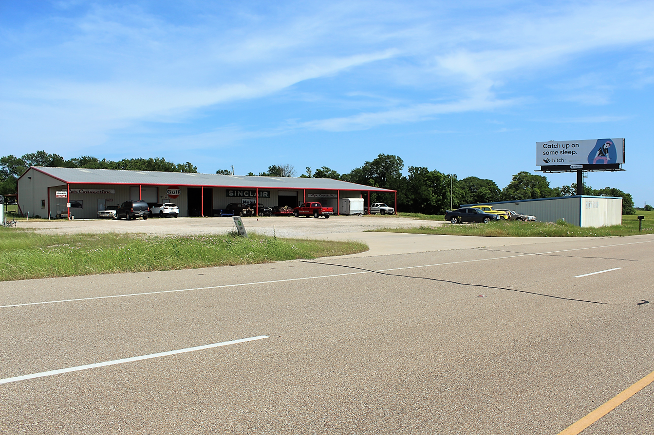
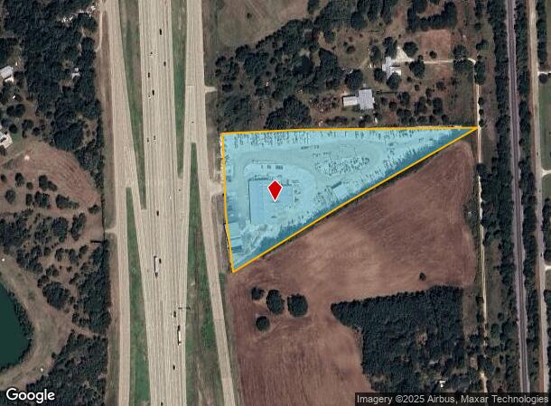
Property Record
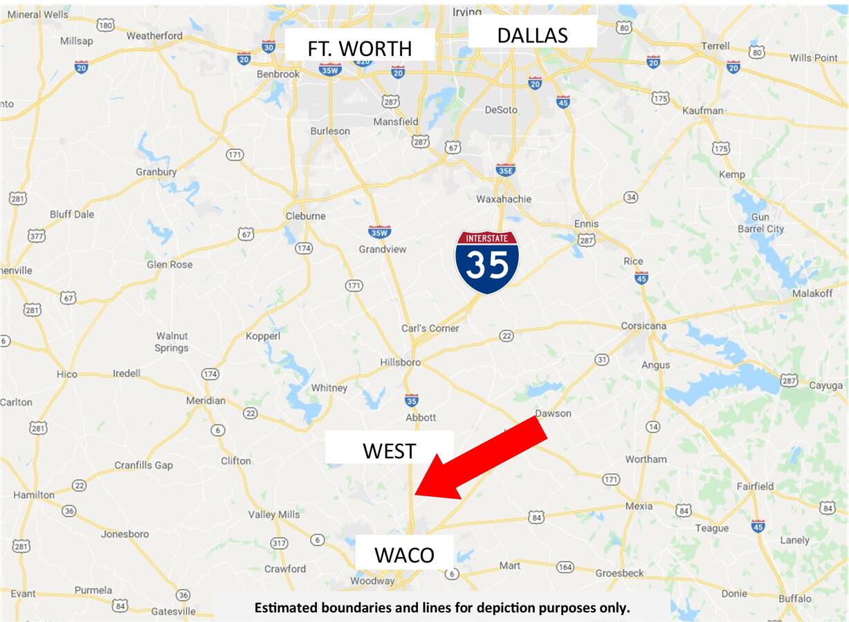
17140 N Interstate 35, West, TX 76691
NEARBY LISTINGS FOR SALE OR LEASE
-
-
View all West listings for sale on LoopNet.com
Property Detail
17140 N Interstate 35
50-062600-000301-6
Makeig F
Commercialnec
MAKEIG F (A-626) 1.87 AC & MORENO J (A-26) 3.71 AC TOTAL 5.58
X
Mclennan
48309C0225D
Texas
2024
5.58 AC
2024
Waco & Killeen
004201
Other Market Areas
20,550 SF
Waco, TX
DEMOGRAPHICS near 17140 N Interstate 35
1 Mile
3 Mile
5 Mile
2024 Total Population
107
1,508
7,379
2029 Population
109
1,535
7,596
Pop Growth 2024-2029
+ 1.87%
+ 1.79%
+ 2.94%
Average Age
42
41
41
2024 Total Households
42
571
2,833
HH Growth 2024-2029
+ 2.38%
+ 1.93%
+ 3.11%
Median Household Inc
$74,999
$71,470
$68,128
Avg Household Size
2.50
2.60
2.50
2024 Avg HH Vehicles
2.00
2.00
2.00
Median Home Value
$244,444
$205,556
$188,140
Median Year Built
1982
1983
1982
Nearby Places
- Restaurants
- Banks
- Shops
- Fitness
- Groceries
PUBLIC TRANSPORTATION
AIRPORT
Waco Regional
DRIVE
WALK
Distance
Waco Regional
36 min
21.0 mi
Freight Ports
Port of Houston
DRIVE
WALK
Distance
Port of Houston
231 min
198.8 mi
SALE & LEASE HISTORY
LISTING DATE
SALE/LEASE

May 13, 2020
For Sale
Nearby Properties
Address
Land Use
TOTAL SIZE
Lot Size
Zoning
Address
Land Use
TOTAL SIZE
Lot Size
Zoning
9,694 SF
34.11 AC
R
Address
Land Use
TOTAL SIZE
Lot Size
Zoning
13,379 SF
8.99 AC
C
Address
Land Use
TOTAL SIZE
Lot Size
Zoning
18,850 SF
21.94 AC
R
Address
Land Use
TOTAL SIZE
Lot Size
Zoning
7,123 SF
14.62 AC
C
Address
Land Use
TOTAL SIZE
Lot Size
Zoning
12,952 SF
4.08 AC
R
Address
Land Use
TOTAL SIZE
Lot Size
Zoning
29,236 SF
8.82 AC
R
Address
Land Use
TOTAL SIZE
Lot Size
Zoning
20,290 SF
6.77 AC
R
Address
Land Use
TOTAL SIZE
Lot Size
Zoning
30,625 SF
19.48 AC
C
Address
Land Use
TOTAL SIZE
Lot Size
Zoning
8,300 SF
18.55 AC
R
Address
Land Use
TOTAL SIZE
Lot Size
Zoning
8,135 SF
8.33 AC
C
Address
Land Use
TOTAL SIZE
Lot Size
Zoning
24,300 SF
2.86 AC
Address
Land Use
TOTAL SIZE
Lot Size
Zoning
3,687 SF
80.13 AC
R
Address
Land Use
TOTAL SIZE
Lot Size
Zoning
3,599 SF
17.10 AC
R
Address
Land Use
TOTAL SIZE
Lot Size
Zoning
5,169 SF
10 AC
R
Address
Land Use
TOTAL SIZE
Lot Size
Zoning
3,041 SF
3.54 AC
Address
Land Use
TOTAL SIZE
Lot Size
Zoning
3,426 SF
21.96 AC
R
Address
Land Use
TOTAL SIZE
Lot Size
Zoning
5,037 SF
5 AC
R
Address
Land Use
TOTAL SIZE
Lot Size
Zoning
3,150 SF
4.29 AC
R
Address
Land Use
TOTAL SIZE
Lot Size
Zoning
17,000 SF
4.36 AC
C
Address
Land Use
TOTAL SIZE
Lot Size
Zoning
3,166 SF
10.07 AC
R
Address
Land Use
TOTAL SIZE
Lot Size
Zoning
3,520 SF
16.82 AC
R
Address
Land Use
TOTAL SIZE
Lot Size
Zoning
3,369 SF
4.54 AC
R
Address
Land Use
TOTAL SIZE
Lot Size
Zoning
3,981 SF
20.03 AC
R
Address
Land Use
TOTAL SIZE
Lot Size
Zoning
2,678 SF
24.39 AC
R
Address
Land Use
TOTAL SIZE
Lot Size
Zoning
4,156 SF
132.76 AC
R
Address
Land Use
TOTAL SIZE
Lot Size
Zoning
16,052 SF
5.66 AC
Address
Land Use
TOTAL SIZE
Lot Size
Zoning
3,008 SF
63.23 AC
R
Address
Land Use
TOTAL SIZE
Lot Size
Zoning
2,446 SF
5.20 AC
Address
Land Use
TOTAL SIZE
Lot Size
Zoning
3,105 SF
10 AC
R
The World's #1 Commercial Real Estate Marketplace
Connect with us
© 2025 CoStar Group
The information above has been obtained from sources believed reliable. While we do not doubt its accuracy we have not verified it and make no guarantee, warranty or representation about it. It is your responsibility to independently confirm its accuracy and completeness. Any projections, opinions, assumptions, or estimates used are for example only and do not represent the current or future performance of the property. The value of this transaction to you depends on tax and other factors which should be evaluated by your tax, financial, and legal advisors. You and your advisors should conduct a careful, independent investigation of the property to determine to your satisfaction the suitability of the property for your needs.