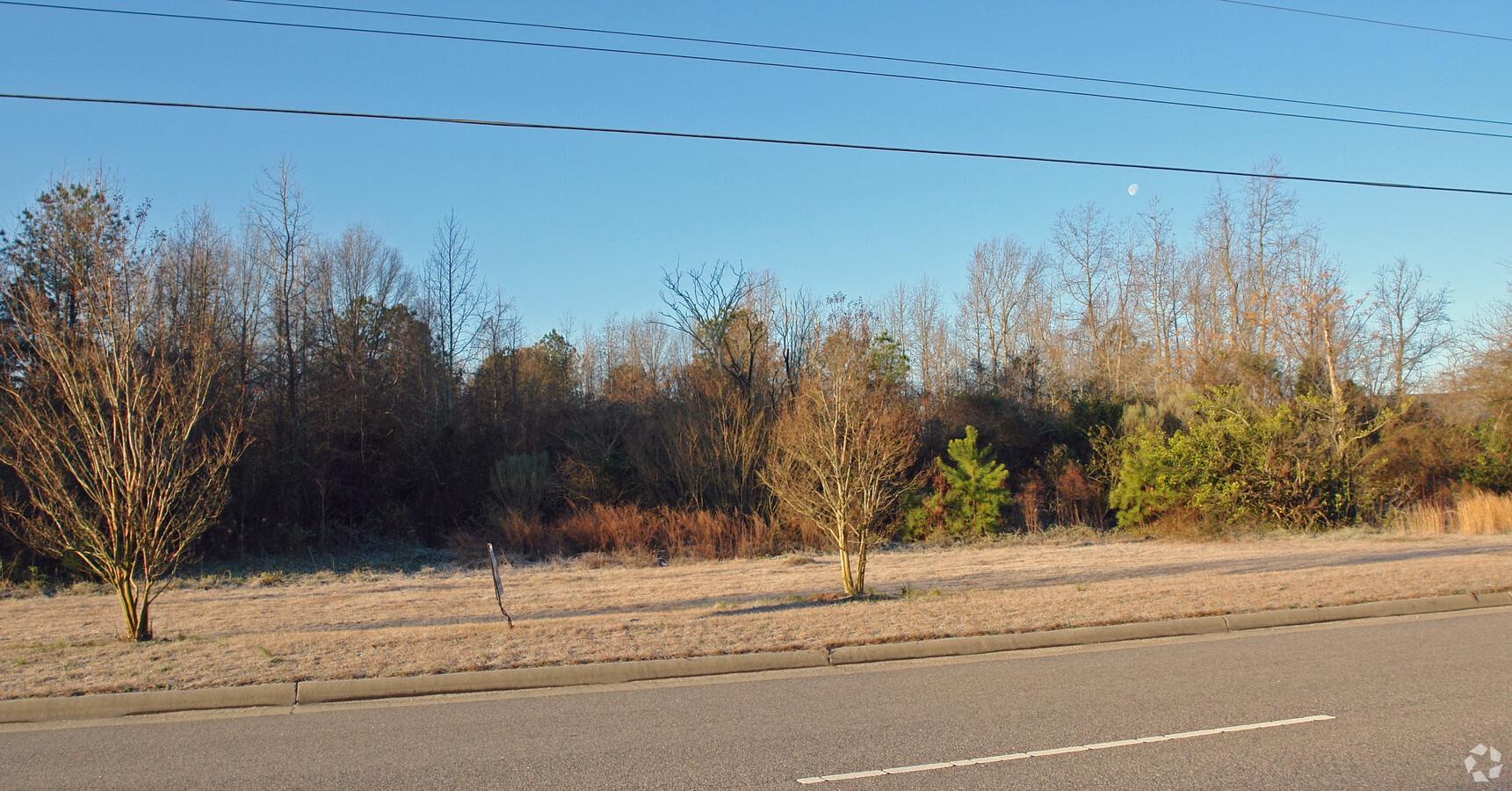
Property Record
1720 Lipscomb Rd E, Wilson, NC 27893
NEARBY LISTINGS FOR SALE OR LEASE
Property Detail
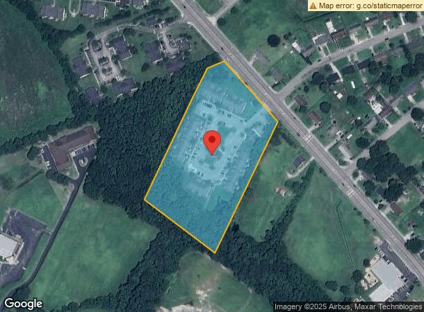
1720 Lipscomb Rd E
3731-07-6213.000
Dry Detention Pond Wesley Lndg
Apartment
1720 LIPSCOMB RD E 6.47AC
X
Wilson
3720373100K
North Carolina
2023
6.47 AC
2023
Rocky Mount/Wilson
000701
Other Market Areas
4,212 SF
Wilson, NC
DEMOGRAPHICS near 1720 Lipscomb Rd E
1 Mile
3 Mile
5 Mile
2024 Total Population
6,173
24,946
47,440
2029 Population
6,314
25,345
47,679
Pop Growth 2024-2029
+ 2.28%
+ 1.60%
+ 0.50%
Average Age
39
40
41
2024 Total Households
2,499
10,269
19,714
HH Growth 2024-2029
+ 2.28%
+ 1.56%
+ 0.47%
Median Household Inc
$29,226
$30,945
$44,774
Avg Household Size
2.30
2.30
2.30
2024 Avg HH Vehicles
1.00
1.00
2.00
Median Home Value
$103,481
$98,963
$146,982
Median Year Built
1984
1972
1980
Nearby Places
- Restaurants
- Banks
- Shops
- Fitness
- Groceries
PUBLIC TRANSPORTATION
COMMUTER RAIL
Wilson (Carolinian - Amtrak, Palmetto - Amtrak)
DRIVE
WALK
Distance
Wilson (Carolinian - Amtrak, Palmetto - Amtrak)
4 min
2.2 mi
AIRPORT
Pitt-Greenville
DRIVE
WALK
Distance
Pitt-Greenville
45 min
36.5 mi
Freight Ports
Port of Morehead City
DRIVE
WALK
Distance
Port of Morehead City
166 min
117.2 mi
Nearby Properties
Address
Land Use
TOTAL SIZE
Lot Size
Zoning
Address
Land Use
TOTAL SIZE
Lot Size
Zoning
27,122 SF
34.44 AC
ICD
Address
Land Use
TOTAL SIZE
Lot Size
Zoning
60,490 SF
75.58 AC
ICD
Address
Land Use
TOTAL SIZE
Lot Size
Zoning
259,000 SF
66.94 AC
HI
Address
Land Use
TOTAL SIZE
Lot Size
Zoning
16,355 SF
29.71 AC
ICD
Address
Land Use
TOTAL SIZE
Lot Size
Zoning
400,000 SF
101.30 AC
HI
Address
Land Use
TOTAL SIZE
Lot Size
Zoning
90,035 SF
91.87 AC
ICD
Address
Land Use
TOTAL SIZE
Lot Size
Zoning
192,420 SF
34.36 AC
HI
Address
Land Use
TOTAL SIZE
Lot Size
Zoning
91,637 SF
1.95 AC
CCMX
Address
Land Use
TOTAL SIZE
Lot Size
Zoning
49,850 SF
9.13 AC
ICD
Address
Land Use
TOTAL SIZE
Lot Size
Zoning
95,767 SF
1.01 AC
CCMX
Address
Land Use
TOTAL SIZE
Lot Size
Zoning
125,000 SF
73.36 AC
LI
Address
Land Use
TOTAL SIZE
Lot Size
Zoning
46,800 SF
51.19 AC
HI
Address
Land Use
TOTAL SIZE
Lot Size
Zoning
7,425 SF
707.94 AC
M2
Address
Land Use
TOTAL SIZE
Lot Size
Zoning
40,425 SF
35.52 AC
ICD
Address
Land Use
TOTAL SIZE
Lot Size
Zoning
195,718 SF
36.18 AC
HI
Address
Land Use
TOTAL SIZE
Lot Size
Zoning
129,404 SF
2.61 AC
HI
Address
Land Use
TOTAL SIZE
Lot Size
Zoning
54,400 SF
7.88 AC
GR6
Address
Land Use
TOTAL SIZE
Lot Size
Zoning
35,406 SF
2.90 AC
GR6
Address
Land Use
TOTAL SIZE
Lot Size
Zoning
41,946 SF
40 AC
ICD
Address
Land Use
TOTAL SIZE
Lot Size
Zoning
139,695 SF
33.53 AC
LI
Address
Land Use
TOTAL SIZE
Lot Size
Zoning
63,788 SF
16.30 AC
ICD
Address
Land Use
TOTAL SIZE
Lot Size
Zoning
61,472 SF
7.68 AC
NC
Address
Land Use
TOTAL SIZE
Lot Size
Zoning
2,480 SF
22.05 AC
RMX
Address
Land Use
TOTAL SIZE
Lot Size
Zoning
17,542 SF
1.88 AC
NMX
Address
Land Use
TOTAL SIZE
Lot Size
Zoning
42,840 SF
10.62 AC
HC
Address
Land Use
TOTAL SIZE
Lot Size
Zoning
51,620 SF
5.71 AC
GR6
Address
Land Use
TOTAL SIZE
Lot Size
Zoning
5,071 SF
228.61 AC
HI
Address
Land Use
TOTAL SIZE
Lot Size
Zoning
7,283 SF
14.90 AC
RMX
Address
Land Use
TOTAL SIZE
Lot Size
Zoning
13,182 SF
32.32 AC
ICD
Address
Land Use
TOTAL SIZE
Lot Size
Zoning
44,226 SF
5.45 AC
GR6
The World's #1 Commercial Real Estate Marketplace
Connect with us
© 2025 CoStar Group
The information above has been obtained from sources believed reliable. While we do not doubt its accuracy we have not verified it and make no guarantee, warranty or representation about it. It is your responsibility to independently confirm its accuracy and completeness. Any projections, opinions, assumptions, or estimates used are for example only and do not represent the current or future performance of the property. The value of this transaction to you depends on tax and other factors which should be evaluated by your tax, financial, and legal advisors. You and your advisors should conduct a careful, independent investigation of the property to determine to your satisfaction the suitability of the property for your needs.