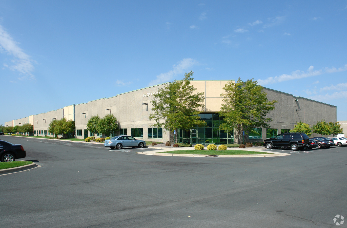
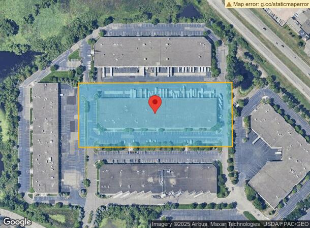
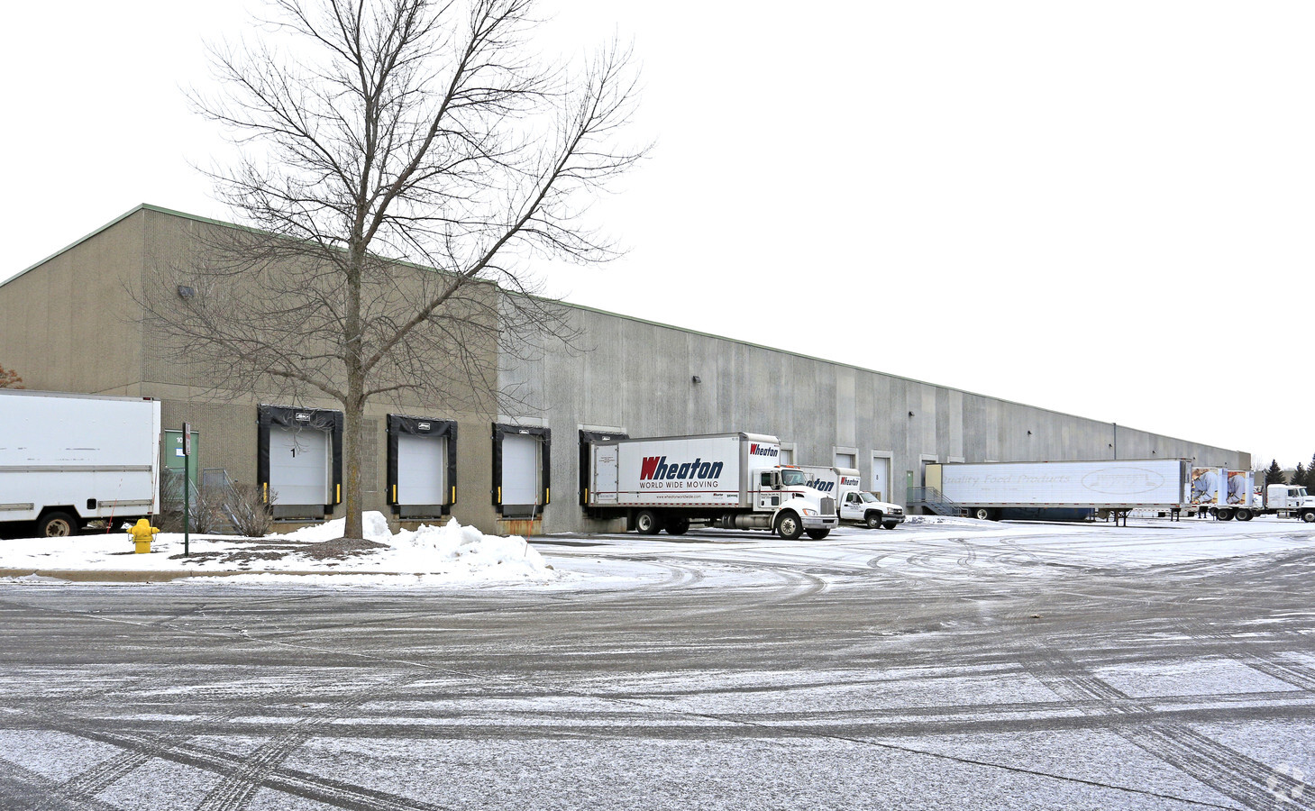
Property Record
17200 Medina Rd, Minneapolis, MN 55447

NEARBY LISTINGS FOR SALE OR LEASE
Property Detail
17200 Medina Rd
Minneapolis-St. Paul-Bloomington, MN-WI
Plymouth Ponds Business Park 3Rd Addn
17-118-22-33-0006
LOT 002 BLOCK 001 A PLYMOUTH PONDS BUSINESS PARK 3RD ADDN E 351X838X351X839
Industrialgeneral
Hennepin
X
Minnesota
27053C0190F
2
2024
6.75 AC
2023
Northwest
0266052007
Minneapolis/St Paul
DEMOGRAPHICS near 17200 Medina Rd
1 Mile
3 Mile
5 Mile
2024 Total Population
7,630
53,004
125,035
2029 Population
7,521
52,244
123,283
Pop Growth 2024-2029
(1.43%)
(1.43%)
(1.40%)
Average Age
43
39
41
2024 Total Households
2,824
19,648
48,351
HH Growth 2024-2029
(1.52%)
(1.71%)
(1.56%)
Median Household Inc
$130,641
$140,115
$127,503
Avg Household Size
2.60
2.60
2.50
2024 Avg HH Vehicles
2.00
2.00
2.00
Median Home Value
$468,914
$482,919
$460,105
Median Year Built
1993
1991
1988
Nearby Places
- Restaurants
- Banks
- Shops
- Fitness
- Groceries
PUBLIC TRANSPORTATION
AIRPORT
Minneapolis-St Paul International/Wold-Chamberlain
DRIVE
WALK
Distance
Minneapolis-St Paul International/Wold-Chamberlain
36 min
24.6 mi
Freight Ports
Port Milwaukee
DRIVE
WALK
Distance
Port Milwaukee
396 min
352.3 mi
SALE & LEASE HISTORY
LISTING DATE
SALE/LEASE

Oct 03, 2022
For Lease
Feb 02, 2017
For Lease
Nearby Properties
Address
Land Use
TOTAL SIZE
Lot Size
Zoning
Address
Land Use
TOTAL SIZE
Lot Size
Zoning
35.53 AC
Address
Land Use
TOTAL SIZE
Lot Size
Zoning
14.19 AC
Address
Land Use
TOTAL SIZE
Lot Size
Zoning
16.32 AC
Address
Land Use
TOTAL SIZE
Lot Size
Zoning
40.17 AC
Address
Land Use
TOTAL SIZE
Lot Size
Zoning
Address
Land Use
TOTAL SIZE
Lot Size
Zoning
15.86 AC
Address
Land Use
TOTAL SIZE
Lot Size
Zoning
22.20 AC
Address
Land Use
TOTAL SIZE
Lot Size
Zoning
16.35 AC
Address
Land Use
TOTAL SIZE
Lot Size
Zoning
18.65 AC
Address
Land Use
TOTAL SIZE
Lot Size
Zoning
Address
Land Use
TOTAL SIZE
Lot Size
Zoning
Address
Land Use
TOTAL SIZE
Lot Size
Zoning
Address
Land Use
TOTAL SIZE
Lot Size
Zoning
18.27 AC
Address
Land Use
TOTAL SIZE
Lot Size
Zoning
Address
Land Use
TOTAL SIZE
Lot Size
Zoning
Address
Land Use
TOTAL SIZE
Lot Size
Zoning
Address
Land Use
TOTAL SIZE
Lot Size
Zoning
Address
Land Use
TOTAL SIZE
Lot Size
Zoning
13.95 AC
Address
Land Use
TOTAL SIZE
Lot Size
Zoning
13.36 AC
Address
Land Use
TOTAL SIZE
Lot Size
Zoning
Address
Land Use
TOTAL SIZE
Lot Size
Zoning
8.81 AC
Address
Land Use
TOTAL SIZE
Lot Size
Zoning
14.73 AC
Address
Land Use
TOTAL SIZE
Lot Size
Zoning
16.75 AC
Address
Land Use
TOTAL SIZE
Lot Size
Zoning
Address
Land Use
TOTAL SIZE
Lot Size
Zoning
9.54 AC
Address
Land Use
TOTAL SIZE
Lot Size
Zoning
Address
Land Use
TOTAL SIZE
Lot Size
Zoning
Address
Land Use
TOTAL SIZE
Lot Size
Zoning
Address
Land Use
TOTAL SIZE
Lot Size
Zoning
17.51 AC
Address
Land Use
TOTAL SIZE
Lot Size
Zoning
The World's #1 Commercial Real Estate Marketplace
Connect with us
© 2025 CoStar Group
The information above has been obtained from sources believed reliable. While we do not doubt its accuracy we have not verified it and make no guarantee, warranty or representation about it. It is your responsibility to independently confirm its accuracy and completeness. Any projections, opinions, assumptions, or estimates used are for example only and do not represent the current or future performance of the property. The value of this transaction to you depends on tax and other factors which should be evaluated by your tax, financial, and legal advisors. You and your advisors should conduct a careful, independent investigation of the property to determine to your satisfaction the suitability of the property for your needs.