Property Record
17213 Parsons Rd, Brooksville, FL 34601
NEARBY LISTINGS FOR SALE OR LEASE
-
-
View all Brooksville listings for sale on LoopNet.com
Property Detail
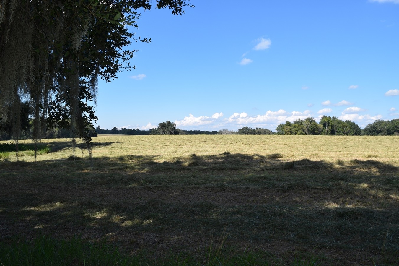
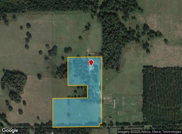
17213 Parsons Rd
Tampa-St. Petersburg-Clearwater, FL
Emerald Woods
R07-421-19-0000-0020-0000
31 AC MOL IN N1/2 OF 7-21-19 AKA STARDUST RANCH LOT 1 IN CLASS C SUB AS APPROVED BY PLANNING DEPT FILE # 1412896 DES IN ORB 4082 PG 1789-92
Pasture
Hernando
AE
Florida
12053C0062D
1
2023
26 AC
2024
Hernando County
040601
Tampa/St Petersburg
5,824 SF
DEMOGRAPHICS near 17213 Parsons Rd
1 Mile
3 Mile
5 Mile
2024 Total Population
75
464
3,741
2029 Population
87
534
4,365
Pop Growth 2024-2029
+ 16.00%
+ 15.09%
+ 16.68%
Average Age
47
47
45
2024 Total Households
31
187
1,451
HH Growth 2024-2029
+ 16.13%
+ 14.97%
+ 16.47%
Median Household Inc
$66,000
$67,788
$75,985
Avg Household Size
2.10
2.30
2.50
2024 Avg HH Vehicles
2.00
2.00
2.00
Median Home Value
$287,499
$288,234
$273,670
Median Year Built
1981
1989
2000
Nearby Places
- Restaurants
- Banks
- Shops
- Fitness
- Groceries
SALE & LEASE HISTORY
LISTING DATE
SALE/LEASE

Sep 24, 2016
For Sale
Oct 12, 2016
For Sale
Nearby Properties
Address
Land Use
TOTAL SIZE
Lot Size
Zoning
Address
Land Use
TOTAL SIZE
Lot Size
Zoning
37,144 SF
460.70 AC
Address
Land Use
TOTAL SIZE
Lot Size
Zoning
33,124 SF
197.90 AC
Address
Land Use
TOTAL SIZE
Lot Size
Zoning
8,898 SF
20 AC
Address
Land Use
TOTAL SIZE
Lot Size
Zoning
6,606 SF
40.51 AC
RURMH
Address
Land Use
TOTAL SIZE
Lot Size
Zoning
Address
Land Use
TOTAL SIZE
Lot Size
Zoning
1,154 SF
10 AC
Address
Land Use
TOTAL SIZE
Lot Size
Zoning
5,747 SF
2 AC
Address
Land Use
TOTAL SIZE
Lot Size
Zoning
12,000 SF
5.40 AC
Address
Land Use
TOTAL SIZE
Lot Size
Zoning
3,488 SF
1 AC
Address
Land Use
TOTAL SIZE
Lot Size
Zoning
672 SF
2 AC
Address
Land Use
TOTAL SIZE
Lot Size
Zoning
4,484 SF
1 AC
Address
Land Use
TOTAL SIZE
Lot Size
Zoning
5,006 SF
19.65 AC
RURMH
Address
Land Use
TOTAL SIZE
Lot Size
Zoning
4,635 SF
56.60 AC
Address
Land Use
TOTAL SIZE
Lot Size
Zoning
1,773 SF
27.80 AC
RURMH
Address
Land Use
TOTAL SIZE
Lot Size
Zoning
3,316 SF
14.70 AC
Address
Land Use
TOTAL SIZE
Lot Size
Zoning
1,400 SF
22.90 AC
Address
Land Use
TOTAL SIZE
Lot Size
Zoning
37.82 AC
AGRMH
Address
Land Use
TOTAL SIZE
Lot Size
Zoning
3,540 SF
47.68 AC
AGR
Address
Land Use
TOTAL SIZE
Lot Size
Zoning
5,861 SF
1.80 AC
Address
Land Use
TOTAL SIZE
Lot Size
Zoning
3,542 SF
1 AC
Address
Land Use
TOTAL SIZE
Lot Size
Zoning
1,476 SF
238.60 AC
Address
Land Use
TOTAL SIZE
Lot Size
Zoning
2,242 SF
1.20 AC
Address
Land Use
TOTAL SIZE
Lot Size
Zoning
4,411 SF
32.33 AC
RURMH
Address
Land Use
TOTAL SIZE
Lot Size
Zoning
4,607 SF
2.50 AC
Address
Land Use
TOTAL SIZE
Lot Size
Zoning
3,100 SF
4.42 AC
Address
Land Use
TOTAL SIZE
Lot Size
Zoning
6,243 SF
0.22 AC
Address
Land Use
TOTAL SIZE
Lot Size
Zoning
1,204 SF
19 AC
Address
Land Use
TOTAL SIZE
Lot Size
Zoning
1,788 SF
2 AC
Address
Land Use
TOTAL SIZE
Lot Size
Zoning
6,072 SF
1 AC
The World's #1 Commercial Real Estate Marketplace
Connect with us
© 2025 CoStar Group
The information above has been obtained from sources believed reliable. While we do not doubt its accuracy we have not verified it and make no guarantee, warranty or representation about it. It is your responsibility to independently confirm its accuracy and completeness. Any projections, opinions, assumptions, or estimates used are for example only and do not represent the current or future performance of the property. The value of this transaction to you depends on tax and other factors which should be evaluated by your tax, financial, and legal advisors. You and your advisors should conduct a careful, independent investigation of the property to determine to your satisfaction the suitability of the property for your needs.