Property Record
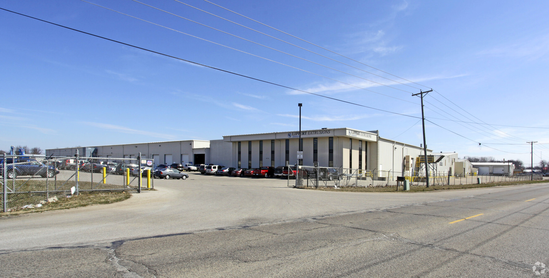
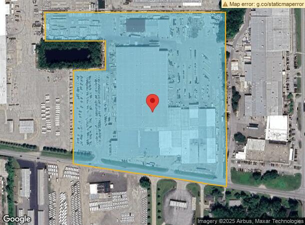
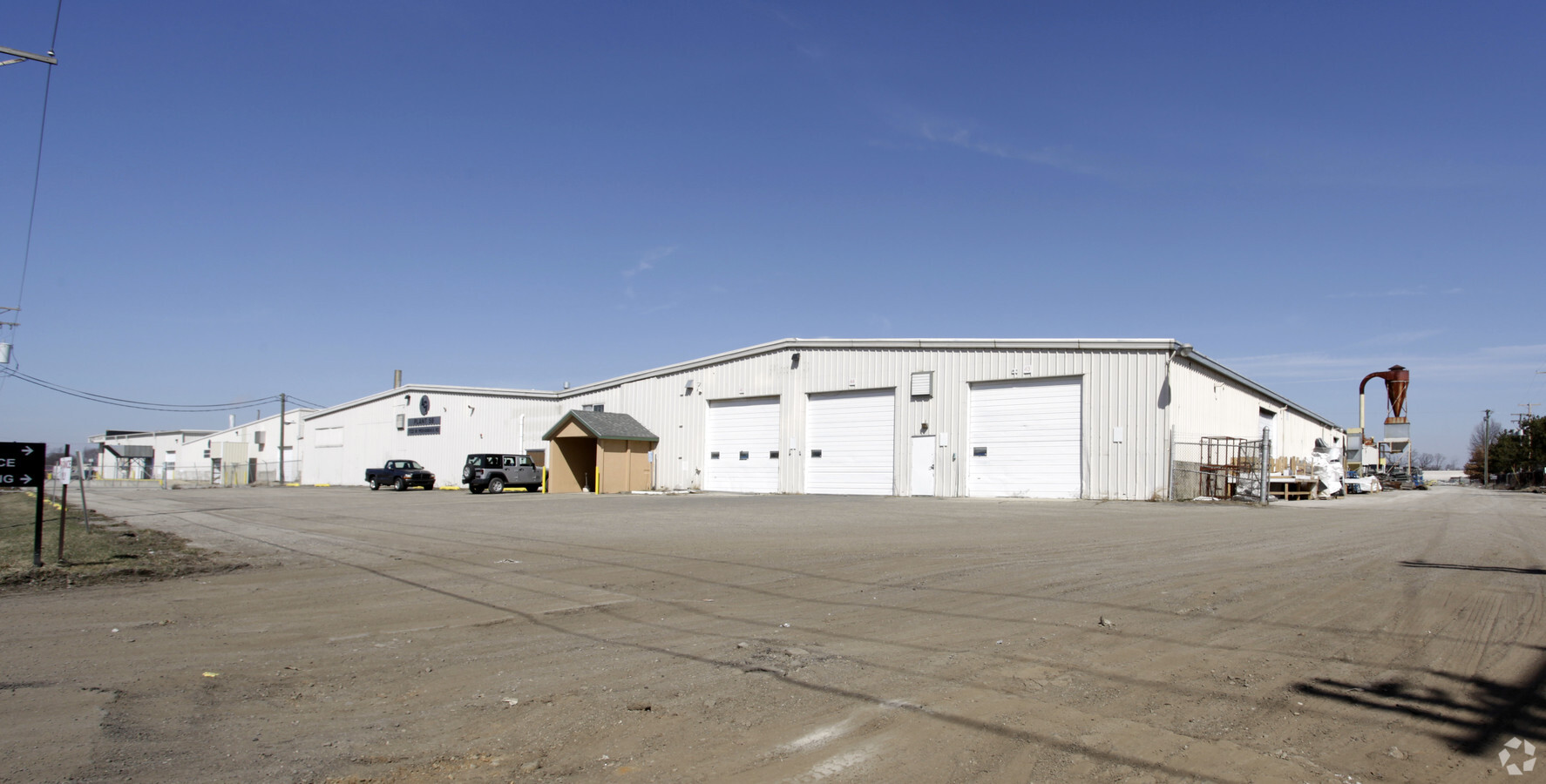
1722 W Mishawaka Rd, Elkhart, IN 46517
NEARBY LISTINGS FOR SALE OR LEASE
Property Detail
1722 W Mishawaka Rd
20-06-18-326-005.000-011
IN CENT PT SW-200 ON MISH RD SEC 18 19.676A (TIF 99)
Industrialgeneral
Elkhart
X
Indiana
18039C0136D
19.68 AC
2023
Outlying Elkhart County
2024
South Bend/Mishawaka
002300
Elkhart-Goshen, IN
301,018 SF
DEMOGRAPHICS near 1722 W Mishawaka Rd
1 Mile
3 Mile
5 Mile
2024 Total Population
2,788
45,976
94,005
2029 Population
2,799
46,288
94,035
Pop Growth 2024-2029
+ 0.39%
+ 0.68%
+ 0.03%
Average Age
40
36
37
2024 Total Households
1,051
16,563
34,796
HH Growth 2024-2029
+ 0.48%
+ 0.82%
+ 0.07%
Median Household Inc
$41,172
$45,966
$54,364
Avg Household Size
2.50
2.60
2.60
2024 Avg HH Vehicles
1.00
2.00
2.00
Median Home Value
$151,963
$127,457
$148,223
Median Year Built
1972
1962
1970
Nearby Places
- Restaurants
- Banks
- Shops
- Fitness
- Groceries
PUBLIC TRANSPORTATION
COMMUTER RAIL
Elkhart Amtrak Station (Capitol Limited - Amtrak, Lake Shore Limited - Amtrak)
DRIVE
WALK
Distance
Elkhart Amtrak Station (Capitol Limited - Amtrak, Lake Shore Limited - Amtrak)
6 min
3.2 mi
AIRPORT
South Bend International
DRIVE
WALK
Distance
South Bend International
39 min
24.2 mi
Freight Ports
Port of Toledo
DRIVE
WALK
Distance
Port of Toledo
176 min
147.6 mi
Nearby Properties
Address
Land Use
TOTAL SIZE
Lot Size
Zoning
Address
Land Use
TOTAL SIZE
Lot Size
Zoning
373,218 SF
14.58 AC
ZO01
Address
Land Use
TOTAL SIZE
Lot Size
Zoning
538,127 SF
39.88 AC
ZO01
Address
Land Use
TOTAL SIZE
Lot Size
Zoning
133,214 SF
0.30 AC
ZO01
Address
Land Use
TOTAL SIZE
Lot Size
Zoning
630,852 SF
37.12 AC
ZO01
Address
Land Use
TOTAL SIZE
Lot Size
Zoning
243,442 SF
6.54 AC
ZO01
Address
Land Use
TOTAL SIZE
Lot Size
Zoning
333,124 SF
16.47 AC
ZO01
Address
Land Use
TOTAL SIZE
Lot Size
Zoning
377,169 SF
23.85 AC
ZO01
Address
Land Use
TOTAL SIZE
Lot Size
Zoning
169,510 SF
26.46 AC
Address
Land Use
TOTAL SIZE
Lot Size
Zoning
106,029 SF
35.15 AC
ZO01
Address
Land Use
TOTAL SIZE
Lot Size
Zoning
278,692 SF
13.86 AC
ZO01
Address
Land Use
TOTAL SIZE
Lot Size
Zoning
129,147 SF
3.23 AC
Address
Land Use
TOTAL SIZE
Lot Size
Zoning
56,310 SF
2.85 AC
ZO01
Address
Land Use
TOTAL SIZE
Lot Size
Zoning
258,244 SF
9.99 AC
ZO01
Address
Land Use
TOTAL SIZE
Lot Size
Zoning
47,495 SF
7.84 AC
ZO01
Address
Land Use
TOTAL SIZE
Lot Size
Zoning
223,713 SF
14.05 AC
ZO01
Address
Land Use
TOTAL SIZE
Lot Size
Zoning
47,936 SF
0.92 AC
ZO01
Address
Land Use
TOTAL SIZE
Lot Size
Zoning
89,295 SF
4.03 AC
ZO01
Address
Land Use
TOTAL SIZE
Lot Size
Zoning
240,587 SF
12 AC
ZO01
Address
Land Use
TOTAL SIZE
Lot Size
Zoning
71,977 SF
8.60 AC
Address
Land Use
TOTAL SIZE
Lot Size
Zoning
38,520 SF
3.31 AC
ZO01
Address
Land Use
TOTAL SIZE
Lot Size
Zoning
188,176 SF
13.90 AC
ZO01
Address
Land Use
TOTAL SIZE
Lot Size
Zoning
86,252 SF
9.13 AC
ZO01
Address
Land Use
TOTAL SIZE
Lot Size
Zoning
228,620 SF
7.36 AC
ZO01
Address
Land Use
TOTAL SIZE
Lot Size
Zoning
207,070 SF
13.38 AC
ZO01
Address
Land Use
TOTAL SIZE
Lot Size
Zoning
40,000 SF
1.79 AC
ZO01
Address
Land Use
TOTAL SIZE
Lot Size
Zoning
132,060 SF
7.12 AC
Address
Land Use
TOTAL SIZE
Lot Size
Zoning
101,306 SF
35.25 AC
ZO01
Address
Land Use
TOTAL SIZE
Lot Size
Zoning
33,810 SF
1.01 AC
ZO01
Address
Land Use
TOTAL SIZE
Lot Size
Zoning
50,492 SF
2.08 AC
ZO01
The World's #1 Commercial Real Estate Marketplace
Connect with us
© 2025 CoStar Group
The information above has been obtained from sources believed reliable. While we do not doubt its accuracy we have not verified it and make no guarantee, warranty or representation about it. It is your responsibility to independently confirm its accuracy and completeness. Any projections, opinions, assumptions, or estimates used are for example only and do not represent the current or future performance of the property. The value of this transaction to you depends on tax and other factors which should be evaluated by your tax, financial, and legal advisors. You and your advisors should conduct a careful, independent investigation of the property to determine to your satisfaction the suitability of the property for your needs.