Property Record
1755 Linnerud Dr, Sun Prairie, WI 53590


NEARBY LISTINGS FOR SALE OR LEASE
-
-
View all Sun Prairie listings for sale on LoopNet.com
Property Detail
1755 Linnerud Dr
Madison, WI
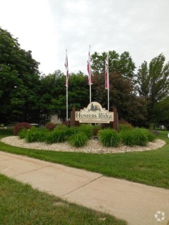
Hunters Ridge
0811-073-2001-9
HUNTERS RIDGE LOT 1 SUBJ TO SIDEWALK ESMT IN R21621/32
Commercialnec
Dane
X
Wisconsin
55025C0286H
1
2023
5.02 AC
2023
Outer Sun Prairie
011506
Milwaukee/Madison
26,675 SF
DEMOGRAPHICS near 1755 Linnerud Dr
1 Mile
3 Mile
5 Mile
2024 Total Population
8,558
44,412
63,939
2029 Population
8,952
46,221
66,496
Pop Growth 2024-2029
+ 4.60%
+ 4.07%
+ 4.00%
Average Age
36
38
38
2024 Total Households
3,675
18,048
26,087
HH Growth 2024-2029
+ 4.76%
+ 4.26%
+ 4.18%
Median Household Inc
$66,363
$86,342
$85,010
Avg Household Size
2.30
2.40
2.40
2024 Avg HH Vehicles
2.00
2.00
2.00
Median Home Value
$281,238
$309,746
$312,102
Median Year Built
1994
1997
1995
Nearby Places
- Restaurants
- Banks
- Shops
- Fitness
- Groceries
PUBLIC TRANSPORTATION
AIRPORT
Dane County Regional/Truax Field
DRIVE
WALK
Distance
Dane County Regional/Truax Field
17 min
9.1 mi
Freight Ports
Port Milwaukee
DRIVE
WALK
Distance
Port Milwaukee
93 min
76.6 mi
Nearby Properties
Address
Land Use
TOTAL SIZE
Lot Size
Zoning
Address
Land Use
TOTAL SIZE
Lot Size
Zoning
344,415 SF
7.45 AC
SEC
Address
Land Use
TOTAL SIZE
Lot Size
Zoning
8.49 AC
SFR
Address
Land Use
TOTAL SIZE
Lot Size
Zoning
921,697 SF
24.28 AC
SEC
Address
Land Use
TOTAL SIZE
Lot Size
Zoning
58,272 SF
136.54 AC
SO
Address
Land Use
TOTAL SIZE
Lot Size
Zoning
97,580 SF
6.86 AC
TR-U1
Address
Land Use
TOTAL SIZE
Lot Size
Zoning
Address
Land Use
TOTAL SIZE
Lot Size
Zoning
1,318,936 SF
25.96 AC
SEC
Address
Land Use
TOTAL SIZE
Lot Size
Zoning
8.56 AC
Address
Land Use
TOTAL SIZE
Lot Size
Zoning
26.32 AC
Address
Land Use
TOTAL SIZE
Lot Size
Zoning
1,322 SF
59.57 AC
SEC
Address
Land Use
TOTAL SIZE
Lot Size
Zoning
4.64 AC
Address
Land Use
TOTAL SIZE
Lot Size
Zoning
31,986 SF
5 AC
PD
Address
Land Use
TOTAL SIZE
Lot Size
Zoning
46,902 SF
5.28 AC
PD
Address
Land Use
TOTAL SIZE
Lot Size
Zoning
222,532 SF
18.02 AC
PD
Address
Land Use
TOTAL SIZE
Lot Size
Zoning
Address
Land Use
TOTAL SIZE
Lot Size
Zoning
72,072 SF
11.78 AC
Address
Land Use
TOTAL SIZE
Lot Size
Zoning
327,302 SF
8.24 AC
PD
Address
Land Use
TOTAL SIZE
Lot Size
Zoning
4,542 SF
10.01 AC
PD
Address
Land Use
TOTAL SIZE
Lot Size
Zoning
81,771 SF
7.76 AC
CC-T
Address
Land Use
TOTAL SIZE
Lot Size
Zoning
147,310 SF
14.68 AC
SC
Address
Land Use
TOTAL SIZE
Lot Size
Zoning
70,080 SF
3.21 AC
Address
Land Use
TOTAL SIZE
Lot Size
Zoning
26,854 SF
8.25 AC
UR12
Address
Land Use
TOTAL SIZE
Lot Size
Zoning
11.48 AC
SEC
Address
Land Use
TOTAL SIZE
Lot Size
Zoning
64,900 SF
4.21 AC
PD
Address
Land Use
TOTAL SIZE
Lot Size
Zoning
12.16 AC
Address
Land Use
TOTAL SIZE
Lot Size
Zoning
Address
Land Use
TOTAL SIZE
Lot Size
Zoning
152,636 SF
13.28 AC
Address
Land Use
TOTAL SIZE
Lot Size
Zoning
430,172 SF
18.33 AC
SI
Address
Land Use
TOTAL SIZE
Lot Size
Zoning
11.28 AC
Address
Land Use
TOTAL SIZE
Lot Size
Zoning
The World's #1 Commercial Real Estate Marketplace
Connect with us
© 2025 CoStar Group
The information above has been obtained from sources believed reliable. While we do not doubt its accuracy we have not verified it and make no guarantee, warranty or representation about it. It is your responsibility to independently confirm its accuracy and completeness. Any projections, opinions, assumptions, or estimates used are for example only and do not represent the current or future performance of the property. The value of this transaction to you depends on tax and other factors which should be evaluated by your tax, financial, and legal advisors. You and your advisors should conduct a careful, independent investigation of the property to determine to your satisfaction the suitability of the property for your needs.