Property Record
17329 Castellammare Dr, Pacific Palisades, CA 90272

NEARBY LISTINGS FOR SALE OR LEASE
-
-
View all Pacific Palisades listings for sale on LoopNet.com
Property Detail
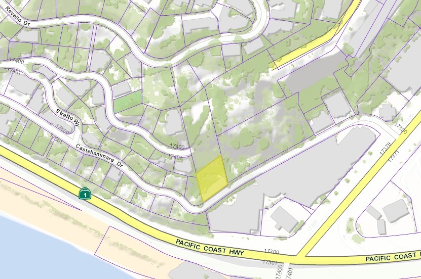
17329 Castellammare Dr
4416-003-001
Castellammare
Multifamilydwelling
CASTELLAMMARE 0.20 AC COM N 13 4437 W 86.44 FT FROM MOST S COR OF BLK D TH NE ON NW LINE OF CASTELLAMMARE DR 100 FT TH N 13 4437 W TO A PT N 13 4437 W 95 FT AND N 53 48 E FROM BEG TH S 53 48 W BLK/DIV/TWN D
X
Los Angeles
06037C1566G
California
2024
0.20 AC
2024
West County
262604
Los Angeles
5,366 SF
Los Angeles-Long Beach-Glendale, CA
DEMOGRAPHICS near 17329 Castellammare Dr
1 Mile
3 Mile
5 Mile
2024 Total Population
4,864
30,247
115,379
2029 Population
4,778
29,657
113,380
Pop Growth 2024-2029
(1.77%)
(1.95%)
(1.73%)
Average Age
47
46
45
2024 Total Households
2,075
12,665
54,592
HH Growth 2024-2029
(1.88%)
(1.90%)
(1.75%)
Median Household Inc
$145,833
$168,324
$127,647
Avg Household Size
2.30
2.30
2.00
2024 Avg HH Vehicles
2.00
2.00
2.00
Median Home Value
$1,135,579
$1,138,475
$1,130,276
Median Year Built
1964
1968
1968
Nearby Places
- Restaurants
- Banks
- Shops
- Fitness
- Groceries
PUBLIC TRANSPORTATION
AIRPORT
Los Angeles International
DRIVE
WALK
Distance
Los Angeles International
25 min
13.2 mi
Bob Hope
DRIVE
WALK
Distance
Bob Hope
39 min
27.0 mi
Long Beach (Daugherty Field)
DRIVE
WALK
Distance
Long Beach (Daugherty Field)
44 min
33.4 mi
Freight Ports
Port of Los Angeles
DRIVE
WALK
Distance
Port of Los Angeles
51 min
36.5 mi
Nearby Properties
Address
Land Use
TOTAL SIZE
Lot Size
Zoning
Address
Land Use
TOTAL SIZE
Lot Size
Zoning
193,462 SF
64.72 AC
LAA1
Address
Land Use
TOTAL SIZE
Lot Size
Zoning
89,748 SF
2.13 AC
Address
Land Use
TOTAL SIZE
Lot Size
Zoning
37,989 SF
1 AC
SMR4*
Address
Land Use
TOTAL SIZE
Lot Size
Zoning
93,900 SF
1.73 AC
LAC2
Address
Land Use
TOTAL SIZE
Lot Size
Zoning
105,909 SF
2.08 AC
LAC2
Address
Land Use
TOTAL SIZE
Lot Size
Zoning
89,671 SF
1.34 AC
LAC2
Address
Land Use
TOTAL SIZE
Lot Size
Zoning
92,957 SF
0.56 AC
SMR2*
Address
Land Use
TOTAL SIZE
Lot Size
Zoning
2.44 AC
LARE40
Address
Land Use
TOTAL SIZE
Lot Size
Zoning
22,751 SF
0.43 AC
Address
Land Use
TOTAL SIZE
Lot Size
Zoning
32,904 SF
5.60 AC
LAA1
Address
Land Use
TOTAL SIZE
Lot Size
Zoning
4,335 SF
0.65 AC
LARE20
Address
Land Use
TOTAL SIZE
Lot Size
Zoning
44,199 SF
0.50 AC
SMR2*
Address
Land Use
TOTAL SIZE
Lot Size
Zoning
40,412 SF
0.51 AC
SMR2*
Address
Land Use
TOTAL SIZE
Lot Size
Zoning
24,813 SF
13.23 AC
LARE40
Address
Land Use
TOTAL SIZE
Lot Size
Zoning
43,738 SF
0.51 AC
SMR2*
Address
Land Use
TOTAL SIZE
Lot Size
Zoning
90,794 SF
7.54 AC
LARE40
Address
Land Use
TOTAL SIZE
Lot Size
Zoning
64,344 SF
1.04 AC
LAR3
Address
Land Use
TOTAL SIZE
Lot Size
Zoning
22,426 SF
0.43 AC
SMR4*
Address
Land Use
TOTAL SIZE
Lot Size
Zoning
25,040 SF
4.19 AC
LAC2
Address
Land Use
TOTAL SIZE
Lot Size
Zoning
41,077 SF
0.51 AC
SMR2*
Address
Land Use
TOTAL SIZE
Lot Size
Zoning
27,513 SF
0.34 AC
LAC2
Address
Land Use
TOTAL SIZE
Lot Size
Zoning
20,490 SF
0.49 AC
SMR2*
Address
Land Use
TOTAL SIZE
Lot Size
Zoning
7,085 SF
0.13 AC
LAC2
Address
Land Use
TOTAL SIZE
Lot Size
Zoning
10,413 SF
0.17 AC
LAC2
Address
Land Use
TOTAL SIZE
Lot Size
Zoning
43,771 SF
0.48 AC
LAC2
Address
Land Use
TOTAL SIZE
Lot Size
Zoning
16,200 SF
0.41 AC
LAR3
Address
Land Use
TOTAL SIZE
Lot Size
Zoning
4,869 SF
0.45 AC
SMR1*
Address
Land Use
TOTAL SIZE
Lot Size
Zoning
34,533 SF
0.34 AC
LAC2
Address
Land Use
TOTAL SIZE
Lot Size
Zoning
2,342 SF
0.56 AC
SMRVC*
The World's #1 Commercial Real Estate Marketplace
Connect with us
© 2025 CoStar Group
The information above has been obtained from sources believed reliable. While we do not doubt its accuracy we have not verified it and make no guarantee, warranty or representation about it. It is your responsibility to independently confirm its accuracy and completeness. Any projections, opinions, assumptions, or estimates used are for example only and do not represent the current or future performance of the property. The value of this transaction to you depends on tax and other factors which should be evaluated by your tax, financial, and legal advisors. You and your advisors should conduct a careful, independent investigation of the property to determine to your satisfaction the suitability of the property for your needs.