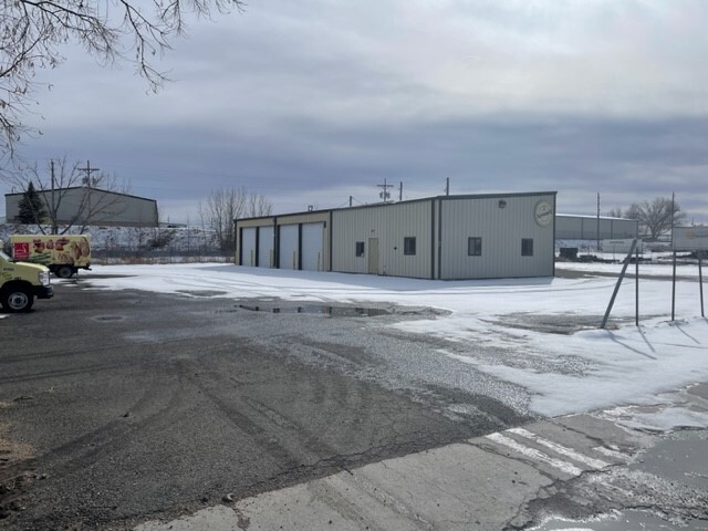
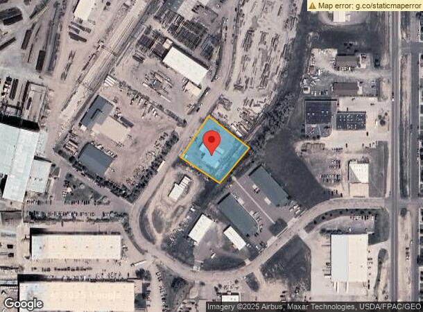
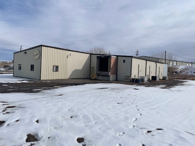
Property Record
1735 Pacific Ave, Cheyenne, WY 82007
NEARBY LISTINGS FOR SALE OR LEASE
Property Detail
1735 Pacific Ave
Cheyenne, WY
Upland Park, 2Nd Filing
1-8991-0001-0001-0
UPLAND PARK, 2ND FILING: LOT 1, BLOCK 1
Commercialnec
Laramie
X
Wyoming
08123C0025E
1
2023
0.96 AC
2024
I-80 Corridor/Cheyenne
000200
Other Market Areas
5,010 SF
DEMOGRAPHICS near 1735 Pacific Ave
1 Mile
3 Mile
5 Mile
2024 Total Population
5,429
35,369
74,381
2029 Population
5,505
36,008
75,671
Pop Growth 2024-2029
+ 1.40%
+ 1.81%
+ 1.73%
Average Age
36
38
39
2024 Total Households
2,266
15,481
31,761
HH Growth 2024-2029
+ 1.50%
+ 1.92%
+ 1.87%
Median Household Inc
$46,090
$48,206
$57,755
Avg Household Size
2.30
2.20
2.20
2024 Avg HH Vehicles
2.00
2.00
2.00
Median Home Value
$240,404
$220,335
$262,657
Median Year Built
1963
1958
1974
Nearby Places
- Restaurants
- Banks
- Shops
- Fitness
- Groceries
SALE & LEASE HISTORY
LISTING DATE
SALE/LEASE

May 22, 2024
For Lease
Apr 10, 2024
For Sale
Nearby Properties
Address
Land Use
TOTAL SIZE
Lot Size
Zoning
Address
Land Use
TOTAL SIZE
Lot Size
Zoning
240.51 AC
A2
Address
Land Use
TOTAL SIZE
Lot Size
Zoning
Address
Land Use
TOTAL SIZE
Lot Size
Zoning
243,960 SF
60.52 AC
Address
Land Use
TOTAL SIZE
Lot Size
Zoning
91,021 SF
7.40 AC
Address
Land Use
TOTAL SIZE
Lot Size
Zoning
148,018 SF
Address
Land Use
TOTAL SIZE
Lot Size
Zoning
189,952 SF
11.15 AC
HR2
Address
Land Use
TOTAL SIZE
Lot Size
Zoning
Address
Land Use
TOTAL SIZE
Lot Size
Zoning
69,726 SF
0.80 AC
CBD
Address
Land Use
TOTAL SIZE
Lot Size
Zoning
109,744 SF
7.04 AC
Address
Land Use
TOTAL SIZE
Lot Size
Zoning
135,427 SF
6.61 AC
Address
Land Use
TOTAL SIZE
Lot Size
Zoning
81,948 SF
9.39 AC
CB
Address
Land Use
TOTAL SIZE
Lot Size
Zoning
86,860 SF
1.70 AC
CB
Address
Land Use
TOTAL SIZE
Lot Size
Zoning
69,941 SF
4.31 AC
LI
Address
Land Use
TOTAL SIZE
Lot Size
Zoning
225,824 SF
32.58 AC
CB
Address
Land Use
TOTAL SIZE
Lot Size
Zoning
59,325 SF
0.85 AC
CBD
Address
Land Use
TOTAL SIZE
Lot Size
Zoning
108,332 SF
0.80 AC
MUB
Address
Land Use
TOTAL SIZE
Lot Size
Zoning
108,716 SF
12.45 AC
Address
Land Use
TOTAL SIZE
Lot Size
Zoning
30,024 SF
9.53 AC
Address
Land Use
TOTAL SIZE
Lot Size
Zoning
55,750 SF
1.58 AC
Address
Land Use
TOTAL SIZE
Lot Size
Zoning
56,714 SF
5.69 AC
CB
Address
Land Use
TOTAL SIZE
Lot Size
Zoning
91,109 SF
24.34 AC
LI
Address
Land Use
TOTAL SIZE
Lot Size
Zoning
43,820 SF
4.34 AC
Address
Land Use
TOTAL SIZE
Lot Size
Zoning
71,841 SF
8.11 AC
Address
Land Use
TOTAL SIZE
Lot Size
Zoning
58,352 SF
2.28 AC
Address
Land Use
TOTAL SIZE
Lot Size
Zoning
124,258 SF
21 AC
A1
Address
Land Use
TOTAL SIZE
Lot Size
Zoning
51,723 SF
2.71 AC
Address
Land Use
TOTAL SIZE
Lot Size
Zoning
103,144 SF
10.24 AC
LI
Address
Land Use
TOTAL SIZE
Lot Size
Zoning
116,121 SF
12.45 AC
CB
Address
Land Use
TOTAL SIZE
Lot Size
Zoning
52,023 SF
2.42 AC
CB
Address
Land Use
TOTAL SIZE
Lot Size
Zoning
25,477 SF
5.36 AC
CB
The World's #1 Commercial Real Estate Marketplace
Connect with us
© 2025 CoStar Group
The information above has been obtained from sources believed reliable. While we do not doubt its accuracy we have not verified it and make no guarantee, warranty or representation about it. It is your responsibility to independently confirm its accuracy and completeness. Any projections, opinions, assumptions, or estimates used are for example only and do not represent the current or future performance of the property. The value of this transaction to you depends on tax and other factors which should be evaluated by your tax, financial, and legal advisors. You and your advisors should conduct a careful, independent investigation of the property to determine to your satisfaction the suitability of the property for your needs.