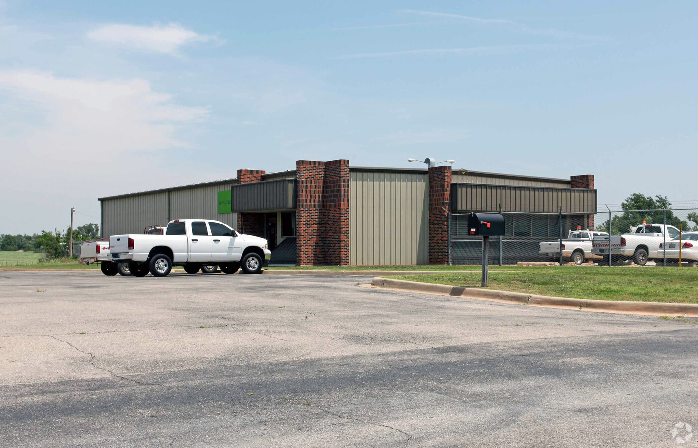
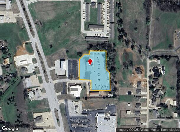
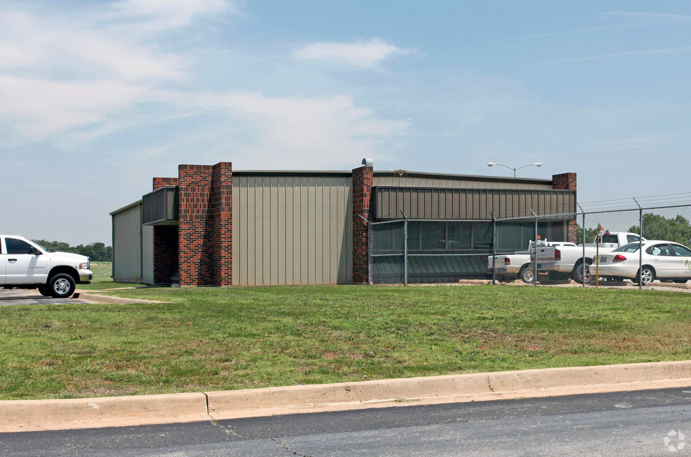
Property Record
1738 N Green Ave, Purcell, OK 73080
NEARBY LISTINGS FOR SALE OR LEASE
-
-
View all Purcell listings for sale on LoopNet.com
Property Detail
1738 N Green Ave
00003607N02W002100
333 Purcell
Privateutilityelectricwatergasnuclearsolarwindetc
2.675 ACS IN SEC 36 7N 2W PURCELL CITY
X
Mcclain
40027C0390H
Oklahoma
2024
2.67 AC
2023
McClain County
400300
Oklahoma City
5,000 SF
Oklahoma City, OK
DEMOGRAPHICS near 1738 N Green Ave
1 Mile
3 Mile
5 Mile
2024 Total Population
2,819
9,455
13,580
2029 Population
3,388
11,020
15,623
Pop Growth 2024-2029
+ 20.18%
+ 16.55%
+ 15.04%
Average Age
40
40
40
2024 Total Households
1,063
3,502
4,995
HH Growth 2024-2029
+ 20.23%
+ 16.73%
+ 15.16%
Median Household Inc
$74,354
$60,086
$59,917
Avg Household Size
2.50
2.60
2.60
2024 Avg HH Vehicles
2.00
2.00
2.00
Median Home Value
$182,726
$153,518
$159,514
Median Year Built
1983
1982
1984
Nearby Places
- Restaurants
- Banks
- Shops
- Fitness
- Groceries
PUBLIC TRANSPORTATION
COMMUTER RAIL
Purcell Amtrak Station (Heartland Flyer - Amtrak)
DRIVE
WALK
Distance
Purcell Amtrak Station (Heartland Flyer - Amtrak)
4 min
2.0 mi
AIRPORT
Will Rogers World
DRIVE
WALK
Distance
Will Rogers World
50 min
36.1 mi
Freight Ports
Tulsa Port Of Catoosa
DRIVE
WALK
Distance
Tulsa Port Of Catoosa
171 min
155.3 mi
Nearby Properties
Address
Land Use
TOTAL SIZE
Lot Size
Zoning
Address
Land Use
TOTAL SIZE
Lot Size
Zoning
9.24 AC
Address
Land Use
TOTAL SIZE
Lot Size
Zoning
50,184 SF
4.07 AC
Address
Land Use
TOTAL SIZE
Lot Size
Zoning
0.42 AC
Address
Land Use
TOTAL SIZE
Lot Size
Zoning
0.86 AC
Address
Land Use
TOTAL SIZE
Lot Size
Zoning
24.70 AC
Address
Land Use
TOTAL SIZE
Lot Size
Zoning
3,200 SF
1 AC
Address
Land Use
TOTAL SIZE
Lot Size
Zoning
5,584 SF
11.67 AC
Address
Land Use
TOTAL SIZE
Lot Size
Zoning
0.64 AC
Address
Land Use
TOTAL SIZE
Lot Size
Zoning
36,752 SF
3.72 AC
Address
Land Use
TOTAL SIZE
Lot Size
Zoning
4,800 SF
7.83 AC
Address
Land Use
TOTAL SIZE
Lot Size
Zoning
0.64 AC
Address
Land Use
TOTAL SIZE
Lot Size
Zoning
11,976 SF
0.14 AC
Address
Land Use
TOTAL SIZE
Lot Size
Zoning
1.23 AC
R1
Address
Land Use
TOTAL SIZE
Lot Size
Zoning
24,333 SF
2.94 AC
R1
Address
Land Use
TOTAL SIZE
Lot Size
Zoning
14,718 SF
1.62 AC
Address
Land Use
TOTAL SIZE
Lot Size
Zoning
80 AC
Address
Land Use
TOTAL SIZE
Lot Size
Zoning
3,375 SF
0.04 AC
Address
Land Use
TOTAL SIZE
Lot Size
Zoning
0.24 AC
Address
Land Use
TOTAL SIZE
Lot Size
Zoning
5,904 SF
4.86 AC
Address
Land Use
TOTAL SIZE
Lot Size
Zoning
25,115 SF
0.21 AC
Address
Land Use
TOTAL SIZE
Lot Size
Zoning
12,152 SF
6.92 AC
Address
Land Use
TOTAL SIZE
Lot Size
Zoning
9,892 SF
0.48 AC
R1
Address
Land Use
TOTAL SIZE
Lot Size
Zoning
26.10 AC
AA
Address
Land Use
TOTAL SIZE
Lot Size
Zoning
4,700 SF
0.32 AC
Address
Land Use
TOTAL SIZE
Lot Size
Zoning
4,061 SF
17.17 AC
NP
Address
Land Use
TOTAL SIZE
Lot Size
Zoning
2,250 SF
0.19 AC
R1
Address
Land Use
TOTAL SIZE
Lot Size
Zoning
21,006 SF
1.33 AC
Address
Land Use
TOTAL SIZE
Lot Size
Zoning
1.23 AC
Address
Land Use
TOTAL SIZE
Lot Size
Zoning
103,556 SF
140 AC
The World's #1 Commercial Real Estate Marketplace
Connect with us
© 2025 CoStar Group
The information above has been obtained from sources believed reliable. While we do not doubt its accuracy we have not verified it and make no guarantee, warranty or representation about it. It is your responsibility to independently confirm its accuracy and completeness. Any projections, opinions, assumptions, or estimates used are for example only and do not represent the current or future performance of the property. The value of this transaction to you depends on tax and other factors which should be evaluated by your tax, financial, and legal advisors. You and your advisors should conduct a careful, independent investigation of the property to determine to your satisfaction the suitability of the property for your needs.