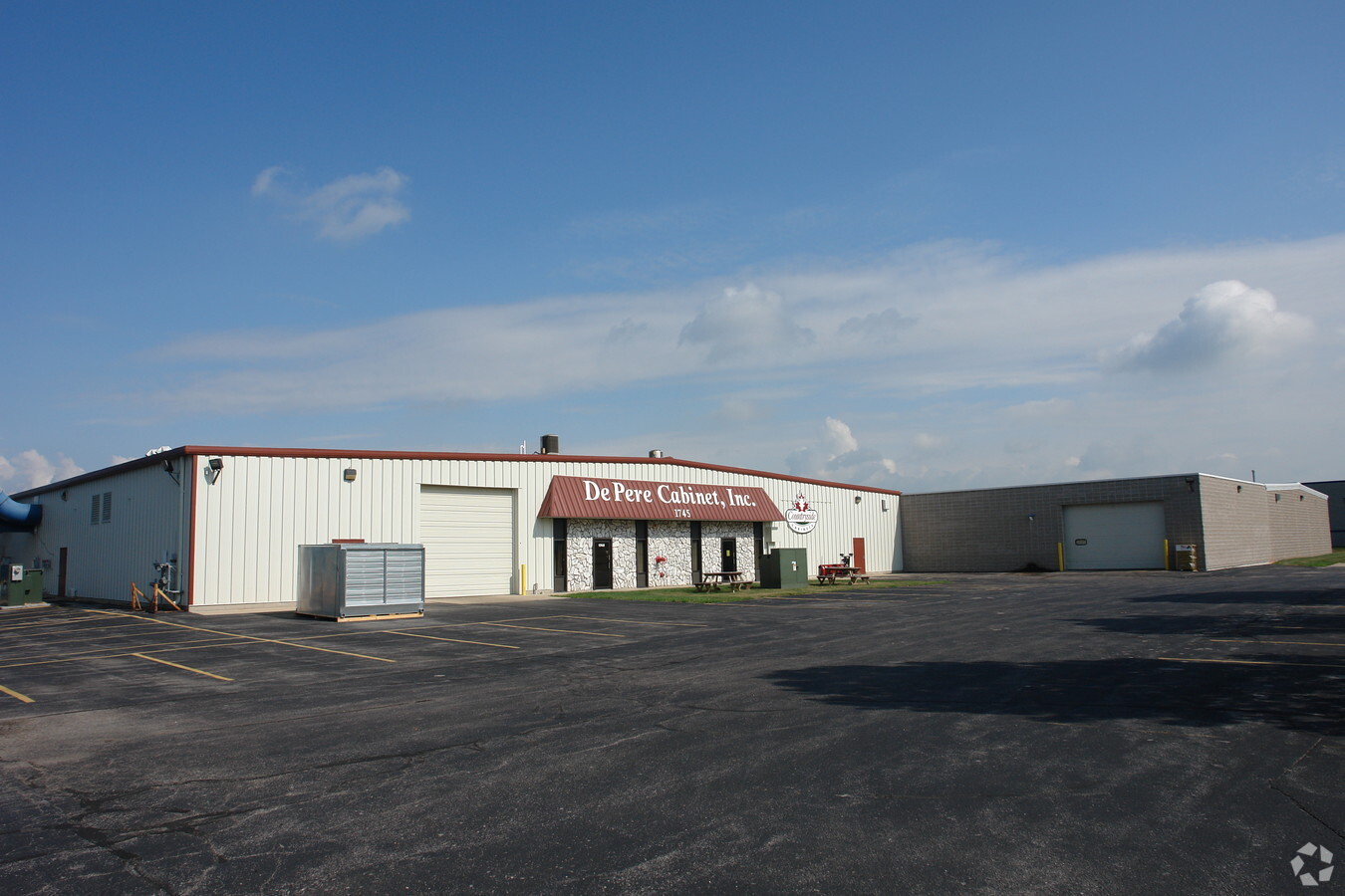
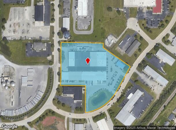
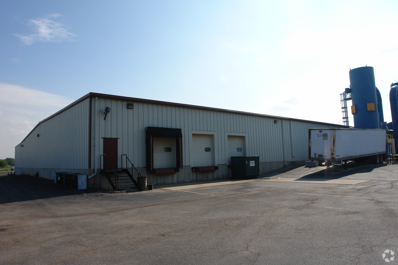
Property Record
1745 E Matthew Dr, De Pere, WI 54115
NEARBY LISTINGS FOR SALE OR LEASE
Property Detail
1745 E Matthew Dr
Green Bay, WI
De Pere Business Park
WD-D0048-2
292,226 SQ FT LOT 1 OF 62 CSM 333 MAP 8791 IN 2785570 BNG PRT OF NE1/4 NE1/4 SEC 32 T23N R20E & ALL OF LOTS 21 & 22 & PRT OF LOT 23 DE PERE BUSINESS PARK
Industrialgeneral
Brown
X
Wisconsin
55009C0262F
1
2023
6.71 AC
2023
Ashwaubenon
010202
Green Bay
DEMOGRAPHICS near 1745 E Matthew Dr
1 Mile
3 Mile
5 Mile
2024 Total Population
5,507
34,780
68,996
2029 Population
5,628
35,586
70,547
Pop Growth 2024-2029
+ 2.20%
+ 2.32%
+ 2.25%
Average Age
38
39
40
2024 Total Households
2,104
13,955
28,357
HH Growth 2024-2029
+ 2.42%
+ 2.47%
+ 2.37%
Median Household Inc
$63,088
$77,763
$77,529
Avg Household Size
2.40
2.30
2.30
2024 Avg HH Vehicles
2.00
2.00
2.00
Median Home Value
$224,184
$269,141
$263,521
Median Year Built
1985
1993
1987
Nearby Places
- Restaurants
- Banks
- Shops
- Fitness
- Groceries
PUBLIC TRANSPORTATION
AIRPORT
Green Bay/Austin Straubel International
DRIVE
WALK
Distance
Green Bay/Austin Straubel International
13 min
6.8 mi
Appleton International
DRIVE
WALK
Distance
Appleton International
38 min
30.2 mi
Freight Ports
Port Milwaukee
DRIVE
WALK
Distance
Port Milwaukee
140 min
120.0 mi
Nearby Properties
Address
Land Use
TOTAL SIZE
Lot Size
Zoning
Address
Land Use
TOTAL SIZE
Lot Size
Zoning
1,108,080 SF
76.76 AC
Address
Land Use
TOTAL SIZE
Lot Size
Zoning
55.45 AC
Address
Land Use
TOTAL SIZE
Lot Size
Zoning
175,271 SF
17.86 AC
Address
Land Use
TOTAL SIZE
Lot Size
Zoning
6.32 AC
R1
Address
Land Use
TOTAL SIZE
Lot Size
Zoning
452,950 SF
34.59 AC
Address
Land Use
TOTAL SIZE
Lot Size
Zoning
25.31 AC
Address
Land Use
TOTAL SIZE
Lot Size
Zoning
35.24 AC
Address
Land Use
TOTAL SIZE
Lot Size
Zoning
53.92 AC
Address
Land Use
TOTAL SIZE
Lot Size
Zoning
339,679 SF
56.88 AC
Address
Land Use
TOTAL SIZE
Lot Size
Zoning
15.61 AC
Address
Land Use
TOTAL SIZE
Lot Size
Zoning
11.89 AC
Address
Land Use
TOTAL SIZE
Lot Size
Zoning
487,996 SF
23.04 AC
Address
Land Use
TOTAL SIZE
Lot Size
Zoning
18.98 AC
Address
Land Use
TOTAL SIZE
Lot Size
Zoning
26.42 AC
Address
Land Use
TOTAL SIZE
Lot Size
Zoning
43.13 AC
Address
Land Use
TOTAL SIZE
Lot Size
Zoning
10.58 AC
Address
Land Use
TOTAL SIZE
Lot Size
Zoning
14.02 AC
Address
Land Use
TOTAL SIZE
Lot Size
Zoning
174,436 SF
12.23 AC
Address
Land Use
TOTAL SIZE
Lot Size
Zoning
19.59 AC
Address
Land Use
TOTAL SIZE
Lot Size
Zoning
98,000 SF
10.84 AC
Address
Land Use
TOTAL SIZE
Lot Size
Zoning
20.05 AC
Address
Land Use
TOTAL SIZE
Lot Size
Zoning
13.10 AC
Address
Land Use
TOTAL SIZE
Lot Size
Zoning
240,000 SF
12.56 AC
Address
Land Use
TOTAL SIZE
Lot Size
Zoning
81,981 SF
0.80 AC
D2
Address
Land Use
TOTAL SIZE
Lot Size
Zoning
189,186 SF
17.54 AC
Address
Land Use
TOTAL SIZE
Lot Size
Zoning
0.71 AC
Address
Land Use
TOTAL SIZE
Lot Size
Zoning
245,300 SF
17.28 AC
Address
Land Use
TOTAL SIZE
Lot Size
Zoning
12.44 AC
Address
Land Use
TOTAL SIZE
Lot Size
Zoning
16.44 AC
Address
Land Use
TOTAL SIZE
Lot Size
Zoning
156,284 SF
13.76 AC
The World's #1 Commercial Real Estate Marketplace
Connect with us
© 2025 CoStar Group
The information above has been obtained from sources believed reliable. While we do not doubt its accuracy we have not verified it and make no guarantee, warranty or representation about it. It is your responsibility to independently confirm its accuracy and completeness. Any projections, opinions, assumptions, or estimates used are for example only and do not represent the current or future performance of the property. The value of this transaction to you depends on tax and other factors which should be evaluated by your tax, financial, and legal advisors. You and your advisors should conduct a careful, independent investigation of the property to determine to your satisfaction the suitability of the property for your needs.