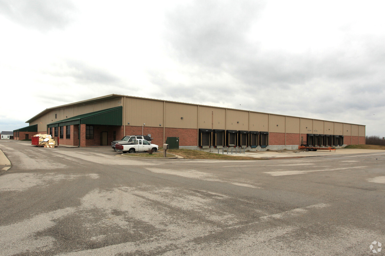
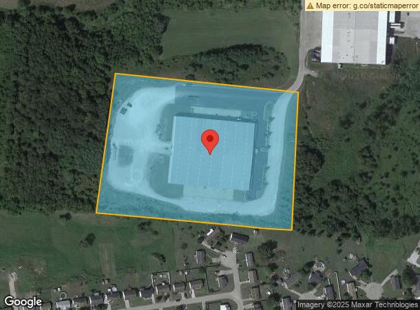
Property Record
175 Clarence Dr, Mount Sterling, KY 40353

NEARBY LISTINGS FOR SALE OR LEASE
-
-
View all Mount Sterling listings for sale on LoopNet.com
Property Detail
175 Clarence Dr
030-00-00-029.06
WOODLAND INDUSTRIAL PARK 11.739 ACRES
Warehouse
Montgomery
X
Kentucky
21173C0108D
11.74 AC
2024
Kentucky East Area
2024
Other Market Areas
920100
Mount Sterling, KY
107,800 SF
DEMOGRAPHICS near 175 Clarence Dr
1 Mile
3 Mile
5 Mile
2024 Total Population
981
10,470
18,390
2029 Population
996
10,697
18,719
Pop Growth 2024-2029
+ 1.53%
+ 2.17%
+ 1.79%
Average Age
38
39
40
2024 Total Households
371
4,176
7,369
HH Growth 2024-2029
+ 1.62%
+ 2.18%
+ 1.78%
Median Household Inc
$76,078
$52,580
$52,720
Avg Household Size
2.60
2.50
2.40
2024 Avg HH Vehicles
2.00
2.00
2.00
Median Home Value
$173,986
$147,306
$148,808
Median Year Built
2000
1986
1978
Nearby Places
- Restaurants
- Banks
- Shops
- Fitness
- Groceries
Nearby Properties
Address
Land Use
TOTAL SIZE
Lot Size
Zoning
Address
Land Use
TOTAL SIZE
Lot Size
Zoning
256,490 SF
25.50 AC
Address
Land Use
TOTAL SIZE
Lot Size
Zoning
178,420 SF
22.08 AC
Address
Land Use
TOTAL SIZE
Lot Size
Zoning
160,949 SF
27.45 AC
COMMERCIAL
Address
Land Use
TOTAL SIZE
Lot Size
Zoning
62.04 AC
Address
Land Use
TOTAL SIZE
Lot Size
Zoning
389,144 SF
43.42 AC
Address
Land Use
TOTAL SIZE
Lot Size
Zoning
35.41 AC
Address
Land Use
TOTAL SIZE
Lot Size
Zoning
176,702 SF
14.44 AC
Address
Land Use
TOTAL SIZE
Lot Size
Zoning
Address
Land Use
TOTAL SIZE
Lot Size
Zoning
111,196 SF
14.28 AC
Address
Land Use
TOTAL SIZE
Lot Size
Zoning
14.58 AC
Address
Land Use
TOTAL SIZE
Lot Size
Zoning
108,000 SF
6.67 AC
Address
Land Use
TOTAL SIZE
Lot Size
Zoning
1.53 AC
COMMERCIAL
Address
Land Use
TOTAL SIZE
Lot Size
Zoning
Address
Land Use
TOTAL SIZE
Lot Size
Zoning
10,564 SF
10.01 AC
Address
Land Use
TOTAL SIZE
Lot Size
Zoning
11,880 SF
2.03 AC
COMMERCIAL
Address
Land Use
TOTAL SIZE
Lot Size
Zoning
19,051 SF
4.73 AC
Address
Land Use
TOTAL SIZE
Lot Size
Zoning
53,000 SF
7.31 AC
Address
Land Use
TOTAL SIZE
Lot Size
Zoning
Address
Land Use
TOTAL SIZE
Lot Size
Zoning
Address
Land Use
TOTAL SIZE
Lot Size
Zoning
40,990 SF
1.25 AC
Address
Land Use
TOTAL SIZE
Lot Size
Zoning
Address
Land Use
TOTAL SIZE
Lot Size
Zoning
988 SF
1.93 AC
COMMERCIAL
Address
Land Use
TOTAL SIZE
Lot Size
Zoning
29,730 SF
1.49 AC
COMMERCIAL
Address
Land Use
TOTAL SIZE
Lot Size
Zoning
80,000 SF
9.71 AC
Address
Land Use
TOTAL SIZE
Lot Size
Zoning
Address
Land Use
TOTAL SIZE
Lot Size
Zoning
40,000 SF
8.34 AC
Address
Land Use
TOTAL SIZE
Lot Size
Zoning
4,453 SF
1 AC
COMMERCIAL
Address
Land Use
TOTAL SIZE
Lot Size
Zoning
68,290 SF
15.70 AC
Address
Land Use
TOTAL SIZE
Lot Size
Zoning
99,520 SF
14.23 AC
The World's #1 Commercial Real Estate Marketplace
Connect with us
© 2025 CoStar Group
The information above has been obtained from sources believed reliable. While we do not doubt its accuracy we have not verified it and make no guarantee, warranty or representation about it. It is your responsibility to independently confirm its accuracy and completeness. Any projections, opinions, assumptions, or estimates used are for example only and do not represent the current or future performance of the property. The value of this transaction to you depends on tax and other factors which should be evaluated by your tax, financial, and legal advisors. You and your advisors should conduct a careful, independent investigation of the property to determine to your satisfaction the suitability of the property for your needs.