Property Record
175 N Mount Tabor Rd, Lexington, KY 40509
NEARBY LISTINGS FOR SALE OR LEASE
-
-
View all Lexington listings for sale on LoopNet.com
Property Detail
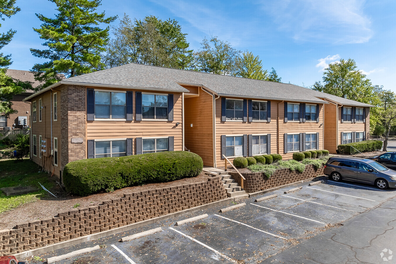
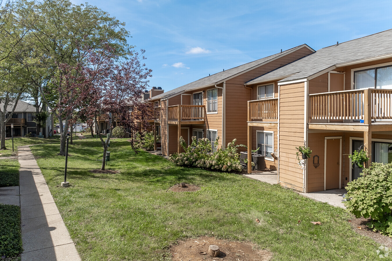
175 N Mount Tabor Rd
Lexington-Fayette, KY
Naylor & White Property
20024220
F-282 NAYLOR & WHITE PROPERTY LOT TR 4; BOOK: 3564 PAGE: 148
Apartment
Fayette
X
Kentucky
2100670139E
4
2024
6.91 AC
2024
Outer Southeast Fayette County
003911
Lexington/Fayette
12,140 SF
DEMOGRAPHICS near 175 N Mount Tabor Rd
1 Mile
3 Mile
5 Mile
2024 Total Population
14,292
94,759
210,874
2029 Population
14,245
94,555
210,656
Pop Growth 2024-2029
(0.33%)
(0.22%)
(0.10%)
Average Age
35
39
38
2024 Total Households
6,470
41,440
91,205
HH Growth 2024-2029
(0.37%)
(0.28%)
(0.09%)
Median Household Inc
$52,956
$65,962
$57,485
Avg Household Size
2.20
2.20
2.20
2024 Avg HH Vehicles
2.00
2.00
2.00
Median Home Value
$153,436
$288,921
$258,235
Median Year Built
1985
1984
1980
Nearby Places
- Restaurants
- Banks
- Shops
- Fitness
- Groceries
PUBLIC TRANSPORTATION
AIRPORT
Blue Grass
Drive
Walk
Distance
Blue Grass
23 min
12.7 mi
Freight Ports
Port of Toledo
Drive
Walk
Distance
Port of Toledo
339 min
293.1 mi
Nearby Properties
Address
Land Use
TOTAL SIZE
Lot Size
Zoning
Address
Land Use
TOTAL SIZE
Lot Size
Zoning
163323
31 AC
P-1
Address
Land Use
TOTAL SIZE
Lot Size
Zoning
76441
63.86 AC
A-U
Address
Land Use
TOTAL SIZE
Lot Size
Zoning
301644
38.07 AC
R-1C
Address
Land Use
TOTAL SIZE
Lot Size
Zoning
7640
9.04 AC
EAR-3
Address
Land Use
TOTAL SIZE
Lot Size
Zoning
156270
11.18 AC
R-1C
Address
Land Use
TOTAL SIZE
Lot Size
Zoning
9746
16.65 AC
R-4
Address
Land Use
TOTAL SIZE
Lot Size
Zoning
163828
17.69 AC
P-1
Address
Land Use
TOTAL SIZE
Lot Size
Zoning
24174
15.02 AC
R-3
Address
Land Use
TOTAL SIZE
Lot Size
Zoning
19 AC
R-3
Address
Land Use
TOTAL SIZE
Lot Size
Zoning
17.20 AC
R-4
Address
Land Use
TOTAL SIZE
Lot Size
Zoning
8208
21.16 AC
R-3
Address
Land Use
TOTAL SIZE
Lot Size
Zoning
9434
16.28 AC
R-3
Address
Land Use
TOTAL SIZE
Lot Size
Zoning
64617
41.63 AC
B-6P
Address
Land Use
TOTAL SIZE
Lot Size
Zoning
18.69 AC
R-3
Address
Land Use
TOTAL SIZE
Lot Size
Zoning
5815
18.51 AC
EAR-2
Address
Land Use
TOTAL SIZE
Lot Size
Zoning
115894
58.52 AC
A-R
Address
Land Use
TOTAL SIZE
Lot Size
Zoning
129 AC
ED
Address
Land Use
TOTAL SIZE
Lot Size
Zoning
57974
15.22 AC
B-6P
Address
Land Use
TOTAL SIZE
Lot Size
Zoning
28776
13.82 AC
B-1
Address
Land Use
TOTAL SIZE
Lot Size
Zoning
73590
13.31 AC
R-1T
Address
Land Use
TOTAL SIZE
Lot Size
Zoning
13.77 AC
R-4
Address
Land Use
TOTAL SIZE
Lot Size
Zoning
267060
65 AC
R-3
Address
Land Use
TOTAL SIZE
Lot Size
Zoning
4406
28.12 AC
R-3
Address
Land Use
TOTAL SIZE
Lot Size
Zoning
4868
15.41 AC
R-3
Address
Land Use
TOTAL SIZE
Lot Size
Zoning
42642
10.35 AC
B-6P
Address
Land Use
TOTAL SIZE
Lot Size
Zoning
25608
104.39 AC
I-1
Address
Land Use
TOTAL SIZE
Lot Size
Zoning
53543
9.78 AC
R-1C
Address
Land Use
TOTAL SIZE
Lot Size
Zoning
147967
17.03 AC
CC
Address
Land Use
TOTAL SIZE
Lot Size
Zoning
39672
46.50 AC
R-1B
Address
Land Use
TOTAL SIZE
Lot Size
Zoning
389.88 AC
A-U
Start a new search to find other properties for sale or lease
Connect with us
© 2024 CoStar Group
The information above has been obtained from sources believed reliable. While we do not doubt its accuracy we have not verified it and make no guarantee, warranty or representation about it. It is your responsibility to independently confirm its accuracy and completeness. Any projections, opinions, assumptions, or estimates used are for example only and do not represent the current or future performance of the property. The value of this transaction to you depends on tax and other factors which should be evaluated by your tax, financial, and legal advisors. You and your advisors should conduct a careful, independent investigation of the property to determine to your satisfaction the suitability of the property for your needs.