Property Record
17555 144Th Ave, Spring Lake, MI 49456


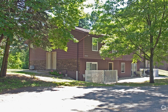
Property Detail
17555 144Th Ave
70-03-13-200-015
PART OF NE 1/4 COM NE COR, TH S 474 FT, TH W 264 FT, TH N 3815 FT, TH NE'LY ALG CEN LI OF STATE RD TO BEG, EXC COM NE COR TH
Multifamilydwelling
Ottawa
RR
Michigan
B and X Area of moderate flood hazard, usually the area between the limits of the 100-year and 500-year floods.
1.84 AC
2025
Grand Haven
2025
West Michigan
020501
Grand Rapids-Wyoming-Kentwood, MI
16,695 SF
NEARBY LISTINGS FOR SALE OR LEASE
-
-
View all Spring Lake listings for sale on LoopNet.com
DEMOGRAPHICS near 17555 144Th Ave
1 mile
3 mile
5 mile
2025 Total Population
2,190
18,772
50,992
2030 Population
2,289
19,404
52,735
Pop Growth 2025-2030
+ 4.52%
+ 3.37%
+ 3.42%
Average Age
42
43
43
2025 Total Households
917
7,495
21,256
HH Growth 2025-2030
+ 4.69%
+ 3.54%
+ 3.63%
Median Household Inc
$56,573
$84,859
$75,663
Avg Household Size
2.30
2.50
2.40
2025 Avg HH Vehicles
2.00
2.00
2.00
Median Home Value
$296,315
$346,565
$318,237
Median Year Built
1991
1983
1982
Nearby Places
Map Layers
Map Styles
 Street
 Aerial
Layers
 Traffic
 Biking
Places
Listings with unknown addresses are not visible on the map
- Restaurants
- Banks
- Shops
- Fitness
- Groceries
Nearby Properties
Address
Land Use
TOTAL SIZE
Lot Size
Zoning
Address
Land Use
TOTAL SIZE
Lot Size
Zoning
40,251 SF
159.38 AC
PR
Address
Land Use
TOTAL SIZE
Lot Size
Zoning
207,571 SF
22 AC
LI
Address
Land Use
TOTAL SIZE
Lot Size
Zoning
55,600 SF
LI
Address
Land Use
TOTAL SIZE
Lot Size
Zoning
2,724 SF
56.50 AC
MHP
Address
Land Use
TOTAL SIZE
Lot Size
Zoning
27,006 SF
6.12 AC
MU
Address
Land Use
TOTAL SIZE
Lot Size
Zoning
64,143 SF
11.43 AC
LI
Address
Land Use
TOTAL SIZE
Lot Size
Zoning
588 SF
39.91 AC
MHP
Address
Land Use
TOTAL SIZE
Lot Size
Zoning
30,400 SF
Address
Land Use
TOTAL SIZE
Lot Size
Zoning
4,064 SF
39.10 AC
Address
Land Use
TOTAL SIZE
Lot Size
Zoning
2,618 SF
13.25 AC
LI
Address
Land Use
TOTAL SIZE
Lot Size
Zoning
32,368 SF
Address
Land Use
TOTAL SIZE
Lot Size
Zoning
23,475 SF
0.23 AC
CBD
Address
Land Use
TOTAL SIZE
Lot Size
Zoning
63,006 SF
3.30 AC
MFR-B
Address
Land Use
TOTAL SIZE
Lot Size
Zoning
13 AC
MHP
Address
Land Use
TOTAL SIZE
Lot Size
Zoning
95,126 SF
5.08 AC
LI
Address
Land Use
TOTAL SIZE
Lot Size
Zoning
94,226 SF
3.70 AC
EED-PUD
Address
Land Use
TOTAL SIZE
Lot Size
Zoning
27,768 SF
4.58 AC
GC
Address
Land Use
TOTAL SIZE
Lot Size
Zoning
122,963 SF
4.23 AC
LI
Address
Land Use
TOTAL SIZE
Lot Size
Zoning
2,466 SF
1.87 AC
EED
Address
Land Use
TOTAL SIZE
Lot Size
Zoning
52,533 SF
2.75 AC
MFR-B
Address
Land Use
TOTAL SIZE
Lot Size
Zoning
84,140 SF
4.66 AC
LI
Address
Land Use
TOTAL SIZE
Lot Size
Zoning
38,042 SF
5.04 AC
Address
Land Use
TOTAL SIZE
Lot Size
Zoning
23,016 SF
7 AC
Address
Land Use
TOTAL SIZE
Lot Size
Zoning
53,100 SF
2.76 AC
LI
Address
Land Use
TOTAL SIZE
Lot Size
Zoning
10.33 AC
R-2
Address
Land Use
TOTAL SIZE
Lot Size
Zoning
22,500 SF
I INDU
Address
Land Use
TOTAL SIZE
Lot Size
Zoning
67,980 SF
11.02 AC
LI
Address
Land Use
TOTAL SIZE
Lot Size
Zoning
41,832 SF
5.24 AC
LI
Address
Land Use
TOTAL SIZE
Lot Size
Zoning
3,676 SF
2.27 AC
R-2
Address
Land Use
TOTAL SIZE
Lot Size
Zoning
9.47 AC
MHP
The World's #1 Commercial Real Estate Marketplace
Connect with us
© 2026 CoStar Group
The information above has been obtained from sources believed reliable. While we do not doubt its accuracy we have not verified it and make no guarantee, warranty or representation about it. It is your responsibility to independently confirm its accuracy and completeness. Any projections, opinions, assumptions, or estimates used are for example only and do not represent the current or future performance of the property. The value of this transaction to you depends on tax and other factors which should be evaluated by your tax, financial, and legal advisors. You and your advisors should conduct a careful, independent investigation of the property to determine to your satisfaction the suitability of the property for your needs.