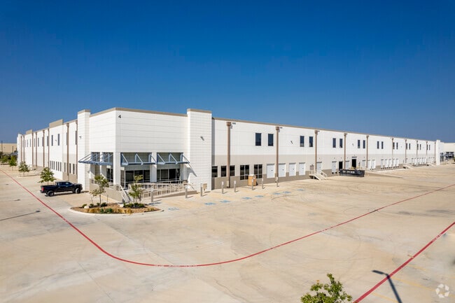
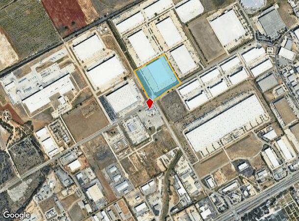
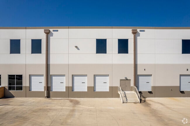
Property Record
17630 Lookout Rd, Selma, TX 78154

NEARBY LISTINGS FOR SALE OR LEASE
Property Detail
17630 Lookout Rd
San Antonio-New Braunfels, TX
Enterprise Industrial Park
16-0297-0001-04
ENTERPRISE INDUSTRIAL PARK, BLOCK 1, LOT 6
Commercialnec
Comal
AE
Texas
48029C0285F
6
2024
21.11 AC
2025
Comal County
310801
San Antonio
576 SF
DEMOGRAPHICS near 17630 Lookout Rd
1 Mile
3 Mile
5 Mile
2024 Total Population
491
42,275
131,755
2029 Population
632
48,314
147,104
Pop Growth 2024-2029
+ 28.72%
+ 14.29%
+ 11.65%
Average Age
42
39
38
2024 Total Households
186
15,253
47,358
HH Growth 2024-2029
+ 27.42%
+ 14.33%
+ 11.61%
Median Household Inc
$120,535
$101,573
$85,195
Avg Household Size
2.60
2.80
2.80
2024 Avg HH Vehicles
2.00
2.00
2.00
Median Home Value
$513,393
$271,473
$246,408
Median Year Built
2003
2003
2000
Nearby Places
Map Layers
Map Styles
 Street
 Aerial
- Restaurants
- Banks
- Shops
- Fitness
- Groceries
PUBLIC TRANSPORTATION
AIRPORT
San Antonio International
DRIVE
WALK
Distance
San Antonio International
20 min
14.4 mi
Freight Ports
Calhoun Port
DRIVE
WALK
Distance
Calhoun Port
182 min
150.1 mi
SALE & LEASE HISTORY
LISTING DATE
SALE/LEASE

May 18, 2021
For Lease
Nearby Properties
Address
Land Use
TOTAL SIZE
Lot Size
Zoning
Address
Land Use
TOTAL SIZE
Lot Size
Zoning
538,168 SF
176.13 AC
Address
Land Use
TOTAL SIZE
Lot Size
Zoning
566,929 SF
89.66 AC
Address
Land Use
TOTAL SIZE
Lot Size
Zoning
116.47 AC
Address
Land Use
TOTAL SIZE
Lot Size
Zoning
350,805 SF
20.85 AC
Address
Land Use
TOTAL SIZE
Lot Size
Zoning
246,965 SF
11.73 AC
Address
Land Use
TOTAL SIZE
Lot Size
Zoning
95,470 SF
35.26 AC
Address
Land Use
TOTAL SIZE
Lot Size
Zoning
Address
Land Use
TOTAL SIZE
Lot Size
Zoning
280,516 SF
12.92 AC
Address
Land Use
TOTAL SIZE
Lot Size
Zoning
199,756 SF
19.75 AC
Address
Land Use
TOTAL SIZE
Lot Size
Zoning
251,110 SF
12.26 AC
Address
Land Use
TOTAL SIZE
Lot Size
Zoning
214,405 SF
11.85 AC
Address
Land Use
TOTAL SIZE
Lot Size
Zoning
223,980 SF
17.11 AC
Address
Land Use
TOTAL SIZE
Lot Size
Zoning
245,993 SF
23.82 AC
Address
Land Use
TOTAL SIZE
Lot Size
Zoning
55,640 SF
24.17 AC
Address
Land Use
TOTAL SIZE
Lot Size
Zoning
511,000 SF
32.40 AC
Address
Land Use
TOTAL SIZE
Lot Size
Zoning
430,320 SF
25.03 AC
Address
Land Use
TOTAL SIZE
Lot Size
Zoning
172,080 SF
17 AC
Address
Land Use
TOTAL SIZE
Lot Size
Zoning
111,269 SF
73.47 AC
Address
Land Use
TOTAL SIZE
Lot Size
Zoning
7,176 SF
24.22 AC
Address
Land Use
TOTAL SIZE
Lot Size
Zoning
358,036 SF
20.77 AC
Address
Land Use
TOTAL SIZE
Lot Size
Zoning
223,965 SF
14.45 AC
Address
Land Use
TOTAL SIZE
Lot Size
Zoning
86,124 SF
9.37 AC
Address
Land Use
TOTAL SIZE
Lot Size
Zoning
73,813 SF
17.33 AC
Address
Land Use
TOTAL SIZE
Lot Size
Zoning
312,696 SF
18.01 AC
Address
Land Use
TOTAL SIZE
Lot Size
Zoning
154,641 SF
9.07 AC
Address
Land Use
TOTAL SIZE
Lot Size
Zoning
308,264 SF
26.51 AC
Address
Land Use
TOTAL SIZE
Lot Size
Zoning
307,240 SF
20.16 AC
Address
Land Use
TOTAL SIZE
Lot Size
Zoning
112,870 SF
13.32 AC
Address
Land Use
TOTAL SIZE
Lot Size
Zoning
576 SF
41.86 AC
Address
Land Use
TOTAL SIZE
Lot Size
Zoning
321,016 SF
18.67 AC
The World's #1 Commercial Real Estate Marketplace
Connect with us
© 2025 CoStar Group
The information above has been obtained from sources believed reliable. While we do not doubt its accuracy we have not verified it and make no guarantee, warranty or representation about it. It is your responsibility to independently confirm its accuracy and completeness. Any projections, opinions, assumptions, or estimates used are for example only and do not represent the current or future performance of the property. The value of this transaction to you depends on tax and other factors which should be evaluated by your tax, financial, and legal advisors. You and your advisors should conduct a careful, independent investigation of the property to determine to your satisfaction the suitability of the property for your needs.