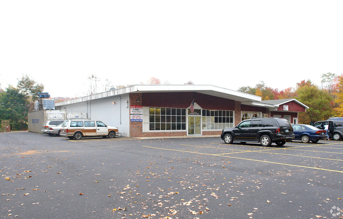
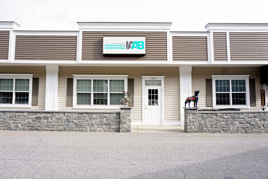
Property Record
178 Birge Park Rd, Harwinton, CT 06791
NEARBY LISTINGS FOR SALE OR LEASE
Property Detail
178 Birge Park Rd
Torrington, CT
Litchfield
HARW-000007-000005-000025C
Connecticut
Commercialnec
25
2024
2.76 AC
2024
Torrington
298300
Hartford
7,016 SF
DEMOGRAPHICS near 178 Birge Park Rd
1 Mile
3 Mile
5 Mile
2024 Total Population
1,326
18,567
42,071
2029 Population
1,319
18,512
41,910
Pop Growth 2024-2029
(0.53%)
(0.30%)
(0.38%)
Average Age
45
44
43
2024 Total Households
558
8,105
18,015
HH Growth 2024-2029
(0.54%)
(0.26%)
(0.37%)
Median Household Inc
$94,687
$72,980
$72,175
Avg Household Size
2.40
2.20
2.30
2024 Avg HH Vehicles
2.00
2.00
2.00
Median Home Value
$306,183
$204,210
$211,876
Median Year Built
1965
1961
1961
Nearby Places
- Restaurants
- Banks
- Shops
- Fitness
- Groceries
PUBLIC TRANSPORTATION
AIRPORT
Bradley International
DRIVE
WALK
Distance
Bradley International
59 min
34.1 mi
Freight Ports
Port of New Haven
DRIVE
WALK
Distance
Port of New Haven
65 min
45.0 mi
SALE & LEASE HISTORY
LISTING DATE
SALE/LEASE

Jan 02, 2020
For Lease
Nearby Properties
Address
Land Use
TOTAL SIZE
Lot Size
Zoning
Address
Land Use
TOTAL SIZE
Lot Size
Zoning
142,840 SF
13.80 AC
R6
Address
Land Use
TOTAL SIZE
Lot Size
Zoning
10.80 AC
R10S
Address
Land Use
TOTAL SIZE
Lot Size
Zoning
128,711 SF
18.50 AC
LB
Address
Land Use
TOTAL SIZE
Lot Size
Zoning
68,011 SF
9.83 AC
R10S
Address
Land Use
TOTAL SIZE
Lot Size
Zoning
93,608 SF
25.40 AC
R2
Address
Land Use
TOTAL SIZE
Lot Size
Zoning
131,925 SF
12.51 AC
DD
Address
Land Use
TOTAL SIZE
Lot Size
Zoning
13,576 SF
12.80 AC
R10
Address
Land Use
TOTAL SIZE
Lot Size
Zoning
56,519 SF
11.41 AC
LB
Address
Land Use
TOTAL SIZE
Lot Size
Zoning
36.55 AC
CIR
Address
Land Use
TOTAL SIZE
Lot Size
Zoning
68,160 SF
2.31 AC
LB
Address
Land Use
TOTAL SIZE
Lot Size
Zoning
57,875 SF
21.83 AC
CRA-2
Address
Land Use
TOTAL SIZE
Lot Size
Zoning
95,978 SF
CIR
Address
Land Use
TOTAL SIZE
Lot Size
Zoning
68,192 SF
1.76 AC
DD
Address
Land Use
TOTAL SIZE
Lot Size
Zoning
5.17 AC
LB
Address
Land Use
TOTAL SIZE
Lot Size
Zoning
25,393 SF
12.60 AC
R10S
Address
Land Use
TOTAL SIZE
Lot Size
Zoning
63,735 SF
3.32 AC
CIR
Address
Land Use
TOTAL SIZE
Lot Size
Zoning
9.39 AC
LB
Address
Land Use
TOTAL SIZE
Lot Size
Zoning
59,670 SF
4.31 AC
R6
Address
Land Use
TOTAL SIZE
Lot Size
Zoning
15.80 AC
R6
Address
Land Use
TOTAL SIZE
Lot Size
Zoning
7,333 SF
180.95 AC
CRA-2
Address
Land Use
TOTAL SIZE
Lot Size
Zoning
14,736 SF
1.85 AC
LB
Address
Land Use
TOTAL SIZE
Lot Size
Zoning
1 AC
DD
Address
Land Use
TOTAL SIZE
Lot Size
Zoning
8.10 AC
R6
Address
Land Use
TOTAL SIZE
Lot Size
Zoning
20,346 SF
2.03 AC
BC
Address
Land Use
TOTAL SIZE
Lot Size
Zoning
16.33 AC
R-1
Address
Land Use
TOTAL SIZE
Lot Size
Zoning
8.13 AC
LB
Address
Land Use
TOTAL SIZE
Lot Size
Zoning
8.89 AC
LB
Address
Land Use
TOTAL SIZE
Lot Size
Zoning
1,185 SF
4.87 AC
R6
Address
Land Use
TOTAL SIZE
Lot Size
Zoning
22,477 SF
4.68 AC
LB
Address
Land Use
TOTAL SIZE
Lot Size
Zoning
4.70 AC
R6
The World's #1 Commercial Real Estate Marketplace
Connect with us
© 2025 CoStar Group
The information above has been obtained from sources believed reliable. While we do not doubt its accuracy we have not verified it and make no guarantee, warranty or representation about it. It is your responsibility to independently confirm its accuracy and completeness. Any projections, opinions, assumptions, or estimates used are for example only and do not represent the current or future performance of the property. The value of this transaction to you depends on tax and other factors which should be evaluated by your tax, financial, and legal advisors. You and your advisors should conduct a careful, independent investigation of the property to determine to your satisfaction the suitability of the property for your needs.