Property Record
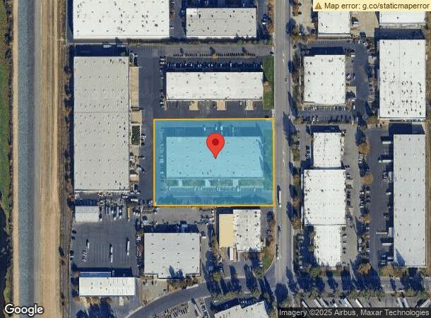
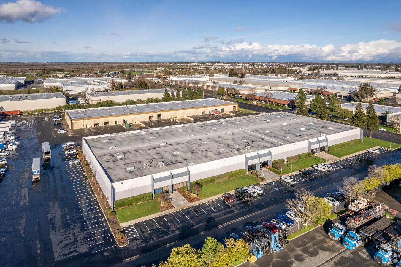
1800 Enterprise Blvd, West Sacramento, CA 95691


NEARBY LISTINGS FOR SALE OR LEASE
Property Detail
1800 Enterprise Blvd
067-020-033-000
Parcel Map 3348
Warehouse
PM3348 PCL C PM BK 7, PG 69
ARE
Yolo
06113C0630G
California
2024
4.44 AC
2023
West Sacramento
010203
Sacramento
75,600 SF
Sacramento--Roseville--Arden-Arcade, CA
DEMOGRAPHICS near 1800 Enterprise Blvd
1 Mile
3 Mile
5 Mile
2024 Total Population
498
34,643
115,858
2029 Population
502
35,154
117,475
Pop Growth 2024-2029
+ 0.80%
+ 1.48%
+ 1.40%
Average Age
54
37
40
2024 Total Households
234
12,451
46,962
HH Growth 2024-2029
+ 0.43%
+ 1.57%
+ 1.55%
Median Household Inc
$59,230
$83,194
$81,999
Avg Household Size
1.90
2.70
2.30
2024 Avg HH Vehicles
1.00
2.00
2.00
Median Home Value
$129,787
$441,030
$554,437
Median Year Built
1975
1989
1975
Nearby Places
- Restaurants
- Banks
- Shops
- Fitness
- Groceries
PUBLIC TRANSPORTATION
AIRPORT
Sacramento International
DRIVE
WALK
Distance
Sacramento International
21 min
13.7 mi
Freight Ports
Port of Stockton
DRIVE
WALK
Distance
Port of Stockton
58 min
49.7 mi
SALE & LEASE HISTORY
LISTING DATE
SALE/LEASE

Sep 24, 2016
For Lease
Jul 16, 2018
For Lease
Aug 15, 2022
For Lease
Nearby Properties
Address
Land Use
TOTAL SIZE
Lot Size
Zoning
Address
Land Use
TOTAL SIZE
Lot Size
Zoning
51,570 SF
9.76 AC
B-P
Address
Land Use
TOTAL SIZE
Lot Size
Zoning
379,161 SF
22.70 AC
MU
Address
Land Use
TOTAL SIZE
Lot Size
Zoning
267,053 SF
22.19 AC
M2
Address
Land Use
TOTAL SIZE
Lot Size
Zoning
13.19 AC
MU
Address
Land Use
TOTAL SIZE
Lot Size
Zoning
181,432 SF
35.96 AC
MU
Address
Land Use
TOTAL SIZE
Lot Size
Zoning
24.83 AC
M-L
Address
Land Use
TOTAL SIZE
Lot Size
Zoning
368,561 SF
24.69 AC
P-O
Address
Land Use
TOTAL SIZE
Lot Size
Zoning
260,285 SF
20.22 AC
C2
Address
Land Use
TOTAL SIZE
Lot Size
Zoning
236,812 SF
12.12 AC
MU
Address
Land Use
TOTAL SIZE
Lot Size
Zoning
229,130 SF
10.64 AC
BP
Address
Land Use
TOTAL SIZE
Lot Size
Zoning
27.65 AC
M-3
Address
Land Use
TOTAL SIZE
Lot Size
Zoning
422,059 SF
22.62 AC
MU
Address
Land Use
TOTAL SIZE
Lot Size
Zoning
31.93 AC
M-3
Address
Land Use
TOTAL SIZE
Lot Size
Zoning
16.87 AC
M-L
Address
Land Use
TOTAL SIZE
Lot Size
Zoning
387,420 SF
20.75 AC
MU
Address
Land Use
TOTAL SIZE
Lot Size
Zoning
444,600 SF
24.81 AC
MU
Address
Land Use
TOTAL SIZE
Lot Size
Zoning
22.03 AC
C2
Address
Land Use
TOTAL SIZE
Lot Size
Zoning
480 SF
1.80 AC
M2
Address
Land Use
TOTAL SIZE
Lot Size
Zoning
5.65 AC
M-2
Address
Land Use
TOTAL SIZE
Lot Size
Zoning
115,234 SF
36.70 AC
M-3
Address
Land Use
TOTAL SIZE
Lot Size
Zoning
300,098 SF
15.79 AC
MU
Address
Land Use
TOTAL SIZE
Lot Size
Zoning
73,349 SF
1.82 AC
C2
Address
Land Use
TOTAL SIZE
Lot Size
Zoning
249,048 SF
12.48 AC
MU
Address
Land Use
TOTAL SIZE
Lot Size
Zoning
127,062 SF
8.50 AC
C2
Address
Land Use
TOTAL SIZE
Lot Size
Zoning
6,600 SF
12.65 AC
M2
Address
Land Use
TOTAL SIZE
Lot Size
Zoning
17.50 AC
MU
Address
Land Use
TOTAL SIZE
Lot Size
Zoning
20.36 AC
M1
Address
Land Use
TOTAL SIZE
Lot Size
Zoning
148,021 SF
8.42 AC
BP
Address
Land Use
TOTAL SIZE
Lot Size
Zoning
65,933 SF
11.09 AC
C2
Address
Land Use
TOTAL SIZE
Lot Size
Zoning
28,028 SF
3.70 AC
BP
The World's #1 Commercial Real Estate Marketplace
Connect with us
© 2025 CoStar Group
The information above has been obtained from sources believed reliable. While we do not doubt its accuracy we have not verified it and make no guarantee, warranty or representation about it. It is your responsibility to independently confirm its accuracy and completeness. Any projections, opinions, assumptions, or estimates used are for example only and do not represent the current or future performance of the property. The value of this transaction to you depends on tax and other factors which should be evaluated by your tax, financial, and legal advisors. You and your advisors should conduct a careful, independent investigation of the property to determine to your satisfaction the suitability of the property for your needs.