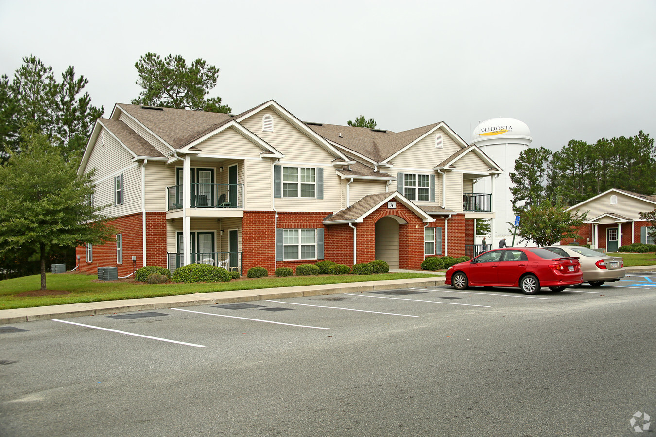
Property Record
1800 Eastwind Rd, Valdosta, GA 31602
NEARBY LISTINGS FOR SALE OR LEASE
-
-
View all Valdosta listings for sale on LoopNet.com
Property Detail
1800 Eastwind Rd
Valdosta, GA
Apartments Grp1
0149C-128
LT 2 HERON LAKE S/D
Multifamilydwelling
Lowndes
X
Georgia
13185C0120E
2
2024
9.69 AC
2024
Valdosta/Lake Park
010601
Other Market Areas
2,144 SF
DEMOGRAPHICS near 1800 Eastwind Rd
1 Mile
3 Mile
5 Mile
2024 Total Population
8,485
41,712
71,947
2029 Population
8,785
43,223
74,732
Pop Growth 2024-2029
+ 3.54%
+ 3.62%
+ 3.87%
Average Age
34
35
35
2024 Total Households
3,184
16,360
28,023
HH Growth 2024-2029
+ 3.64%
+ 3.80%
+ 4.04%
Median Household Inc
$36,287
$36,319
$36,308
Avg Household Size
2.60
2.40
2.40
2024 Avg HH Vehicles
2.00
2.00
2.00
Median Home Value
$97,135
$161,956
$162,505
Median Year Built
1992
1987
1989
Nearby Places
- Restaurants
- Banks
- Shops
- Fitness
- Groceries
PUBLIC TRANSPORTATION
AIRPORT
Valdosta Regional
DRIVE
WALK
Distance
Valdosta Regional
15 min
7.4 mi
Freight Ports
Georgia Ports - Brunswick
DRIVE
WALK
Distance
Georgia Ports - Brunswick
154 min
116.2 mi
Nearby Properties
Address
Land Use
TOTAL SIZE
Lot Size
Zoning
Address
Land Use
TOTAL SIZE
Lot Size
Zoning
60,000 SF
56.32 AC
M-1
Address
Land Use
TOTAL SIZE
Lot Size
Zoning
39,024 SF
18.04 AC
P-D
Address
Land Use
TOTAL SIZE
Lot Size
Zoning
4,878 SF
14.83 AC
R-P
Address
Land Use
TOTAL SIZE
Lot Size
Zoning
15.75 AC
R-P
Address
Land Use
TOTAL SIZE
Lot Size
Zoning
339 SF
23.53 AC
E-R
Address
Land Use
TOTAL SIZE
Lot Size
Zoning
19,825 SF
16.93 AC
R-M
Address
Land Use
TOTAL SIZE
Lot Size
Zoning
2,574 SF
12 AC
R-P
Address
Land Use
TOTAL SIZE
Lot Size
Zoning
185,727 SF
20.33 AC
C-H
Address
Land Use
TOTAL SIZE
Lot Size
Zoning
114,922 SF
11.38 AC
C-C
Address
Land Use
TOTAL SIZE
Lot Size
Zoning
142,140 SF
24.29 AC
DR-10
Address
Land Use
TOTAL SIZE
Lot Size
Zoning
24,928 SF
10 AC
R-M
Address
Land Use
TOTAL SIZE
Lot Size
Zoning
65,664 SF
16.06 AC
R-M
Address
Land Use
TOTAL SIZE
Lot Size
Zoning
7,200 SF
9.92 AC
M-1
Address
Land Use
TOTAL SIZE
Lot Size
Zoning
40,800 SF
5.83 AC
R-P
Address
Land Use
TOTAL SIZE
Lot Size
Zoning
53,880 SF
8.01 AC
C-H,C-C
Address
Land Use
TOTAL SIZE
Lot Size
Zoning
574 SF
7.28 AC
PPD
Address
Land Use
TOTAL SIZE
Lot Size
Zoning
93,032 SF
2.80 AC
C-H
Address
Land Use
TOTAL SIZE
Lot Size
Zoning
78,048 SF
9.18 AC
R-P
Address
Land Use
TOTAL SIZE
Lot Size
Zoning
13,056 SF
9.41 AC
R-M
Address
Land Use
TOTAL SIZE
Lot Size
Zoning
2,096 SF
6.98 AC
P-D
Address
Land Use
TOTAL SIZE
Lot Size
Zoning
1,902 SF
10.58 AC
R-M
Address
Land Use
TOTAL SIZE
Lot Size
Zoning
166,300 SF
43.05 AC
M-2
Address
Land Use
TOTAL SIZE
Lot Size
Zoning
48,000 SF
9.06 AC
C-C
Address
Land Use
TOTAL SIZE
Lot Size
Zoning
110,646 SF
9.76 AC
R-P
Address
Land Use
TOTAL SIZE
Lot Size
Zoning
49,546 SF
10.45 AC
R-P
Address
Land Use
TOTAL SIZE
Lot Size
Zoning
202,062 SF
7.12 AC
R-15
Address
Land Use
TOTAL SIZE
Lot Size
Zoning
25,727 SF
9.12 AC
R-A
Address
Land Use
TOTAL SIZE
Lot Size
Zoning
103,468 SF
9.38 AC
C-H
Address
Land Use
TOTAL SIZE
Lot Size
Zoning
9,180 SF
4.86 AC
C-H
Address
Land Use
TOTAL SIZE
Lot Size
Zoning
9,000 SF
72.18 AC
E-A
The World's #1 Commercial Real Estate Marketplace
Connect with us
© 2025 CoStar Group
The information above has been obtained from sources believed reliable. While we do not doubt its accuracy we have not verified it and make no guarantee, warranty or representation about it. It is your responsibility to independently confirm its accuracy and completeness. Any projections, opinions, assumptions, or estimates used are for example only and do not represent the current or future performance of the property. The value of this transaction to you depends on tax and other factors which should be evaluated by your tax, financial, and legal advisors. You and your advisors should conduct a careful, independent investigation of the property to determine to your satisfaction the suitability of the property for your needs.