Property Record
1800 Indianapolis Ave, Lebanon, IN 46052

NEARBY LISTINGS FOR SALE OR LEASE
Property Detail
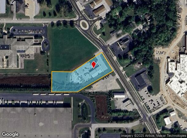
1800 Indianapolis Ave
06-07-06-000-095.000-002
PT NE 6-18-1E 2.76
Storebuilding
Boone
X
Indiana
18011C0187E
2.76 AC
2023
Boone County
2024
Indianapolis
810500
Indianapolis-Carmel-Anderson, IN
5,200 SF
DEMOGRAPHICS near 1800 Indianapolis Ave
1 Mile
3 Mile
5 Mile
2024 Total Population
1,773
16,371
20,396
2029 Population
1,973
18,296
22,786
Pop Growth 2024-2029
+ 11.28%
+ 11.76%
+ 11.72%
Average Age
38
41
41
2024 Total Households
729
6,918
8,568
HH Growth 2024-2029
+ 11.66%
+ 12.08%
+ 12.03%
Median Household Inc
$50,769
$64,572
$68,510
Avg Household Size
2.30
2.30
2.30
2024 Avg HH Vehicles
2.00
2.00
2.00
Median Home Value
$139,570
$169,334
$184,350
Median Year Built
1973
1973
1976
Nearby Places
- Restaurants
- Banks
- Shops
- Fitness
- Groceries
PUBLIC TRANSPORTATION
AIRPORT
Indianapolis International
DRIVE
WALK
Distance
Indianapolis International
47 min
31.4 mi
Freight Ports
Port of Toledo
DRIVE
WALK
Distance
Port of Toledo
284 min
239.9 mi
Nearby Properties
Address
Land Use
TOTAL SIZE
Lot Size
Zoning
Address
Land Use
TOTAL SIZE
Lot Size
Zoning
518,530 SF
57.16 AC
ZO01
Address
Land Use
TOTAL SIZE
Lot Size
Zoning
418,084 SF
40.25 AC
ZO01
Address
Land Use
TOTAL SIZE
Lot Size
Zoning
1,029,528 SF
58.50 AC
ZO01
Address
Land Use
TOTAL SIZE
Lot Size
Zoning
589,616 SF
49.19 AC
ZO01
Address
Land Use
TOTAL SIZE
Lot Size
Zoning
962,135 SF
56.15 AC
ZO01
Address
Land Use
TOTAL SIZE
Lot Size
Zoning
559,722 SF
41.90 AC
ZO01
Address
Land Use
TOTAL SIZE
Lot Size
Zoning
842,006 SF
57.92 AC
ZO01
Address
Land Use
TOTAL SIZE
Lot Size
Zoning
741,000 SF
67.48 AC
ZO01
Address
Land Use
TOTAL SIZE
Lot Size
Zoning
392,368 SF
54.57 AC
ZO01
Address
Land Use
TOTAL SIZE
Lot Size
Zoning
695,269 SF
44.28 AC
ZO01
Address
Land Use
TOTAL SIZE
Lot Size
Zoning
707,952 SF
32.35 AC
ZO01
Address
Land Use
TOTAL SIZE
Lot Size
Zoning
615,708 SF
41.91 AC
ZO01
Address
Land Use
TOTAL SIZE
Lot Size
Zoning
478,230 SF
28.96 AC
ZO01
Address
Land Use
TOTAL SIZE
Lot Size
Zoning
149,353 SF
29.98 AC
ZO01
Address
Land Use
TOTAL SIZE
Lot Size
Zoning
479,040 SF
44.07 AC
ZO01
Address
Land Use
TOTAL SIZE
Lot Size
Zoning
204,480 SF
27.67 AC
ZO01
Address
Land Use
TOTAL SIZE
Lot Size
Zoning
396,096 SF
23.32 AC
ZO01
Address
Land Use
TOTAL SIZE
Lot Size
Zoning
395,686 SF
34.20 AC
ZO01
Address
Land Use
TOTAL SIZE
Lot Size
Zoning
171,748 SF
10.33 AC
ZO01
Address
Land Use
TOTAL SIZE
Lot Size
Zoning
250,000 SF
21.40 AC
ZO01
Address
Land Use
TOTAL SIZE
Lot Size
Zoning
215,406 SF
33 AC
ZO01
Address
Land Use
TOTAL SIZE
Lot Size
Zoning
6,278 SF
11.88 AC
ZO01
Address
Land Use
TOTAL SIZE
Lot Size
Zoning
219,220 SF
12.86 AC
ZO01
Address
Land Use
TOTAL SIZE
Lot Size
Zoning
4,379 SF
19.22 AC
ZO01
Address
Land Use
TOTAL SIZE
Lot Size
Zoning
225,000 SF
22.68 AC
ZO01
Address
Land Use
TOTAL SIZE
Lot Size
Zoning
106,152 SF
7.47 AC
ZO01
Address
Land Use
TOTAL SIZE
Lot Size
Zoning
114,600 SF
33.68 AC
ZO01
Address
Land Use
TOTAL SIZE
Lot Size
Zoning
193,382 SF
30.23 AC
ZO01
Address
Land Use
TOTAL SIZE
Lot Size
Zoning
184,013 SF
12.09 AC
ZO01
Address
Land Use
TOTAL SIZE
Lot Size
Zoning
173,140 SF
25.18 AC
ZO01
The World's #1 Commercial Real Estate Marketplace
Connect with us
© 2025 CoStar Group
The information above has been obtained from sources believed reliable. While we do not doubt its accuracy we have not verified it and make no guarantee, warranty or representation about it. It is your responsibility to independently confirm its accuracy and completeness. Any projections, opinions, assumptions, or estimates used are for example only and do not represent the current or future performance of the property. The value of this transaction to you depends on tax and other factors which should be evaluated by your tax, financial, and legal advisors. You and your advisors should conduct a careful, independent investigation of the property to determine to your satisfaction the suitability of the property for your needs.