Property Record
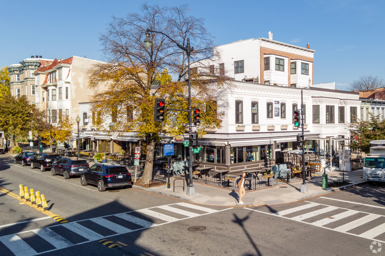
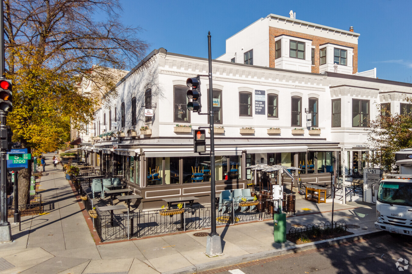
1761 S St Nw, Washington, DC 20009

Current Lease Availabilities
NEARBY LISTINGS FOR SALE OR LEASE
Property Detail
1761 S St Nw
Washington-Arlington-Alexandria, DC-VA-MD-WV
Old City 2
0152-0192
SQUARE 0152 LOT 0192 NBHD: OLD CITY 2
Storemultistory
District of Columbia
X
District of Columbia
1100010016C
192
2024
0.09 AC
2024
Dupont Circle
004201
Washington, DC
12,812 SF
DEMOGRAPHICS near 1761 S St Nw
1 Mile
3 Mile
5 Mile
2024 Total Population
81,414
352,807
745,820
2029 Population
73,587
324,111
697,333
Pop Growth 2024-2029
(9.61%)
(8.13%)
(6.50%)
Average Age
37
37
38
2024 Total Households
47,138
179,835
352,819
HH Growth 2024-2029
(10.57%)
(8.88%)
(7.08%)
Median Household Inc
$117,780
$112,819
$110,698
Avg Household Size
1.60
1.80
2.00
2024 Avg HH Vehicles
1.00
1.00
1.00
Median Home Value
$762,036
$782,861
$773,790
Median Year Built
1954
1961
1963
Nearby Places
- Restaurants
- Banks
- Shops
- Fitness
- Groceries
PUBLIC TRANSPORTATION
TRANSIT/SUBWAY
Dupont Circle (Red Line - Washington Metropolitan Area Transit Authority Metrorail (Metrorail))
DRIVE
WALK
Distance
Dupont Circle (Red Line - Washington Metropolitan Area Transit Authority Metrorail (Metrorail))
3 min
10 min
0.5 mi
Farragut North (Red Line - Washington Metropolitan Area Transit Authority Metrorail (Metrorail))
DRIVE
WALK
Distance
Farragut North (Red Line - Washington Metropolitan Area Transit Authority Metrorail (Metrorail))
5 min
15 min
0.8 mi
U Street (Green Line - Washington Metropolitan Area Transit Authority Metrorail (Metrorail), Yellow Line - Washington Metropolitan Area Transit Authority Metrorail (Metrorail))
DRIVE
WALK
Distance
U Street (Green Line - Washington Metropolitan Area Transit Authority Metrorail (Metrorail), Yellow Line - Washington Metropolitan Area Transit Authority Metrorail (Metrorail))
5 min
17 min
0.9 mi
Farragut West (Blue Line - Washington Metropolitan Area Transit Authority Metrorail (Metrorail), Orange Line - Washington Metropolitan Area Transit Authority Metrorail (Metrorail), Silver Line - Washington Metropolitan Area Transit Authority Metrorail (Metrorail))
DRIVE
WALK
Distance
Farragut West (Blue Line - Washington Metropolitan Area Transit Authority Metrorail (Metrorail), Orange Line - Washington Metropolitan Area Transit Authority Metrorail (Metrorail), Silver Line - Washington Metropolitan Area Transit Authority Metrorail (Metrorail))
7 min
18 min
1.0 mi
COMMUTER RAIL
Union Station (Brunswick Line - Maryland Area Regional Commuter Trains (The MARC), Camden Line - Maryland Area Regional Commuter Trains (The MARC), Penn Line - Maryland Area Regional Commuter Trains (The MARC))
DRIVE
WALK
Distance
Union Station (Brunswick Line - Maryland Area Regional Commuter Trains (The MARC), Camden Line - Maryland Area Regional Commuter Trains (The MARC), Penn Line - Maryland Area Regional Commuter Trains (The MARC))
15 min
3.5 mi
Union Station (Fredericksburg Line - Virginia Railway Express, Manassas Line - Virginia Railway Express)
DRIVE
WALK
Distance
Union Station (Fredericksburg Line - Virginia Railway Express, Manassas Line - Virginia Railway Express)
15 min
3.5 mi
AIRPORT
Ronald Reagan Washington National
DRIVE
WALK
Distance
Ronald Reagan Washington National
20 min
6.2 mi
Washington Dulles International
DRIVE
WALK
Distance
Washington Dulles International
42 min
27.9 mi
Baltimore-Washington International
DRIVE
WALK
Distance
Baltimore-Washington International
51 min
32.6 mi
Freight Ports
Port of Baltimore
DRIVE
WALK
Distance
Port of Baltimore
1 min
33.9 mi
Nearby Properties
Address
Land Use
TOTAL SIZE
Lot Size
Zoning
Address
Land Use
TOTAL SIZE
Lot Size
Zoning
2,300,000 SF
1.60 AC
D-5-R
Address
Land Use
TOTAL SIZE
Lot Size
Zoning
40,980 SF
373.22 AC
UNZONED
Address
Land Use
TOTAL SIZE
Lot Size
Zoning
1,121 SF
88.76 AC
GOV
Address
Land Use
TOTAL SIZE
Lot Size
Zoning
443,830 SF
70.25 AC
UNZONED
Address
Land Use
TOTAL SIZE
Lot Size
Zoning
142 AC
GOV
Address
Land Use
TOTAL SIZE
Lot Size
Zoning
533,778 SF
18.08 AC
UNZONED
Address
Land Use
TOTAL SIZE
Lot Size
Zoning
1,290,186 SF
8.99 AC
UNZONED
Address
Land Use
TOTAL SIZE
Lot Size
Zoning
3.71 AC
UNZONED
Address
Land Use
TOTAL SIZE
Lot Size
Zoning
63.89 AC
GOV
Address
Land Use
TOTAL SIZE
Lot Size
Zoning
418.97 AC
MU-4,UNZON
Address
Land Use
TOTAL SIZE
Lot Size
Zoning
120 SF
276.66 AC
UNZONED
Address
Land Use
TOTAL SIZE
Lot Size
Zoning
1,170,529 SF
10.82 AC
UNZONED
Address
Land Use
TOTAL SIZE
Lot Size
Zoning
262,673 SF
5.34 AC
D-7
Address
Land Use
TOTAL SIZE
Lot Size
Zoning
1,530,865 SF
6.04 AC
D-6,UNZONE
Address
Land Use
TOTAL SIZE
Lot Size
Zoning
6,500,000 SF
0.20 AC
S-3A
Address
Land Use
TOTAL SIZE
Lot Size
Zoning
42.57 AC
GOV
Address
Land Use
TOTAL SIZE
Lot Size
Zoning
52.44 AC
UNZONED
Address
Land Use
TOTAL SIZE
Lot Size
Zoning
1,100,000 SF
2.13 AC
D-6
Address
Land Use
TOTAL SIZE
Lot Size
Zoning
1,336,013 SF
5.41 AC
D-5
Address
Land Use
TOTAL SIZE
Lot Size
Zoning
1,310,661 SF
3.38 AC
D-6
Address
Land Use
TOTAL SIZE
Lot Size
Zoning
2,455,000 SF
11.08 AC
MU-2
Address
Land Use
TOTAL SIZE
Lot Size
Zoning
1,545,768 SF
2.11 AC
D-7
Address
Land Use
TOTAL SIZE
Lot Size
Zoning
185,826 SF
9.40 AC
UNZONED
Address
Land Use
TOTAL SIZE
Lot Size
Zoning
130,083 SF
6.46 AC
UNZONED
Address
Land Use
TOTAL SIZE
Lot Size
Zoning
1,043,058 SF
4.03 AC
UNZONED
Address
Land Use
TOTAL SIZE
Lot Size
Zoning
1.57 AC
D-5
Address
Land Use
TOTAL SIZE
Lot Size
Zoning
2,058,692 SF
4.77 AC
UNZONED
Address
Land Use
TOTAL SIZE
Lot Size
Zoning
1,015,833 SF
1.60 AC
D-7
Address
Land Use
TOTAL SIZE
Lot Size
Zoning
553,914 SF
55.91 AC
R-1-B
Address
Land Use
TOTAL SIZE
Lot Size
Zoning
1,185,122 SF
2.43 AC
D-6
The World's #1 Commercial Real Estate Marketplace
Connect with us
© 2025 CoStar Group
The information above has been obtained from sources believed reliable. While we do not doubt its accuracy we have not verified it and make no guarantee, warranty or representation about it. It is your responsibility to independently confirm its accuracy and completeness. Any projections, opinions, assumptions, or estimates used are for example only and do not represent the current or future performance of the property. The value of this transaction to you depends on tax and other factors which should be evaluated by your tax, financial, and legal advisors. You and your advisors should conduct a careful, independent investigation of the property to determine to your satisfaction the suitability of the property for your needs.