Property Record
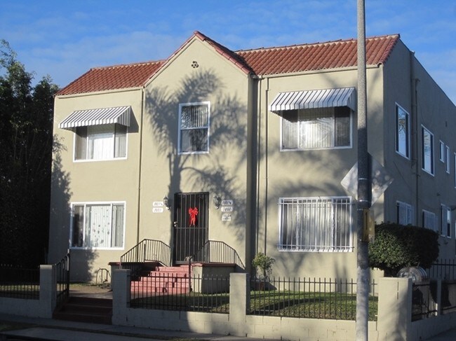
1801 S Highland Ave, Los Angeles, CA 90019


NEARBY LISTINGS FOR SALE OR LEASE
Property Detail
1801 S Highland Ave
Los Angeles-Long Beach-Glendale, CA
5870
5067-013-001
TRACT NO 5870 LOT 1 BLK 7
Quadruplex
Los Angeles
AO
California
06037C1611G
1
2024
0.14 AC
2025
Mid-City
218300
Los Angeles
5,174 SF
DEMOGRAPHICS near 1801 S Highland Ave
1 Mile
3 Mile
5 Mile
2024 Total Population
48,293
398,054
1,208,261
2029 Population
47,129
388,084
1,179,522
Pop Growth 2024-2029
(2.41%)
(2.50%)
(2.38%)
Average Age
39
40
39
2024 Total Households
17,791
160,662
499,121
HH Growth 2024-2029
(2.67%)
(2.67%)
(2.35%)
Median Household Inc
$64,290
$67,945
$64,238
Avg Household Size
2.60
2.40
2.30
2024 Avg HH Vehicles
2.00
1.00
1.00
Median Home Value
$952,064
$1,018,994
$1,001,537
Median Year Built
1948
1952
1961
Nearby Places
Map Layers
Map Styles
 Street
 Aerial
- Restaurants
- Banks
- Shops
- Fitness
- Groceries
PUBLIC TRANSPORTATION
COMMUTER RAIL
Los Angeles (Coast Starlight - Amtrak, Pacific Surfliner - Amtrak, Southwest Chief - Amtrak, Texas Eagle - Amtrak)
DRIVE
WALK
Distance
Los Angeles (Coast Starlight - Amtrak, Pacific Surfliner - Amtrak, Southwest Chief - Amtrak, Texas Eagle - Amtrak)
13 min
8.5 mi
Union Station (91 Line - Southern California Regional Rail Authority (Metrolink), Antelope Valley Line - Southern California Regional Rail Authority (Metrolink), Orange County Line - Southern California Regional Rail Authority (Metrolink), Riverside Line - Southern California Regional Rail Authority (Metrolink), San Bernardino Line - Southern California Regional Rail Authority (Metrolink), Ventura County Line - Southern California Regional Rail Authority (Metrolink))
DRIVE
WALK
Distance
Union Station (91 Line - Southern California Regional Rail Authority (Metrolink), Antelope Valley Line - Southern California Regional Rail Authority (Metrolink), Orange County Line - Southern California Regional Rail Authority (Metrolink), Riverside Line - Southern California Regional Rail Authority (Metrolink), San Bernardino Line - Southern California Regional Rail Authority (Metrolink), Ventura County Line - Southern California Regional Rail Authority (Metrolink))
15 min
8.6 mi
AIRPORT
Los Angeles International
DRIVE
WALK
Distance
Los Angeles International
18 min
9.3 mi
Bob Hope
DRIVE
WALK
Distance
Bob Hope
25 min
12.7 mi
Long Beach (Daugherty Field)
DRIVE
WALK
Distance
Long Beach (Daugherty Field)
35 min
26.4 mi
Freight Ports
Port of Long Beach
DRIVE
WALK
Distance
Port of Long Beach
38 min
28.3 mi
SALE & LEASE HISTORY
LISTING DATE
SALE/LEASE

Nov 27, 2017
For Sale
Nov 10, 2017
For Sale
May 17, 2018
For Sale
May 08, 2018
For Sale
Mar 22, 2018
For Sale
Mar 01, 2018
For Sale
Jan 26, 2018
For Sale
Jan 08, 2018
For Sale
Apr 24, 2018
For Sale
Nearby Properties
Address
Land Use
TOTAL SIZE
Lot Size
Zoning
Address
Land Use
TOTAL SIZE
Lot Size
Zoning
2,529,036 SF
8.48 AC
LAC2
Address
Land Use
TOTAL SIZE
Lot Size
Zoning
1,447,077 SF
10.63 AC
LAC2
Address
Land Use
TOTAL SIZE
Lot Size
Zoning
436,774 SF
1.49 AC
LAC2
Address
Land Use
TOTAL SIZE
Lot Size
Zoning
1,002,990 SF
8.42 AC
LAC4
Address
Land Use
TOTAL SIZE
Lot Size
Zoning
252,523 SF
2.26 AC
LAC2
Address
Land Use
TOTAL SIZE
Lot Size
Zoning
597,713 SF
11.18 AC
CCS1YY
Address
Land Use
TOTAL SIZE
Lot Size
Zoning
871,235 SF
14.56 AC
LAC2
Address
Land Use
TOTAL SIZE
Lot Size
Zoning
476,779 SF
1.57 AC
LAC4
Address
Land Use
TOTAL SIZE
Lot Size
Zoning
754,581 SF
3.75 AC
LAC1
Address
Land Use
TOTAL SIZE
Lot Size
Zoning
728,063 SF
2.08 AC
LAC4
Address
Land Use
TOTAL SIZE
Lot Size
Zoning
472,363 SF
3.24 AC
LAC4
Address
Land Use
TOTAL SIZE
Lot Size
Zoning
515,531 SF
14.65 AC
LAC2
Address
Land Use
TOTAL SIZE
Lot Size
Zoning
368,411 SF
10.91 AC
C2-2D-CPIO
Address
Land Use
TOTAL SIZE
Lot Size
Zoning
793,274 SF
7.80 AC
LAR4
Address
Land Use
TOTAL SIZE
Lot Size
Zoning
110,580 SF
6.88 AC
LAC2
Address
Land Use
TOTAL SIZE
Lot Size
Zoning
453,182 SF
2.76 AC
LAC4
Address
Land Use
TOTAL SIZE
Lot Size
Zoning
8.93 AC
LAC2
Address
Land Use
TOTAL SIZE
Lot Size
Zoning
679,557 SF
6.41 AC
LAC2
Address
Land Use
TOTAL SIZE
Lot Size
Zoning
786,423 SF
11.74 AC
LAC2
Address
Land Use
TOTAL SIZE
Lot Size
Zoning
78,793 SF
3.53 AC
LAMR1
Address
Land Use
TOTAL SIZE
Lot Size
Zoning
216,433 SF
1.38 AC
LAR5
Address
Land Use
TOTAL SIZE
Lot Size
Zoning
269,116 SF
2.43 AC
LAC2
Address
Land Use
TOTAL SIZE
Lot Size
Zoning
426,106 SF
2.34 AC
BHC3*
Address
Land Use
TOTAL SIZE
Lot Size
Zoning
274,892 SF
3.53 AC
CCC3EY
Address
Land Use
TOTAL SIZE
Lot Size
Zoning
417,118 SF
1.58 AC
LAC4
Address
Land Use
TOTAL SIZE
Lot Size
Zoning
310,063 SF
2.22 AC
LAC2
Address
Land Use
TOTAL SIZE
Lot Size
Zoning
93,785 SF
3.95 AC
LAR5
Address
Land Use
TOTAL SIZE
Lot Size
Zoning
200,893 SF
1 AC
LAC4
Address
Land Use
TOTAL SIZE
Lot Size
Zoning
127,537 SF
1.16 AC
CCC3YY
Address
Land Use
TOTAL SIZE
Lot Size
Zoning
230,714 SF
5.38 AC
LAC2
The World's #1 Commercial Real Estate Marketplace
Connect with us
© 2025 CoStar Group
The information above has been obtained from sources believed reliable. While we do not doubt its accuracy we have not verified it and make no guarantee, warranty or representation about it. It is your responsibility to independently confirm its accuracy and completeness. Any projections, opinions, assumptions, or estimates used are for example only and do not represent the current or future performance of the property. The value of this transaction to you depends on tax and other factors which should be evaluated by your tax, financial, and legal advisors. You and your advisors should conduct a careful, independent investigation of the property to determine to your satisfaction the suitability of the property for your needs.