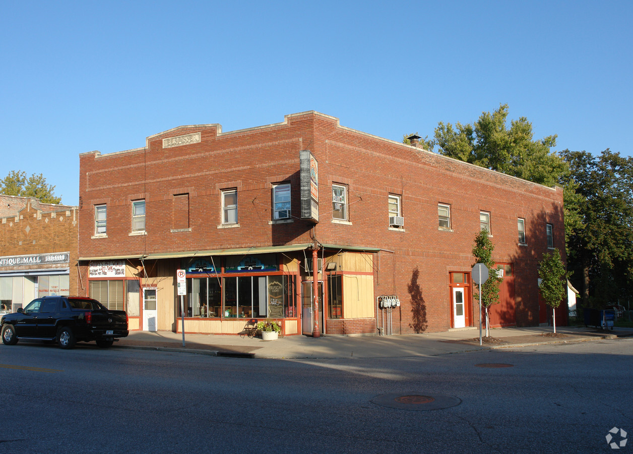
Property Record
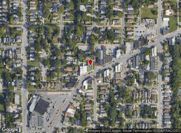
1802 Vinton St, Omaha, NE 68108
NEARBY LISTINGS FOR SALE OR LEASE
Property Detail
1802 Vinton St
Omaha-Council Bluffs, NE-IA
Okahoma Park
0727-0000-19
OKAHOMA PARK LOT 4 BLOCK 1 40 X 84.5
Storebuilding
Douglas
X
Nebraska
31153C0080G
4
2023
0.08 AC
2023
Southeast Omaha
0020003017
Omaha/Council Bluffs
8,780 SF
DEMOGRAPHICS near 1802 Vinton St
1 Mile
3 Mile
5 Mile
2024 Total Population
16,817
114,722
246,429
2029 Population
17,049
116,906
251,222
Pop Growth 2024-2029
+ 1.38%
+ 1.90%
+ 1.94%
Average Age
34
35
36
2024 Total Households
5,617
45,722
97,442
HH Growth 2024-2029
+ 1.50%
+ 2.23%
+ 2.08%
Median Household Inc
$43,946
$49,187
$53,074
Avg Household Size
2.80
2.30
2.30
2024 Avg HH Vehicles
2.00
2.00
2.00
Median Home Value
$137,488
$155,701
$161,455
Median Year Built
1946
1951
1955
Nearby Places
- Restaurants
- Banks
- Shops
- Fitness
- Groceries
PUBLIC TRANSPORTATION
COMMUTER RAIL
Omaha Amtrak Station (California Zephyr - Amtrak)
DRIVE
WALK
Distance
Omaha Amtrak Station (California Zephyr - Amtrak)
3 min
1.6 mi
AIRPORT
Eppley Airfield
DRIVE
WALK
Distance
Eppley Airfield
14 min
5.8 mi
Freight Ports
Tulsa Port Of Catoosa
DRIVE
WALK
Distance
Tulsa Port Of Catoosa
461 min
417.8 mi
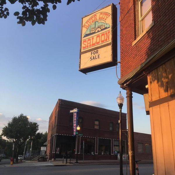
SALE & LEASE HISTORY
LISTING DATE
SALE/LEASE

Aug 31, 2021
For Sale
Nearby Properties
Address
Land Use
TOTAL SIZE
Lot Size
Zoning
Address
Land Use
TOTAL SIZE
Lot Size
Zoning
1,068,760 SF
1.72 AC
Address
Land Use
TOTAL SIZE
Lot Size
Zoning
1,318,852 SF
8.77 AC
Address
Land Use
TOTAL SIZE
Lot Size
Zoning
603,518 SF
5.55 AC
CBD
Address
Land Use
TOTAL SIZE
Lot Size
Zoning
62.66 AC
P-C
Address
Land Use
TOTAL SIZE
Lot Size
Zoning
36.26 AC
P-C
Address
Land Use
TOTAL SIZE
Lot Size
Zoning
362,402 SF
1.94 AC
Address
Land Use
TOTAL SIZE
Lot Size
Zoning
30.39 AC
P-C
Address
Land Use
TOTAL SIZE
Lot Size
Zoning
318,811 SF
11.51 AC
Address
Land Use
TOTAL SIZE
Lot Size
Zoning
370,431 SF
8.57 AC
Address
Land Use
TOTAL SIZE
Lot Size
Zoning
473,977 SF
4.35 AC
Address
Land Use
TOTAL SIZE
Lot Size
Zoning
254,306 SF
0.82 AC
Address
Land Use
TOTAL SIZE
Lot Size
Zoning
426,416 SF
1.55 AC
Address
Land Use
TOTAL SIZE
Lot Size
Zoning
16.18 AC
P-C
Address
Land Use
TOTAL SIZE
Lot Size
Zoning
1,027,620 SF
4.33 AC
Address
Land Use
TOTAL SIZE
Lot Size
Zoning
378,420 SF
0.72 AC
Address
Land Use
TOTAL SIZE
Lot Size
Zoning
276,622 SF
3.90 AC
Address
Land Use
TOTAL SIZE
Lot Size
Zoning
187,240 SF
1.22 AC
CBD
Address
Land Use
TOTAL SIZE
Lot Size
Zoning
373,574 SF
0.73 AC
CBD
Address
Land Use
TOTAL SIZE
Lot Size
Zoning
346,816 SF
0.80 AC
Address
Land Use
TOTAL SIZE
Lot Size
Zoning
318,392 SF
7.77 AC
Address
Land Use
TOTAL SIZE
Lot Size
Zoning
319,440 SF
3.05 AC
Address
Land Use
TOTAL SIZE
Lot Size
Zoning
722,753 SF
4.35 AC
Address
Land Use
TOTAL SIZE
Lot Size
Zoning
335,431 SF
0.79 AC
Address
Land Use
TOTAL SIZE
Lot Size
Zoning
140,130 SF
1.88 AC
Address
Land Use
TOTAL SIZE
Lot Size
Zoning
4.22 AC
R-4
Address
Land Use
TOTAL SIZE
Lot Size
Zoning
149,737 SF
1.93 AC
Address
Land Use
TOTAL SIZE
Lot Size
Zoning
205,967 SF
1.67 AC
Address
Land Use
TOTAL SIZE
Lot Size
Zoning
42.97 AC
I-2
Address
Land Use
TOTAL SIZE
Lot Size
Zoning
10.91 AC
R-3
Address
Land Use
TOTAL SIZE
Lot Size
Zoning
274,024 SF
1.46 AC
The World's #1 Commercial Real Estate Marketplace
Connect with us
© 2025 CoStar Group
The information above has been obtained from sources believed reliable. While we do not doubt its accuracy we have not verified it and make no guarantee, warranty or representation about it. It is your responsibility to independently confirm its accuracy and completeness. Any projections, opinions, assumptions, or estimates used are for example only and do not represent the current or future performance of the property. The value of this transaction to you depends on tax and other factors which should be evaluated by your tax, financial, and legal advisors. You and your advisors should conduct a careful, independent investigation of the property to determine to your satisfaction the suitability of the property for your needs.