Property Record
1805 N Interstate 35, San Marcos, TX 78666
NEARBY LISTINGS FOR SALE OR LEASE
Property Detail
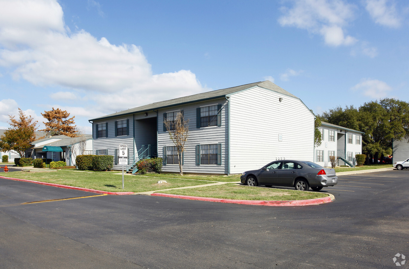
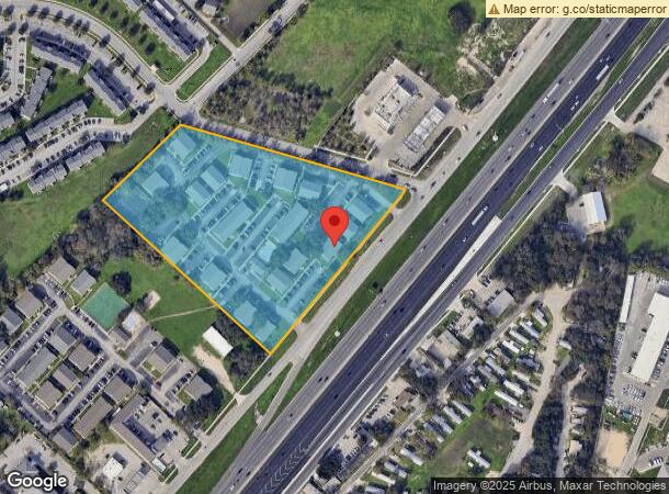
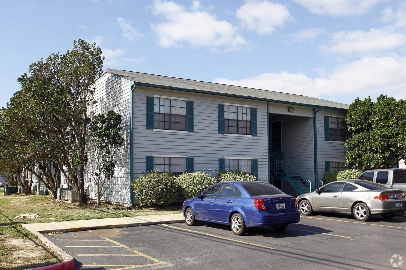
1805 N Interstate 35
R21906
Bordeaux V
Multifamilydwelling
BORDEAUX V 7.45 AC 342,520 SQ FT AND BUSINESS PERSONAL PROPERTY TAX CODES:SSM,WEU,WUS
X
Hays
48055C0070F
Texas
2023
7.45 AC
2024
San Marcos
010309
Austin
133,480 SF
Austin-Round Rock, TX
DEMOGRAPHICS near 1805 N Interstate 35
1 Mile
3 Mile
5 Mile
2024 Total Population
15,677
47,246
82,298
2029 Population
20,143
60,510
106,024
Pop Growth 2024-2029
+ 28.49%
+ 28.07%
+ 28.83%
Average Age
28
29
32
2024 Total Households
7,268
18,642
32,151
HH Growth 2024-2029
+ 29.18%
+ 30.68%
+ 30.92%
Median Household Inc
$28,677
$28,887
$34,444
Avg Household Size
2.00
2.20
2.30
2024 Avg HH Vehicles
2.00
2.00
2.00
Median Home Value
$90,262
$185,646
$250,755
Median Year Built
1997
1995
1998
Nearby Places
- Restaurants
- Banks
- Shops
- Fitness
- Groceries
PUBLIC TRANSPORTATION
COMMUTER RAIL
San Marcos Amtrak (Texas Eagle - Amtrak)
DRIVE
WALK
Distance
San Marcos Amtrak (Texas Eagle - Amtrak)
6 min
3.2 mi
AIRPORT
Austin-Bergstrom International
DRIVE
WALK
Distance
Austin-Bergstrom International
45 min
34.3 mi
Freight Ports
Calhoun Port
DRIVE
WALK
Distance
Calhoun Port
164 min
135.6 mi
Nearby Properties
Address
Land Use
TOTAL SIZE
Lot Size
Zoning
Address
Land Use
TOTAL SIZE
Lot Size
Zoning
377,937 SF
1.46 AC
Address
Land Use
TOTAL SIZE
Lot Size
Zoning
7,131 SF
23.69 AC
Address
Land Use
TOTAL SIZE
Lot Size
Zoning
63,280 SF
76.50 AC
Address
Land Use
TOTAL SIZE
Lot Size
Zoning
119,914 SF
2.69 AC
Address
Land Use
TOTAL SIZE
Lot Size
Zoning
196,500 SF
24.78 AC
Address
Land Use
TOTAL SIZE
Lot Size
Zoning
46,168 SF
20.65 AC
Address
Land Use
TOTAL SIZE
Lot Size
Zoning
146,520 SF
15.19 AC
Address
Land Use
TOTAL SIZE
Lot Size
Zoning
31,720 SF
16.38 AC
Address
Land Use
TOTAL SIZE
Lot Size
Zoning
1,464 SF
3.67 AC
Address
Land Use
TOTAL SIZE
Lot Size
Zoning
5,834 SF
10.54 AC
Address
Land Use
TOTAL SIZE
Lot Size
Zoning
207,900 SF
13 AC
Address
Land Use
TOTAL SIZE
Lot Size
Zoning
42,124 SF
5.11 AC
Address
Land Use
TOTAL SIZE
Lot Size
Zoning
6,605 SF
14.23 AC
Address
Land Use
TOTAL SIZE
Lot Size
Zoning
5,000 SF
18.33 AC
Address
Land Use
TOTAL SIZE
Lot Size
Zoning
300,779 SF
10.84 AC
Address
Land Use
TOTAL SIZE
Lot Size
Zoning
753 SF
14.70 AC
Address
Land Use
TOTAL SIZE
Lot Size
Zoning
2,278 SF
2.35 AC
Address
Land Use
TOTAL SIZE
Lot Size
Zoning
402,983 SF
21.30 AC
Address
Land Use
TOTAL SIZE
Lot Size
Zoning
4,831 SF
10.36 AC
Address
Land Use
TOTAL SIZE
Lot Size
Zoning
150,840 SF
18.45 AC
Address
Land Use
TOTAL SIZE
Lot Size
Zoning
179,764 SF
3.27 AC
Address
Land Use
TOTAL SIZE
Lot Size
Zoning
9,685 SF
28.15 AC
Address
Land Use
TOTAL SIZE
Lot Size
Zoning
6,347 SF
0.87 AC
Address
Land Use
TOTAL SIZE
Lot Size
Zoning
9,727 SF
11.25 AC
Address
Land Use
TOTAL SIZE
Lot Size
Zoning
8,814 SF
17.77 AC
Address
Land Use
TOTAL SIZE
Lot Size
Zoning
83,520 SF
14.37 AC
Address
Land Use
TOTAL SIZE
Lot Size
Zoning
4,173 SF
128.50 AC
Address
Land Use
TOTAL SIZE
Lot Size
Zoning
2,058 SF
19.33 AC
Address
Land Use
TOTAL SIZE
Lot Size
Zoning
15,657 SF
8.48 AC
Address
Land Use
TOTAL SIZE
Lot Size
Zoning
99,000 SF
12.99 AC
The World's #1 Commercial Real Estate Marketplace
Connect with us
© 2025 CoStar Group
The information above has been obtained from sources believed reliable. While we do not doubt its accuracy we have not verified it and make no guarantee, warranty or representation about it. It is your responsibility to independently confirm its accuracy and completeness. Any projections, opinions, assumptions, or estimates used are for example only and do not represent the current or future performance of the property. The value of this transaction to you depends on tax and other factors which should be evaluated by your tax, financial, and legal advisors. You and your advisors should conduct a careful, independent investigation of the property to determine to your satisfaction the suitability of the property for your needs.