Property Record
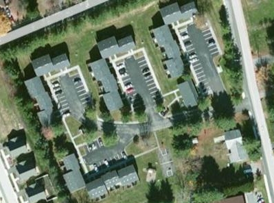
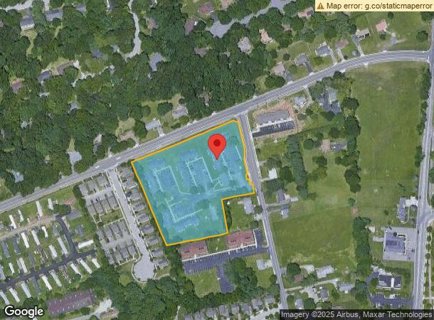
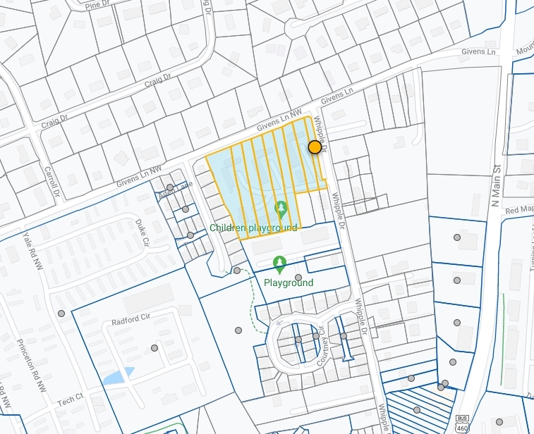
1805 Whipple Dr, Blacksburg, VA 24060
NEARBY LISTINGS FOR SALE OR LEASE
-
-
View all Blacksburg listings for sale on LoopNet.com
Property Detail
1805 Whipple Dr
Blacksburg-Christiansburg-Radford, VA
Alleghany Hts
014672
ALLEGHANY HTS LOTS 57-62 PT 54-56
Multifamilydwelling
Montgomery
X
Virginia
51071C0270C
57-62
2024
3.86 AC
2024
Main-Patrick Henry
020402
Other Market Areas
43,024 SF
DEMOGRAPHICS near 1805 Whipple Dr
1 Mile
3 Mile
5 Mile
2024 Total Population
9,059
28,979
43,375
2029 Population
8,989
28,674
42,983
Pop Growth 2024-2029
(0.77%)
(1.05%)
(0.90%)
Average Age
30
33
34
2024 Total Households
3,525
12,142
18,545
HH Growth 2024-2029
(0.82%)
(1.15%)
(0.96%)
Median Household Inc
$19,541
$45,283
$46,111
Avg Household Size
2.50
2.30
2.30
2024 Avg HH Vehicles
2.00
2.00
2.00
Median Home Value
$405,749
$393,519
$396,945
Median Year Built
1991
1987
1986
Nearby Places
- Restaurants
- Banks
- Shops
- Fitness
- Groceries
PUBLIC TRANSPORTATION
AIRPORT
Roanoke/Blacksburg Regional (Woodrum Field)
DRIVE
WALK
Distance
Roanoke/Blacksburg Regional (Woodrum Field)
59 min
35.5 mi
Freight Ports
Virginia Port Authority - Richmond
DRIVE
WALK
Distance
Virginia Port Authority - Richmond
261 min
219.4 mi
Nearby Properties
Address
Land Use
TOTAL SIZE
Lot Size
Zoning
Address
Land Use
TOTAL SIZE
Lot Size
Zoning
1,761.28 AC
UNIV
Address
Land Use
TOTAL SIZE
Lot Size
Zoning
Address
Land Use
TOTAL SIZE
Lot Size
Zoning
41.51 AC
PR
Address
Land Use
TOTAL SIZE
Lot Size
Zoning
120,948 SF
15.28 AC
RM-48
Address
Land Use
TOTAL SIZE
Lot Size
Zoning
134,784 SF
21.21 AC
PR
Address
Land Use
TOTAL SIZE
Lot Size
Zoning
224,316 SF
6.10 AC
RM48
Address
Land Use
TOTAL SIZE
Lot Size
Zoning
31,178 SF
7.32 AC
RM48
Address
Land Use
TOTAL SIZE
Lot Size
Zoning
3.23 AC
DC
Address
Land Use
TOTAL SIZE
Lot Size
Zoning
4,332 SF
24.35 AC
RM-48
Address
Land Use
TOTAL SIZE
Lot Size
Zoning
50,728 SF
14.25 AC
PR
Address
Land Use
TOTAL SIZE
Lot Size
Zoning
125,184 SF
9.12 AC
RM-48
Address
Land Use
TOTAL SIZE
Lot Size
Zoning
140,302 SF
1.09 AC
DC
Address
Land Use
TOTAL SIZE
Lot Size
Zoning
5.58 AC
MXD
Address
Land Use
TOTAL SIZE
Lot Size
Zoning
124,356 SF
4.79 AC
RM-48
Address
Land Use
TOTAL SIZE
Lot Size
Zoning
111,728 SF
8.11 AC
PR
Address
Land Use
TOTAL SIZE
Lot Size
Zoning
125,388 SF
5.68 AC
RM-48
Address
Land Use
TOTAL SIZE
Lot Size
Zoning
127,968 SF
5.62 AC
RM-48
Address
Land Use
TOTAL SIZE
Lot Size
Zoning
3.47 AC
MXD
Address
Land Use
TOTAL SIZE
Lot Size
Zoning
106,740 SF
6.04 AC
PR
Address
Land Use
TOTAL SIZE
Lot Size
Zoning
2,336 SF
4.22 AC
R5
Address
Land Use
TOTAL SIZE
Lot Size
Zoning
100,620 SF
5.10 AC
RM-48
Address
Land Use
TOTAL SIZE
Lot Size
Zoning
88,980 SF
5.03 AC
PR
Address
Land Use
TOTAL SIZE
Lot Size
Zoning
3,654 SF
3.72 AC
RM-48
Address
Land Use
TOTAL SIZE
Lot Size
Zoning
2.08 AC
GC
Address
Land Use
TOTAL SIZE
Lot Size
Zoning
149,655 SF
12.51 AC
GC
Address
Land Use
TOTAL SIZE
Lot Size
Zoning
12,893 SF
13.07 AC
GC
Address
Land Use
TOTAL SIZE
Lot Size
Zoning
1.57 AC
R-4
Address
Land Use
TOTAL SIZE
Lot Size
Zoning
60,516 SF
9.46 AC
RM-48
Address
Land Use
TOTAL SIZE
Lot Size
Zoning
5,109 SF
5.51 AC
PR
Address
Land Use
TOTAL SIZE
Lot Size
Zoning
253,134 SF
1.60 AC
DC
The World's #1 Commercial Real Estate Marketplace
Connect with us
© 2025 CoStar Group
The information above has been obtained from sources believed reliable. While we do not doubt its accuracy we have not verified it and make no guarantee, warranty or representation about it. It is your responsibility to independently confirm its accuracy and completeness. Any projections, opinions, assumptions, or estimates used are for example only and do not represent the current or future performance of the property. The value of this transaction to you depends on tax and other factors which should be evaluated by your tax, financial, and legal advisors. You and your advisors should conduct a careful, independent investigation of the property to determine to your satisfaction the suitability of the property for your needs.