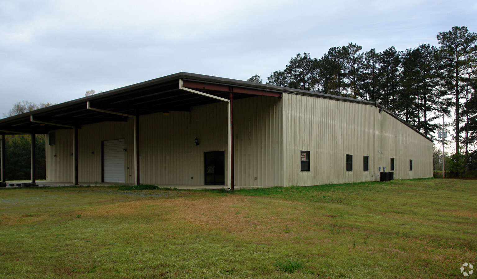
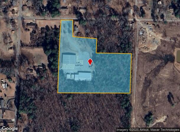
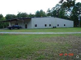
Property Record
1809 Russenberger Rd, Little Rock, AR 72206
NEARBY LISTINGS FOR SALE OR LEASE
Property Detail
1809 Russenberger Rd
35R-010-00-007-00
PT NW NE BEG 447 36E OF NW COR NW NE TH E406 14 AL CLN RUSSENBERGER RD TH S1*2730W374 E408 S1*2730 W412 87 S88*55W820.18 N1*5230 E801.18 TO POB EXC COM NW COR NW NE TH E782.4 FOR POB TH S2*W94.1 N89* E76.7 N94.1 W76.7 TO POB & EXC COM NW
Officebuilding
Pulaski
X
Arkansas
05119C0470G
10.44 AC
2023
Outlying Pulaski County
2023
Little Rock/N Little Rock
0040061007
Little Rock-North Little Rock-Conway, AR
10,776 SF
DEMOGRAPHICS near 1809 Russenberger Rd
1 Mile
3 Mile
5 Mile
2024 Total Population
817
8,621
45,925
2029 Population
830
8,701
46,342
Pop Growth 2024-2029
+ 1.59%
+ 0.93%
+ 0.91%
Average Age
45
39
37
2024 Total Households
301
3,266
17,604
HH Growth 2024-2029
+ 1.99%
+ 0.95%
+ 0.92%
Median Household Inc
$58,255
$37,543
$40,534
Avg Household Size
2.50
2.50
2.50
2024 Avg HH Vehicles
2.00
2.00
2.00
Median Home Value
$172,277
$102,810
$94,523
Median Year Built
1981
1975
1974
Nearby Places
- Restaurants
- Banks
- Shops
- Fitness
- Groceries
PUBLIC TRANSPORTATION
COMMUTER RAIL
Little Rock Union Station (Texas Eagle - Amtrak)
DRIVE
WALK
Distance
Little Rock Union Station (Texas Eagle - Amtrak)
13 min
8.8 mi
AIRPORT
Bill and Hillary Clinton Ntl/Adams Field
DRIVE
WALK
Distance
Bill and Hillary Clinton Ntl/Adams Field
13 min
8.5 mi
Freight Ports
Port of Shreveport
DRIVE
WALK
Distance
Port of Shreveport
251 min
231.5 mi
Nearby Properties
Address
Land Use
TOTAL SIZE
Lot Size
Zoning
Address
Land Use
TOTAL SIZE
Lot Size
Zoning
2,799,880 SF
77.22 AC
Address
Land Use
TOTAL SIZE
Lot Size
Zoning
2,798,820 SF
80.45 AC
Address
Land Use
TOTAL SIZE
Lot Size
Zoning
50,433 SF
22.23 AC
Address
Land Use
TOTAL SIZE
Lot Size
Zoning
272,996 SF
22.27 AC
Address
Land Use
TOTAL SIZE
Lot Size
Zoning
310,000 SF
13.21 AC
Address
Land Use
TOTAL SIZE
Lot Size
Zoning
1,233 SF
6.19 AC
Address
Land Use
TOTAL SIZE
Lot Size
Zoning
38,640 SF
11.48 AC
Address
Land Use
TOTAL SIZE
Lot Size
Zoning
27,760 SF
9.95 AC
Address
Land Use
TOTAL SIZE
Lot Size
Zoning
63,927 SF
20 AC
Address
Land Use
TOTAL SIZE
Lot Size
Zoning
14,367 SF
1,257.41 AC
Address
Land Use
TOTAL SIZE
Lot Size
Zoning
80,982 SF
74.25 AC
Address
Land Use
TOTAL SIZE
Lot Size
Zoning
2,740 SF
2.07 AC
Address
Land Use
TOTAL SIZE
Lot Size
Zoning
1,112 SF
36.04 AC
Address
Land Use
TOTAL SIZE
Lot Size
Zoning
2,046 SF
6.04 AC
Address
Land Use
TOTAL SIZE
Lot Size
Zoning
109,000 SF
7.46 AC
Address
Land Use
TOTAL SIZE
Lot Size
Zoning
137,159 SF
6.79 AC
Address
Land Use
TOTAL SIZE
Lot Size
Zoning
5,920 SF
4.69 AC
Address
Land Use
TOTAL SIZE
Lot Size
Zoning
9,235 SF
10.93 AC
Address
Land Use
TOTAL SIZE
Lot Size
Zoning
30,261 SF
70 AC
Address
Land Use
TOTAL SIZE
Lot Size
Zoning
10 SF
7.70 AC
Address
Land Use
TOTAL SIZE
Lot Size
Zoning
110,003 SF
18.40 AC
Address
Land Use
TOTAL SIZE
Lot Size
Zoning
2,880 SF
39.87 AC
Address
Land Use
TOTAL SIZE
Lot Size
Zoning
20,163 SF
8.75 AC
Address
Land Use
TOTAL SIZE
Lot Size
Zoning
26,770 SF
4.38 AC
Address
Land Use
TOTAL SIZE
Lot Size
Zoning
20,798 SF
3.82 AC
Address
Land Use
TOTAL SIZE
Lot Size
Zoning
10.32 AC
Address
Land Use
TOTAL SIZE
Lot Size
Zoning
20,442 SF
16.70 AC
Address
Land Use
TOTAL SIZE
Lot Size
Zoning
13,125 SF
23.40 AC
Address
Land Use
TOTAL SIZE
Lot Size
Zoning
Address
Land Use
TOTAL SIZE
Lot Size
Zoning
7,242 SF
3.84 AC
The World's #1 Commercial Real Estate Marketplace
Connect with us
© 2025 CoStar Group
The information above has been obtained from sources believed reliable. While we do not doubt its accuracy we have not verified it and make no guarantee, warranty or representation about it. It is your responsibility to independently confirm its accuracy and completeness. Any projections, opinions, assumptions, or estimates used are for example only and do not represent the current or future performance of the property. The value of this transaction to you depends on tax and other factors which should be evaluated by your tax, financial, and legal advisors. You and your advisors should conduct a careful, independent investigation of the property to determine to your satisfaction the suitability of the property for your needs.