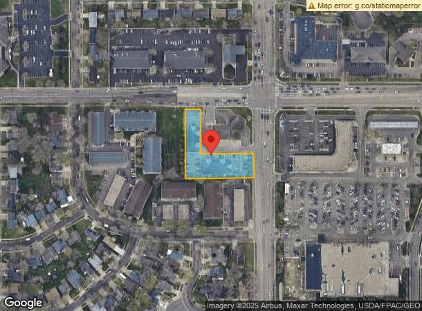
Property Record
1809 S Marion Rd, Sioux Falls, SD 57106


NEARBY LISTINGS FOR SALE OR LEASE
Property Detail
1809 S Marion Rd
Sioux Falls, SD
Bank Addn
60245
(EX LOT H1) TRACT 1 2 FIRST INTERSTATE BANK ADDN TO SIOUX FALLS
Stripcommercialcenter
Minnehaha
X
South Dakota
46083C0050D
2
2024
0.90 AC
2023
Sioux Falls
001107
Other Market Areas
6,714 SF
DEMOGRAPHICS near 1809 S Marion Rd
1 Mile
3 Mile
5 Mile
2024 Total Population
10,541
80,577
146,621
2029 Population
11,388
88,152
162,955
Pop Growth 2024-2029
+ 8.04%
+ 9.40%
+ 11.14%
Average Age
39
37
38
2024 Total Households
4,396
33,710
60,749
HH Growth 2024-2029
+ 8.55%
+ 9.77%
+ 11.47%
Median Household Inc
$68,502
$67,081
$70,142
Avg Household Size
2.30
2.30
2.30
2024 Avg HH Vehicles
2.00
2.00
2.00
Median Home Value
$246,153
$232,124
$249,537
Median Year Built
1990
1990
1990
Nearby Places
- Restaurants
- Banks
- Shops
- Fitness
- Groceries
PUBLIC TRANSPORTATION
AIRPORT
Joe Foss Field
DRIVE
WALK
Distance
Joe Foss Field
24 min
7.9 mi
Freight Ports
Port Milwaukee
DRIVE
WALK
Distance
Port Milwaukee
553 min
509.1 mi
SALE & LEASE HISTORY
LISTING DATE
SALE/LEASE

Jul 19, 2017
For Lease
Feb 10, 2020
For Lease
Nearby Properties
Address
Land Use
TOTAL SIZE
Lot Size
Zoning
Address
Land Use
TOTAL SIZE
Lot Size
Zoning
8.88 AC
MUNICIPALI
Address
Land Use
TOTAL SIZE
Lot Size
Zoning
8.90 AC
C1;NEIGHBO
Address
Land Use
TOTAL SIZE
Lot Size
Zoning
8.80 AC
MUNICIPALI
Address
Land Use
TOTAL SIZE
Lot Size
Zoning
7,252 SF
12.07 AC
Address
Land Use
TOTAL SIZE
Lot Size
Zoning
8.51 AC
MUNICIPALI
Address
Land Use
TOTAL SIZE
Lot Size
Zoning
15.40 AC
MUNICIPALI
Address
Land Use
TOTAL SIZE
Lot Size
Zoning
10.75 AC
MUNICIPALI
Address
Land Use
TOTAL SIZE
Lot Size
Zoning
8.57 AC
MUNICIPALI
Address
Land Use
TOTAL SIZE
Lot Size
Zoning
7.91 AC
MUNICIPALI
Address
Land Use
TOTAL SIZE
Lot Size
Zoning
11.13 AC
MUNICIPALI
Address
Land Use
TOTAL SIZE
Lot Size
Zoning
13,806 SF
10.99 AC
Address
Land Use
TOTAL SIZE
Lot Size
Zoning
16.45 AC
MUNICIPALI
Address
Land Use
TOTAL SIZE
Lot Size
Zoning
7.07 AC
MUNICIPALI
Address
Land Use
TOTAL SIZE
Lot Size
Zoning
28,098 SF
13.13 AC
Address
Land Use
TOTAL SIZE
Lot Size
Zoning
9.27 AC
MUNICIPALI
Address
Land Use
TOTAL SIZE
Lot Size
Zoning
3.97 AC
MUNICIPALI
Address
Land Use
TOTAL SIZE
Lot Size
Zoning
639,393 SF
53.46 AC
FP;FP
Address
Land Use
TOTAL SIZE
Lot Size
Zoning
9.16 AC
MUNICIPALI
Address
Land Use
TOTAL SIZE
Lot Size
Zoning
360,262 SF
26 AC
Address
Land Use
TOTAL SIZE
Lot Size
Zoning
8,768 SF
5.48 AC
Address
Land Use
TOTAL SIZE
Lot Size
Zoning
4.87 AC
MUNICIPALI
Address
Land Use
TOTAL SIZE
Lot Size
Zoning
29,313 SF
9.13 AC
Address
Land Use
TOTAL SIZE
Lot Size
Zoning
5.27 AC
MUNICIPALI
Address
Land Use
TOTAL SIZE
Lot Size
Zoning
4.36 AC
MUNICIPALI
Address
Land Use
TOTAL SIZE
Lot Size
Zoning
13.82 AC
MUNICIPALI
Address
Land Use
TOTAL SIZE
Lot Size
Zoning
2.45 AC
MUNICIPALI
Address
Land Use
TOTAL SIZE
Lot Size
Zoning
6.11 AC
MUNICIPALI
Address
Land Use
TOTAL SIZE
Lot Size
Zoning
4.78 AC
MUNICIPALI
Address
Land Use
TOTAL SIZE
Lot Size
Zoning
11.07 AC
MUNICIPALI
Address
Land Use
TOTAL SIZE
Lot Size
Zoning
3.06 AC
MUNICIPALI
The World's #1 Commercial Real Estate Marketplace
Connect with us
© 2025 CoStar Group
The information above has been obtained from sources believed reliable. While we do not doubt its accuracy we have not verified it and make no guarantee, warranty or representation about it. It is your responsibility to independently confirm its accuracy and completeness. Any projections, opinions, assumptions, or estimates used are for example only and do not represent the current or future performance of the property. The value of this transaction to you depends on tax and other factors which should be evaluated by your tax, financial, and legal advisors. You and your advisors should conduct a careful, independent investigation of the property to determine to your satisfaction the suitability of the property for your needs.