Property Record
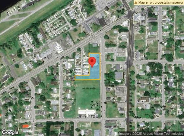
181 Rardin Ave, Pahokee, FL 33476

NEARBY LISTINGS FOR SALE OR LEASE
-
-
View all Pahokee listings for sale on LoopNet.com
Property Detail
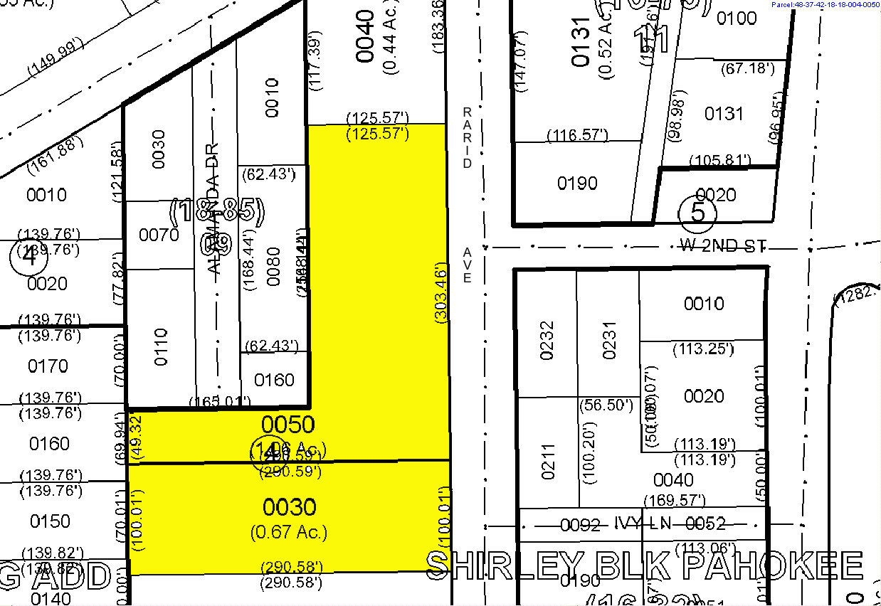
181 Rardin Ave
West Palm Beach-Boca Raton-Delray Beach, FL
Ridgeway Beach
48-37-42-18-18-004-0050
RIDGEWAY BEACH S 303.48 FT OF NLY 489.88 FT OF E 1/2 OF TRS 4 & 15 & N 50 FT OF S 515 FT OF W 165 FT OF TR 15 IN OR1412P556
Supermarket
Palm Beach
2023
Florida
2023
1.06 AC
008002
Palm Bch Cty Outlying
10,136 SF
South Florida
DEMOGRAPHICS near 181 Rardin Ave
1 Mile
3 Mile
5 Mile
2024 Total Population
3,937
7,106
7,678
2029 Population
4,053
7,319
7,911
Pop Growth 2024-2029
+ 2.95%
+ 3.00%
+ 3.03%
Average Age
36
35
36
2024 Total Households
1,272
2,289
2,424
HH Growth 2024-2029
+ 2.36%
+ 2.40%
+ 2.43%
Median Household Inc
$26,160
$22,561
$22,865
Avg Household Size
3.00
2.90
2.90
2024 Avg HH Vehicles
2.00
1.00
1.00
Median Home Value
$144,573
$138,516
$139,830
Median Year Built
1971
1972
1972
Nearby Places
- Restaurants
- Banks
- Shops
- Fitness
- Groceries
SALE & LEASE HISTORY
LISTING DATE
SALE/LEASE

Apr 02, 2024
For Sale
Nearby Properties
Address
Land Use
TOTAL SIZE
Lot Size
Zoning
Address
Land Use
TOTAL SIZE
Lot Size
Zoning
156,457.94 AC
PC
Address
Land Use
TOTAL SIZE
Lot Size
Zoning
776,137 SF
120.88 AC
AP
Address
Land Use
TOTAL SIZE
Lot Size
Zoning
197,891 SF
15.08 AC
PF
Address
Land Use
TOTAL SIZE
Lot Size
Zoning
97,658 SF
19.97 AC
AP
Address
Land Use
TOTAL SIZE
Lot Size
Zoning
164,185 SF
33.70 AC
PF
Address
Land Use
TOTAL SIZE
Lot Size
Zoning
197,175 SF
23.70 AC
RH
Address
Land Use
TOTAL SIZE
Lot Size
Zoning
33,656 SF
9.97 AC
PUD
Address
Land Use
TOTAL SIZE
Lot Size
Zoning
10,513 SF
33.29 AC
WOR
Address
Land Use
TOTAL SIZE
Lot Size
Zoning
28,878 SF
2.47 AC
SFMU
Address
Land Use
TOTAL SIZE
Lot Size
Zoning
67,866 SF
11.05 AC
RM
Address
Land Use
TOTAL SIZE
Lot Size
Zoning
452 SF
346.93 AC
AP
Address
Land Use
TOTAL SIZE
Lot Size
Zoning
19,343 SF
209.57 AC
PO
Address
Land Use
TOTAL SIZE
Lot Size
Zoning
47,310 SF
7.65 AC
RH
Address
Land Use
TOTAL SIZE
Lot Size
Zoning
49,753 SF
8.67 AC
CORE
Address
Land Use
TOTAL SIZE
Lot Size
Zoning
74,714 SF
10.87 AC
RM
Address
Land Use
TOTAL SIZE
Lot Size
Zoning
12,584 SF
15.02 AC
AG
Address
Land Use
TOTAL SIZE
Lot Size
Zoning
31,474 SF
2.42 AC
PF
Address
Land Use
TOTAL SIZE
Lot Size
Zoning
26,328 SF
3.34 AC
AP
Address
Land Use
TOTAL SIZE
Lot Size
Zoning
8,821 SF
2.68 AC
AG
Address
Land Use
TOTAL SIZE
Lot Size
Zoning
72,518 SF
7.06 AC
RH
Address
Land Use
TOTAL SIZE
Lot Size
Zoning
7,690 SF
2.53 AC
PF
Address
Land Use
TOTAL SIZE
Lot Size
Zoning
15,306 SF
5.68 AC
SF1
Address
Land Use
TOTAL SIZE
Lot Size
Zoning
9,173 SF
0.91 AC
CORE
Address
Land Use
TOTAL SIZE
Lot Size
Zoning
42,042 SF
5.67 AC
MF12
Address
Land Use
TOTAL SIZE
Lot Size
Zoning
19,054 SF
2.86 AC
SFMU
Address
Land Use
TOTAL SIZE
Lot Size
Zoning
12,842 SF
628.35 AC
AP
Address
Land Use
TOTAL SIZE
Lot Size
Zoning
14,940 SF
1.90 AC
CORE
Address
Land Use
TOTAL SIZE
Lot Size
Zoning
5,379 SF
0.98 AC
CORE
Address
Land Use
TOTAL SIZE
Lot Size
Zoning
19,272 SF
0.94 AC
RH
Address
Land Use
TOTAL SIZE
Lot Size
Zoning
6,624 SF
620.84 AC
AP
The World's #1 Commercial Real Estate Marketplace
Connect with us
© 2025 CoStar Group
The information above has been obtained from sources believed reliable. While we do not doubt its accuracy we have not verified it and make no guarantee, warranty or representation about it. It is your responsibility to independently confirm its accuracy and completeness. Any projections, opinions, assumptions, or estimates used are for example only and do not represent the current or future performance of the property. The value of this transaction to you depends on tax and other factors which should be evaluated by your tax, financial, and legal advisors. You and your advisors should conduct a careful, independent investigation of the property to determine to your satisfaction the suitability of the property for your needs.