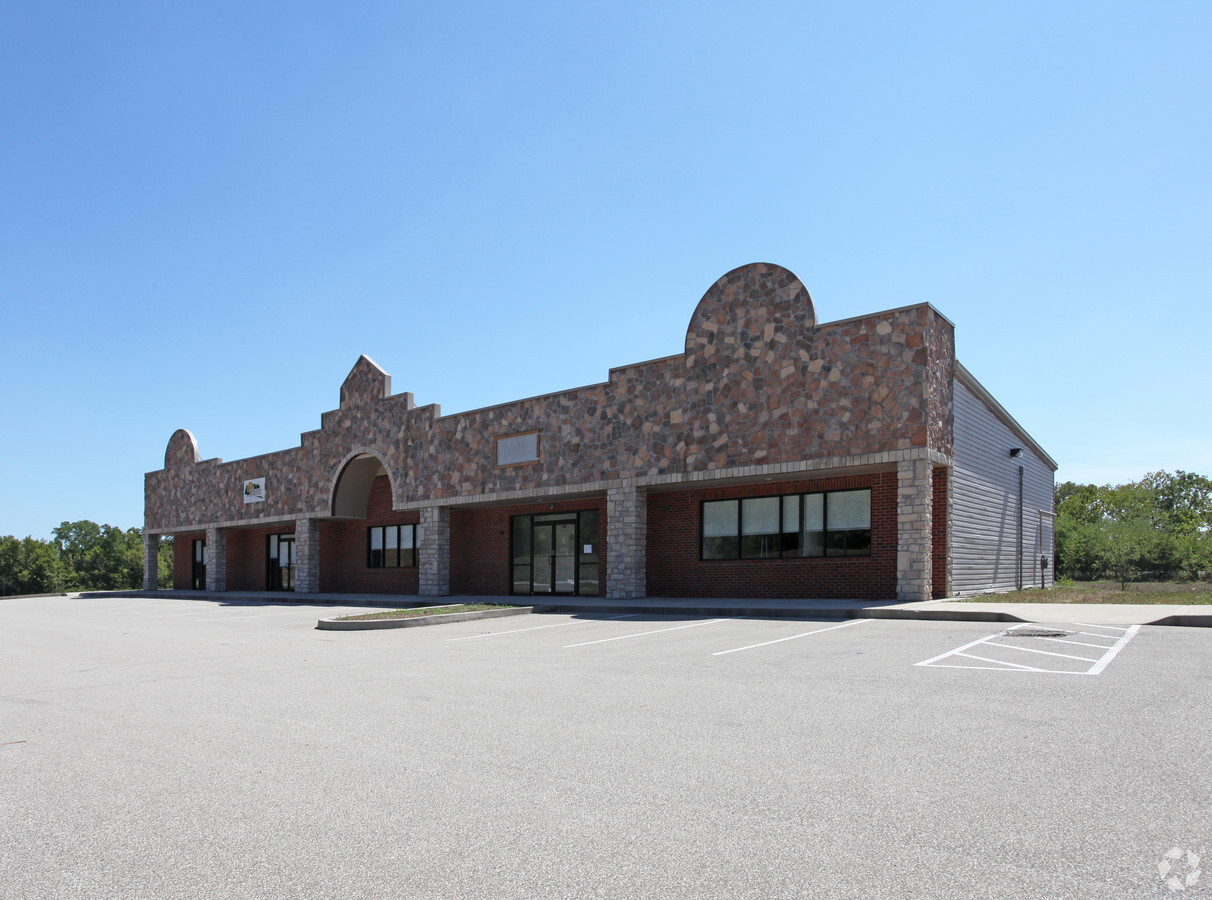
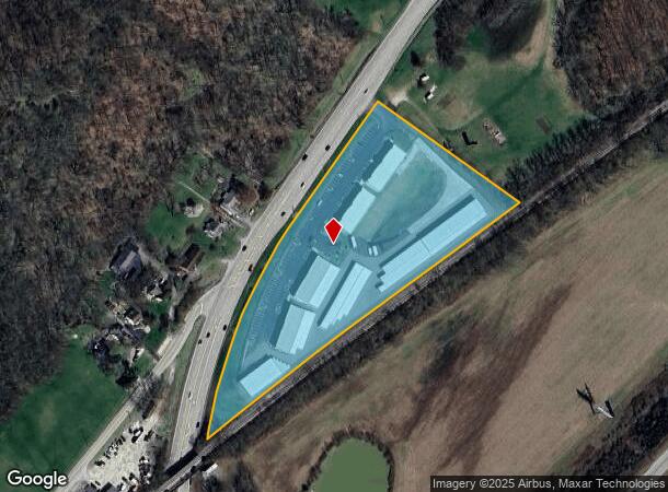
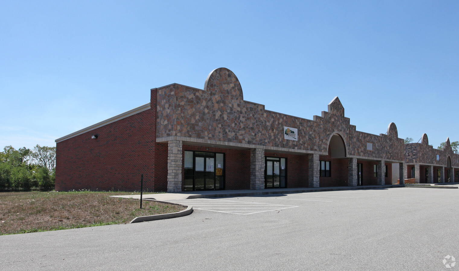
Property Record
181 Us Highway 50 E, Greendale, IN 47025
NEARBY LISTINGS FOR SALE OR LEASE
-
-
View all Greendale listings for sale on LoopNet.com
Property Detail
181 Us Highway 50 E
15-06-36-102-015.000-016
Ne4s36t6nr1w
Stripcommercialcenter
05-17 NE QR 36-6-1 8.009A
AE
Dearborn
18029C0139C
Indiana
2023
8.01 AC
2023
Dearborn County
080400
Cincinnati/Dayton
5,166 SF
Cincinnati, OH-KY-IN
DEMOGRAPHICS near 181 Us Highway 50 E
1 Mile
3 Mile
5 Mile
2024 Total Population
800
10,151
27,476
2029 Population
829
10,416
28,068
Pop Growth 2024-2029
+ 3.63%
+ 2.61%
+ 2.15%
Average Age
42
42
41
2024 Total Households
305
3,819
10,529
HH Growth 2024-2029
+ 3.61%
+ 2.54%
+ 2.14%
Median Household Inc
$88,988
$91,278
$79,690
Avg Household Size
2.50
2.60
2.50
2024 Avg HH Vehicles
2.00
2.00
2.00
Median Home Value
$268,965
$216,950
$202,592
Median Year Built
1992
1990
1986
Nearby Places
- Restaurants
- Banks
- Shops
- Fitness
- Groceries
PUBLIC TRANSPORTATION
AIRPORT
Cincinnati/Northern Kentucky International
DRIVE
WALK
Distance
Cincinnati/Northern Kentucky International
32 min
18.7 mi
Freight Ports
Port of Toledo
DRIVE
WALK
Distance
Port of Toledo
254 min
216.6 mi
Nearby Properties
Address
Land Use
TOTAL SIZE
Lot Size
Zoning
Address
Land Use
TOTAL SIZE
Lot Size
Zoning
255,203 SF
3.04 AC
Address
Land Use
TOTAL SIZE
Lot Size
Zoning
2.10 AC
G
Address
Land Use
TOTAL SIZE
Lot Size
Zoning
3.30 AC
Address
Land Use
TOTAL SIZE
Lot Size
Zoning
43,895 SF
59.12 AC
Address
Land Use
TOTAL SIZE
Lot Size
Zoning
24,487 SF
8.81 AC
Address
Land Use
TOTAL SIZE
Lot Size
Zoning
32,169 SF
5.49 AC
Address
Land Use
TOTAL SIZE
Lot Size
Zoning
200 SF
49.08 AC
Address
Land Use
TOTAL SIZE
Lot Size
Zoning
37,296 SF
2.02 AC
Address
Land Use
TOTAL SIZE
Lot Size
Zoning
40,872 SF
1.31 AC
Address
Land Use
TOTAL SIZE
Lot Size
Zoning
20,544 SF
2.43 AC
Address
Land Use
TOTAL SIZE
Lot Size
Zoning
15,640 SF
4.71 AC
Address
Land Use
TOTAL SIZE
Lot Size
Zoning
35,004 SF
1.25 AC
Address
Land Use
TOTAL SIZE
Lot Size
Zoning
6,476 SF
2.60 AC
Address
Land Use
TOTAL SIZE
Lot Size
Zoning
47,936 SF
3.26 AC
Address
Land Use
TOTAL SIZE
Lot Size
Zoning
14,684 SF
1.37 AC
Address
Land Use
TOTAL SIZE
Lot Size
Zoning
10,500 SF
5.39 AC
Address
Land Use
TOTAL SIZE
Lot Size
Zoning
10,000 SF
4.67 AC
Address
Land Use
TOTAL SIZE
Lot Size
Zoning
17,460 SF
2.70 AC
Address
Land Use
TOTAL SIZE
Lot Size
Zoning
10,415 SF
1.95 AC
Address
Land Use
TOTAL SIZE
Lot Size
Zoning
4,393 SF
1.74 AC
Address
Land Use
TOTAL SIZE
Lot Size
Zoning
17,952 SF
15.08 AC
Address
Land Use
TOTAL SIZE
Lot Size
Zoning
15,000 SF
2.66 AC
Address
Land Use
TOTAL SIZE
Lot Size
Zoning
5,845 SF
2 AC
Address
Land Use
TOTAL SIZE
Lot Size
Zoning
5,730 SF
1.77 AC
Address
Land Use
TOTAL SIZE
Lot Size
Zoning
21,752 SF
3.41 AC
Address
Land Use
TOTAL SIZE
Lot Size
Zoning
13,591 SF
2.17 AC
Address
Land Use
TOTAL SIZE
Lot Size
Zoning
6,541 SF
1.50 AC
Address
Land Use
TOTAL SIZE
Lot Size
Zoning
20.98 AC
Address
Land Use
TOTAL SIZE
Lot Size
Zoning
7,734 SF
1.18 AC
The World's #1 Commercial Real Estate Marketplace
Connect with us
© 2025 CoStar Group
The information above has been obtained from sources believed reliable. While we do not doubt its accuracy we have not verified it and make no guarantee, warranty or representation about it. It is your responsibility to independently confirm its accuracy and completeness. Any projections, opinions, assumptions, or estimates used are for example only and do not represent the current or future performance of the property. The value of this transaction to you depends on tax and other factors which should be evaluated by your tax, financial, and legal advisors. You and your advisors should conduct a careful, independent investigation of the property to determine to your satisfaction the suitability of the property for your needs.