Property Record
1 14Th St, San Francisco, CA 94103


Current Lease Availabilities
NEARBY LISTINGS FOR SALE OR LEASE
Property Detail
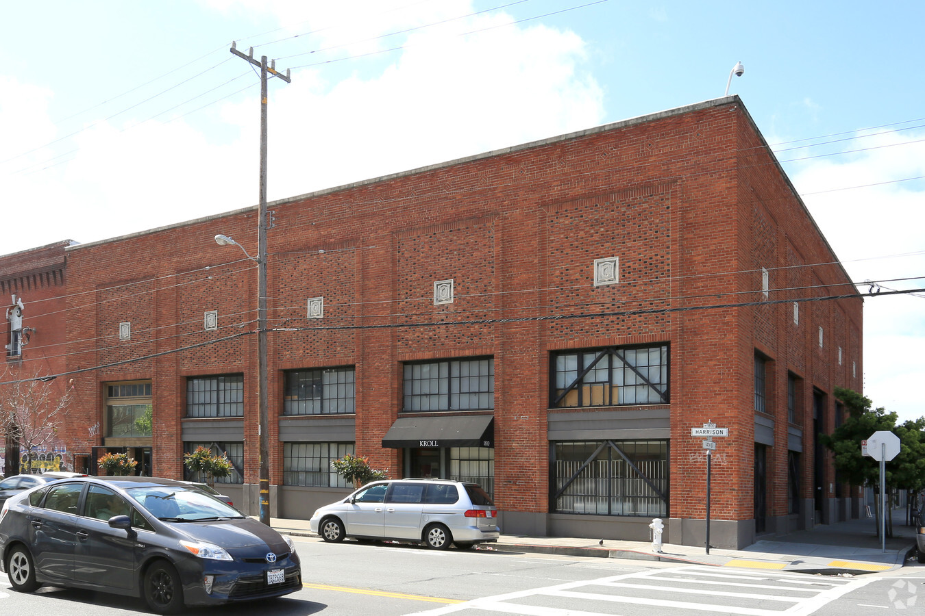
1 14Th St
San Francisco
Mission
San Francisco-Redwood City-South San Francisco, CA
San Francisco
3550-001
California
Industrialgeneral
1
2023
0.21 AC
2023
Mission/Potrero
017803
DEMOGRAPHICS near 1 14Th St
1 Mile
3 Mile
5 Mile
2024 Total Population
98,012
521,004
779,240
2029 Population
92,137
484,375
720,447
Pop Growth 2024-2029
(5.99%)
(7.03%)
(7.54%)
Average Age
41
42
42
2024 Total Households
44,857
242,714
329,738
HH Growth 2024-2029
(6.48%)
(7.48%)
(7.87%)
Median Household Inc
$116,391
$131,825
$127,209
Avg Household Size
1.90
2.00
2.20
2024 Avg HH Vehicles
1.00
1.00
1.00
Median Home Value
$1,067,642
$1,100,625
$1,096,961
Median Year Built
1964
1949
1949
Nearby Places
- Restaurants
- Banks
- Shops
- Fitness
- Groceries
PUBLIC TRANSPORTATION
TRANSIT/SUBWAY
Market And Hyde Outbound (F Market - San Francisco Municipal Railway (MUNI Metro))
Drive
Walk
Distance
Market And Hyde Outbound (F Market - San Francisco Municipal Railway (MUNI Metro))
1 min
8 min
0.4 mi
Civic Center Station (Dublin/Pleasanton - Millbrae - Bay Area Rapid Transit (BART), Fremont - Daly City - Bay Area Rapid Transit (BART), J Church - Bay Area Rapid Transit (BART), K Ingleside - Bay Area Rapid Transit (BART), L Taraval - Bay Area Rapid Transit (BART), M Ocean View - Bay Area Rapid Transit (BART), N Judah - Bay Area Rapid Transit (BART), Pittsburg/Bay Point - San Francisco International - Bay Area Rapid Transit (BART), Richmond - Millbrae - Bay Area Rapid Transit (BART), S Castro Shuttle - Bay Area Rapid Transit (BART), T Third Street - Bay Area Rapid Transit (BART))
Drive
Walk
Distance
Civic Center Station (Dublin/Pleasanton - Millbrae - Bay Area Rapid Transit (BART), Fremont - Daly City - Bay Area Rapid Transit (BART), J Church - Bay Area Rapid Transit (BART), K Ingleside - Bay Area Rapid Transit (BART), L Taraval - Bay Area Rapid Transit (BART), M Ocean View - Bay Area Rapid Transit (BART), N Judah - Bay Area Rapid Transit (BART), Pittsburg/Bay Point - San Francisco International - Bay Area Rapid Transit (BART), Richmond - Millbrae - Bay Area Rapid Transit (BART), S Castro Shuttle - Bay Area Rapid Transit (BART), T Third Street - Bay Area Rapid Transit (BART))
3 min
9 min
0.5 mi
Van Ness (Metro) (J Church - San Francisco Municipal Railway (MUNI Metro), K Ingleside - San Francisco Municipal Railway (MUNI Metro), L Taraval - San Francisco Municipal Railway (MUNI Metro), M Ocean View - San Francisco Municipal Railway (MUNI Metro), N Judah - San Francisco Municipal Railway (MUNI Metro), S Castro Shuttle - San Francisco Municipal Railway (MUNI Metro), T Third Street - San Francisco Municipal Railway (MUNI Metro))
Drive
Walk
Distance
Van Ness (Metro) (J Church - San Francisco Municipal Railway (MUNI Metro), K Ingleside - San Francisco Municipal Railway (MUNI Metro), L Taraval - San Francisco Municipal Railway (MUNI Metro), M Ocean View - San Francisco Municipal Railway (MUNI Metro), N Judah - San Francisco Municipal Railway (MUNI Metro), S Castro Shuttle - San Francisco Municipal Railway (MUNI Metro), T Third Street - San Francisco Municipal Railway (MUNI Metro))
2 min
10 min
0.5 mi
Market And Van Ness (F Line) (F Market - San Francisco Municipal Railway (MUNI Metro))
Drive
Walk
Distance
Market And Van Ness (F Line) (F Market - San Francisco Municipal Railway (MUNI Metro))
2 min
10 min
0.5 mi
Market And 7Th/Jones (F Market - San Francisco Municipal Railway (MUNI Metro))
Drive
Walk
Distance
Market And 7Th/Jones (F Market - San Francisco Municipal Railway (MUNI Metro))
3 min
11 min
0.6 mi
COMMUTER RAIL
San Francisco 4Th & King (Caltrain - Caltrain (Caltrain))
Drive
Walk
Distance
San Francisco 4Th & King (Caltrain - Caltrain (Caltrain))
3 min
1.8 mi
22Nd Street (Caltrain - Caltrain (Caltrain))
Drive
Walk
Distance
22Nd Street (Caltrain - Caltrain (Caltrain))
5 min
2.6 mi
AIRPORT
San Francisco International
Drive
Walk
Distance
San Francisco International
20 min
13.0 mi
Metro Oakland International
Drive
Walk
Distance
Metro Oakland International
31 min
20.2 mi
Freight Ports
Port of San Francisco
Drive
Walk
Distance
Port of San Francisco
5 min
2.1 mi
Nearby Properties
Address
Land Use
TOTAL SIZE
Lot Size
Zoning
Address
Land Use
TOTAL SIZE
Lot Size
Zoning
1420430
1.16 AC
C3OSD
Address
Land Use
TOTAL SIZE
Lot Size
Zoning
10.92 AC
Address
Land Use
TOTAL SIZE
Lot Size
Zoning
764661
0.66 AC
C3OSD
Address
Land Use
TOTAL SIZE
Lot Size
Zoning
750370
3.25 AC
MBR3
Address
Land Use
TOTAL SIZE
Lot Size
Zoning
1471929
1.92 AC
C3O
Address
Land Use
TOTAL SIZE
Lot Size
Zoning
1300000
1.74 AC
C3O
Address
Land Use
TOTAL SIZE
Lot Size
Zoning
1534312
2.60 AC
C3O
Address
Land Use
TOTAL SIZE
Lot Size
Zoning
508714
1.29 AC
C3R
Address
Land Use
TOTAL SIZE
Lot Size
Zoning
248303
4.35 AC
Address
Land Use
TOTAL SIZE
Lot Size
Zoning
914037
1.36 AC
C3O
Address
Land Use
TOTAL SIZE
Lot Size
Zoning
717234
3.47 AC
UMU
Address
Land Use
TOTAL SIZE
Lot Size
Zoning
696431
0.97 AC
C3G
Address
Land Use
TOTAL SIZE
Lot Size
Zoning
605459
0.63 AC
C3O
Address
Land Use
TOTAL SIZE
Lot Size
Zoning
475791
0.55 AC
C3OSD
Address
Land Use
TOTAL SIZE
Lot Size
Zoning
690442
0.79 AC
C3O
Address
Land Use
TOTAL SIZE
Lot Size
Zoning
750491
0.51 AC
C3O
Address
Land Use
TOTAL SIZE
Lot Size
Zoning
432000
0.35 AC
C3OSD
Address
Land Use
TOTAL SIZE
Lot Size
Zoning
266143
4 AC
C-3-R
Address
Land Use
TOTAL SIZE
Lot Size
Zoning
885581
5.20 AC
M2
Address
Land Use
TOTAL SIZE
Lot Size
Zoning
512395
1.24 AC
C3O
Address
Land Use
TOTAL SIZE
Lot Size
Zoning
1084662
1.67 AC
C3O
Address
Land Use
TOTAL SIZE
Lot Size
Zoning
505120
0.41 AC
C3O
Address
Land Use
TOTAL SIZE
Lot Size
Zoning
694334
1.01 AC
C3O
Address
Land Use
TOTAL SIZE
Lot Size
Zoning
1424230
2.60 AC
C3G
Address
Land Use
TOTAL SIZE
Lot Size
Zoning
1.52 AC
C3G
Address
Land Use
TOTAL SIZE
Lot Size
Zoning
139070
0.64 AC
C3O
Address
Land Use
TOTAL SIZE
Lot Size
Zoning
614740
1.74 AC
C3OSD
Address
Land Use
TOTAL SIZE
Lot Size
Zoning
615957
0.63 AC
C3O
Address
Land Use
TOTAL SIZE
Lot Size
Zoning
492980
0.43 AC
C3O
Address
Land Use
TOTAL SIZE
Lot Size
Zoning
385000
0.80 AC
C3O
Start a new search to find other properties for sale or lease
Connect with us
© 2024 CoStar Group
The information above has been obtained from sources believed reliable. While we do not doubt its accuracy we have not verified it and make no guarantee, warranty or representation about it. It is your responsibility to independently confirm its accuracy and completeness. Any projections, opinions, assumptions, or estimates used are for example only and do not represent the current or future performance of the property. The value of this transaction to you depends on tax and other factors which should be evaluated by your tax, financial, and legal advisors. You and your advisors should conduct a careful, independent investigation of the property to determine to your satisfaction the suitability of the property for your needs.