Property Record
1811 Columbia Tpke, Castleton On Hudson, NY 12033
NEARBY LISTINGS FOR SALE OR LEASE
-
-
View all Castleton On Hudson listings for sale on LoopNet.com
Property Detail
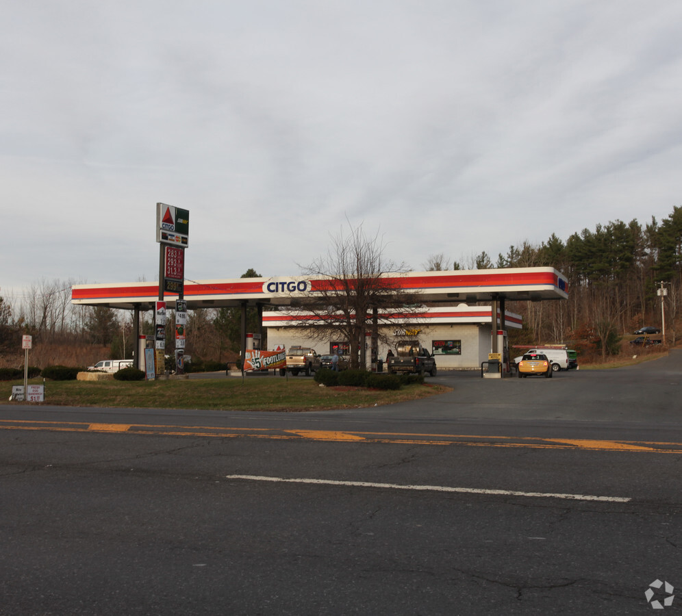
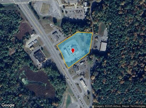
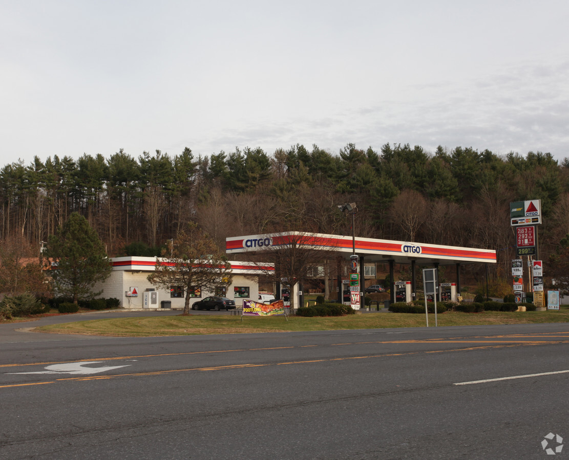
1811 Columbia Tpke
4489-189-10-8.32
Rensselaer
Servicestationmarket
New York
ARE
8.032
36083C0366D
2.60 AC
2023
Outer Rensselaer County
2023
Albany/Schenectady/Troy
052502
Albany-Schenectady-Troy, NY
3,975 SF
DEMOGRAPHICS near 1811 Columbia Tpke
1 Mile
3 Mile
5 Mile
2024 Total Population
1,034
9,673
23,746
2029 Population
1,022
9,574
23,490
Pop Growth 2024-2029
(1.16%)
(1.02%)
(1.08%)
Average Age
45
45
44
2024 Total Households
426
4,039
9,879
HH Growth 2024-2029
(1.17%)
(1.14%)
(1.19%)
Median Household Inc
$92,382
$98,373
$96,943
Avg Household Size
2.40
2.40
2.30
2024 Avg HH Vehicles
2.00
2.00
2.00
Median Home Value
$266,556
$267,738
$253,744
Median Year Built
1975
1974
1973
Nearby Places
- Restaurants
- Banks
- Shops
- Fitness
- Groceries
PUBLIC TRANSPORTATION
COMMUTER RAIL
Albany-Rensselaer Amtrak Station (Adirondack - Amtrak, Empire Service - Amtrak, Ethan Allen Express - Amtrak, Lake Shore Limited - Amtrak, Maple Leaf - Amtrak, Toronto - New York - Amtrak)
DRIVE
WALK
Distance
Albany-Rensselaer Amtrak Station (Adirondack - Amtrak, Empire Service - Amtrak, Ethan Allen Express - Amtrak, Lake Shore Limited - Amtrak, Maple Leaf - Amtrak, Toronto - New York - Amtrak)
15 min
9.7 mi
AIRPORT
Albany International
DRIVE
WALK
Distance
Albany International
29 min
18.4 mi
Freight Ports
Albany, NY Port
DRIVE
WALK
Distance
Albany, NY Port
18 min
12.5 mi
Nearby Properties
Address
Land Use
TOTAL SIZE
Lot Size
Zoning
Address
Land Use
TOTAL SIZE
Lot Size
Zoning
115.46 AC
PD3
Address
Land Use
TOTAL SIZE
Lot Size
Zoning
278,670 SF
55.98 AC
PD-3
Address
Land Use
TOTAL SIZE
Lot Size
Zoning
44,712 SF
25.58 AC
R-3
Address
Land Use
TOTAL SIZE
Lot Size
Zoning
108,473 SF
62.61 AC
R-40
Address
Land Use
TOTAL SIZE
Lot Size
Zoning
27,192 SF
8.52 AC
B-2
Address
Land Use
TOTAL SIZE
Lot Size
Zoning
66,354 SF
10.26 AC
R-20
Address
Land Use
TOTAL SIZE
Lot Size
Zoning
20,320 SF
4.39 AC
PD-3
Address
Land Use
TOTAL SIZE
Lot Size
Zoning
15,000 SF
2.53 AC
PDD
Address
Land Use
TOTAL SIZE
Lot Size
Zoning
8.41 AC
R-40
Address
Land Use
TOTAL SIZE
Lot Size
Zoning
3.84 AC
R-40
Address
Land Use
TOTAL SIZE
Lot Size
Zoning
Address
Land Use
TOTAL SIZE
Lot Size
Zoning
43,328 SF
7.46 AC
R-40
Address
Land Use
TOTAL SIZE
Lot Size
Zoning
34,184 SF
17.63 AC
HC
Address
Land Use
TOTAL SIZE
Lot Size
Zoning
14,653 SF
1.95 AC
HC
Address
Land Use
TOTAL SIZE
Lot Size
Zoning
3,970 SF
2.52 AC
HC
Address
Land Use
TOTAL SIZE
Lot Size
Zoning
Address
Land Use
TOTAL SIZE
Lot Size
Zoning
29,580 SF
8.62 AC
PD-3
Address
Land Use
TOTAL SIZE
Lot Size
Zoning
Address
Land Use
TOTAL SIZE
Lot Size
Zoning
28,800 SF
5.12 AC
PD-3
Address
Land Use
TOTAL SIZE
Lot Size
Zoning
18,678 SF
11.91 AC
HC
Address
Land Use
TOTAL SIZE
Lot Size
Zoning
6,000 SF
5.33 AC
Address
Land Use
TOTAL SIZE
Lot Size
Zoning
9,815 SF
1.63 AC
B-2
Address
Land Use
TOTAL SIZE
Lot Size
Zoning
648 SF
46.65 AC
RA
Address
Land Use
TOTAL SIZE
Lot Size
Zoning
55,427 SF
4.88 AC
RA
Address
Land Use
TOTAL SIZE
Lot Size
Zoning
2.30 AC
R-40
Address
Land Use
TOTAL SIZE
Lot Size
Zoning
30,192 SF
9.06 AC
HC
Address
Land Use
TOTAL SIZE
Lot Size
Zoning
27.46 AC
RA
Address
Land Use
TOTAL SIZE
Lot Size
Zoning
12,826 SF
206.90 AC
RA
Address
Land Use
TOTAL SIZE
Lot Size
Zoning
15,288 SF
3.36 AC
PDD
The World's #1 Commercial Real Estate Marketplace
Connect with us
© 2025 CoStar Group
The information above has been obtained from sources believed reliable. While we do not doubt its accuracy we have not verified it and make no guarantee, warranty or representation about it. It is your responsibility to independently confirm its accuracy and completeness. Any projections, opinions, assumptions, or estimates used are for example only and do not represent the current or future performance of the property. The value of this transaction to you depends on tax and other factors which should be evaluated by your tax, financial, and legal advisors. You and your advisors should conduct a careful, independent investigation of the property to determine to your satisfaction the suitability of the property for your needs.