Property Record
1819 Memorial Dr, Alexandria, LA 71301


NEARBY LISTINGS FOR SALE OR LEASE
Property Detail
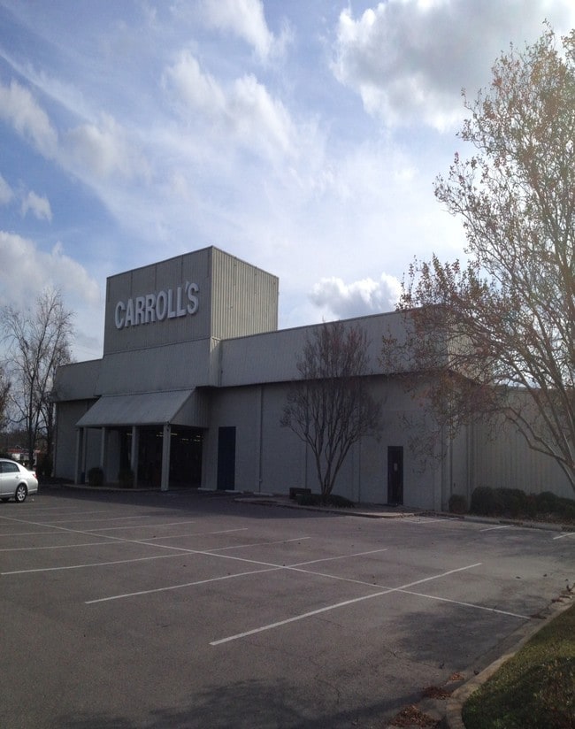
1819 Memorial Dr
Alexandria, LA
Sterkx-Deming
24-042-08738-0006
5 ACS: FRTG 360.37' ON MEMORIAL DR X 615.79' X 350' X 583.2' ADJ TO WEDGEWOOD DOWNS SUBD & STERKX-DEMING SUBD (108900) (CB 14
Commercialnec
Rapides
2024
Louisiana
2024
Louisiana North Area
012600
Other Market Areas
DEMOGRAPHICS near 1819 Memorial Dr
1 Mile
3 Mile
5 Mile
2024 Total Population
4,203
43,132
60,039
2029 Population
4,194
42,376
58,912
Pop Growth 2024-2029
(0.21%)
(1.75%)
(1.88%)
Average Age
42
40
39
2024 Total Households
1,689
17,653
24,347
HH Growth 2024-2029
(0.12%)
(1.75%)
(1.90%)
Median Household Inc
$29,470
$36,338
$39,367
Avg Household Size
2.30
2.30
2.30
2024 Avg HH Vehicles
1.00
1.00
1.00
Median Home Value
$89,120
$154,603
$159,512
Median Year Built
1959
1969
1971
Nearby Places
Map Layers
Map Styles
 Street
 Aerial
- Restaurants
- Banks
- Shops
- Fitness
- Groceries
PUBLIC TRANSPORTATION
AIRPORT
Alexandria International
DRIVE
WALK
Distance
Alexandria International
24 min
10.1 mi
Freight Ports
Port of Lake Charles
DRIVE
WALK
Distance
Port of Lake Charles
117 min
97.5 mi
SALE & LEASE HISTORY
LISTING DATE
SALE/LEASE

Sep 25, 2016
For Lease
Nearby Properties
Address
Land Use
TOTAL SIZE
Lot Size
Zoning
Address
Land Use
TOTAL SIZE
Lot Size
Zoning
Address
Land Use
TOTAL SIZE
Lot Size
Zoning
Address
Land Use
TOTAL SIZE
Lot Size
Zoning
Address
Land Use
TOTAL SIZE
Lot Size
Zoning
Address
Land Use
TOTAL SIZE
Lot Size
Zoning
82,585 SF
9 AC
Address
Land Use
TOTAL SIZE
Lot Size
Zoning
Address
Land Use
TOTAL SIZE
Lot Size
Zoning
Address
Land Use
TOTAL SIZE
Lot Size
Zoning
Address
Land Use
TOTAL SIZE
Lot Size
Zoning
Address
Land Use
TOTAL SIZE
Lot Size
Zoning
Address
Land Use
TOTAL SIZE
Lot Size
Zoning
Address
Land Use
TOTAL SIZE
Lot Size
Zoning
33,778 SF
2.59 AC
Address
Land Use
TOTAL SIZE
Lot Size
Zoning
54,135 SF
7 AC
Address
Land Use
TOTAL SIZE
Lot Size
Zoning
Address
Land Use
TOTAL SIZE
Lot Size
Zoning
Address
Land Use
TOTAL SIZE
Lot Size
Zoning
59,500 SF
2.23 AC
Address
Land Use
TOTAL SIZE
Lot Size
Zoning
Address
Land Use
TOTAL SIZE
Lot Size
Zoning
3.07 AC
Address
Land Use
TOTAL SIZE
Lot Size
Zoning
10.27 AC
Address
Land Use
TOTAL SIZE
Lot Size
Zoning
Address
Land Use
TOTAL SIZE
Lot Size
Zoning
57,867 SF
1.80 AC
Address
Land Use
TOTAL SIZE
Lot Size
Zoning
Address
Land Use
TOTAL SIZE
Lot Size
Zoning
Address
Land Use
TOTAL SIZE
Lot Size
Zoning
Address
Land Use
TOTAL SIZE
Lot Size
Zoning
318,655 SF
19.14 AC
Address
Land Use
TOTAL SIZE
Lot Size
Zoning
100,959 SF
9 AC
Address
Land Use
TOTAL SIZE
Lot Size
Zoning
Address
Land Use
TOTAL SIZE
Lot Size
Zoning
4.13 AC
The World's #1 Commercial Real Estate Marketplace
Connect with us
© 2026 CoStar Group
The information above has been obtained from sources believed reliable. While we do not doubt its accuracy we have not verified it and make no guarantee, warranty or representation about it. It is your responsibility to independently confirm its accuracy and completeness. Any projections, opinions, assumptions, or estimates used are for example only and do not represent the current or future performance of the property. The value of this transaction to you depends on tax and other factors which should be evaluated by your tax, financial, and legal advisors. You and your advisors should conduct a careful, independent investigation of the property to determine to your satisfaction the suitability of the property for your needs.