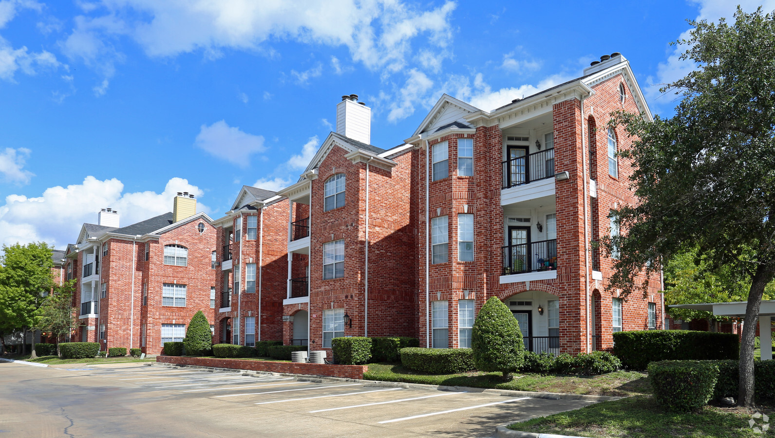
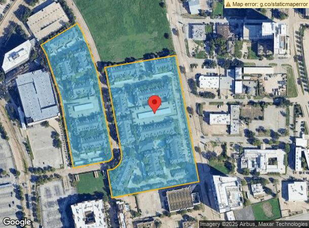
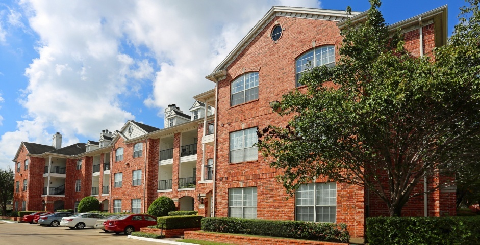
Property Record
1819 S Braeswood Blvd, Houston, TX 77030
NEARBY LISTINGS FOR SALE OR LEASE
Property Detail
1819 S Braeswood Blvd
1192390010003
Medcenter Park
Apartment
RES C BLK 1 & RES A BLK 2 MEDCENTER PARK
X
Harris
48201C0860L
Texas
2023
15.79 AC
2024
Medical Center South
314401
Houston
593,742 SF
Houston-The Woodlands-Sugar Land, TX
DEMOGRAPHICS near 1819 S Braeswood Blvd
1 Mile
3 Mile
5 Mile
2024 Total Population
24,682
171,973
465,913
2029 Population
25,464
178,182
482,969
Pop Growth 2024-2029
+ 3.17%
+ 3.61%
+ 3.66%
Average Age
33
38
37
2024 Total Households
11,766
81,020
212,842
HH Growth 2024-2029
+ 3.43%
+ 3.72%
+ 3.83%
Median Household Inc
$63,804
$71,300
$73,766
Avg Household Size
1.80
2.00
2.10
2024 Avg HH Vehicles
1.00
1.00
1.00
Median Home Value
$371,965
$535,916
$432,654
Median Year Built
1989
1992
1993
Nearby Places
- Restaurants
- Banks
- Shops
- Fitness
- Groceries
PUBLIC TRANSPORTATION
TRANSIT/SUBWAY
Tmc Transit Center (Redline - Harris County Metropolitan Transit Authority METRO Rail (METRORail))
Drive
Walk
Distance
Tmc Transit Center (Redline - Harris County Metropolitan Transit Authority METRO Rail (METRORail))
2 min
8 min
0.4 mi
Smith Lands (Redline - Harris County Metropolitan Transit Authority METRO Rail (METRORail))
Drive
Walk
Distance
Smith Lands (Redline - Harris County Metropolitan Transit Authority METRO Rail (METRORail))
0 min
11 min
0.5 mi
Dryden/Tmc (Redline - Harris County Metropolitan Transit Authority METRO Rail (METRORail))
Drive
Walk
Distance
Dryden/Tmc (Redline - Harris County Metropolitan Transit Authority METRO Rail (METRORail))
2 min
16 min
0.8 mi
Reliant Park (Redline - Harris County Metropolitan Transit Authority METRO Rail (METRORail))
Drive
Walk
Distance
Reliant Park (Redline - Harris County Metropolitan Transit Authority METRO Rail (METRORail))
1 min
18 min
0.9 mi
COMMUTER RAIL
Houston (Sunset Limited - Amtrak)
Drive
Walk
Distance
Houston (Sunset Limited - Amtrak)
13 min
7.3 mi
AIRPORT
William P Hobby
Drive
Walk
Distance
William P Hobby
24 min
13.0 mi
George Bush Intcntl/Houston
Drive
Walk
Distance
George Bush Intcntl/Houston
33 min
24.0 mi
Freight Ports
Port of Houston
Drive
Walk
Distance
Port of Houston
21 min
13.3 mi
Nearby Properties
Address
Land Use
TOTAL SIZE
Lot Size
Zoning
Address
Land Use
TOTAL SIZE
Lot Size
Zoning
519,409 SF
1.52 AC
Address
Land Use
TOTAL SIZE
Lot Size
Zoning
1,880,742 SF
20.76 AC
Address
Land Use
TOTAL SIZE
Lot Size
Zoning
1,252,274 SF
2.02 AC
Address
Land Use
TOTAL SIZE
Lot Size
Zoning
704,249 SF
2.34 AC
Address
Land Use
TOTAL SIZE
Lot Size
Zoning
819,560 SF
1.35 AC
Address
Land Use
TOTAL SIZE
Lot Size
Zoning
1,044,305 SF
3.16 AC
Address
Land Use
TOTAL SIZE
Lot Size
Zoning
1,009,859 SF
28.73 AC
Address
Land Use
TOTAL SIZE
Lot Size
Zoning
402,467 SF
28.30 AC
Address
Land Use
TOTAL SIZE
Lot Size
Zoning
464,134 SF
3.57 AC
Address
Land Use
TOTAL SIZE
Lot Size
Zoning
507,499 SF
7.66 AC
Address
Land Use
TOTAL SIZE
Lot Size
Zoning
958,147 SF
16.60 AC
Address
Land Use
TOTAL SIZE
Lot Size
Zoning
1,360,194 SF
Address
Land Use
TOTAL SIZE
Lot Size
Zoning
701,043 SF
4.69 AC
Address
Land Use
TOTAL SIZE
Lot Size
Zoning
607,893 SF
3.69 AC
Address
Land Use
TOTAL SIZE
Lot Size
Zoning
396,888 SF
2.02 AC
Address
Land Use
TOTAL SIZE
Lot Size
Zoning
310,967 SF
1.38 AC
Address
Land Use
TOTAL SIZE
Lot Size
Zoning
565,246 SF
1.14 AC
Address
Land Use
TOTAL SIZE
Lot Size
Zoning
320,710 SF
1.19 AC
Address
Land Use
TOTAL SIZE
Lot Size
Zoning
828,746 SF
7.76 AC
Address
Land Use
TOTAL SIZE
Lot Size
Zoning
287,348 SF
1.15 AC
Address
Land Use
TOTAL SIZE
Lot Size
Zoning
1,279,489 SF
2.83 AC
Address
Land Use
TOTAL SIZE
Lot Size
Zoning
261,388 SF
1.56 AC
Address
Land Use
TOTAL SIZE
Lot Size
Zoning
444,589 SF
11 AC
Address
Land Use
TOTAL SIZE
Lot Size
Zoning
316,101 SF
2.12 AC
Address
Land Use
TOTAL SIZE
Lot Size
Zoning
552,795 SF
4.29 AC
Address
Land Use
TOTAL SIZE
Lot Size
Zoning
519,237 SF
1.73 AC
Address
Land Use
TOTAL SIZE
Lot Size
Zoning
1,000,928 SF
18.79 AC
Address
Land Use
TOTAL SIZE
Lot Size
Zoning
486,076 SF
3.79 AC
Address
Land Use
TOTAL SIZE
Lot Size
Zoning
499,411 SF
5.73 AC
Address
Land Use
TOTAL SIZE
Lot Size
Zoning
590,425 SF
8.87 AC
Start a new search to find other properties for sale or lease
Connect with us
© 2025 CoStar Group
The information above has been obtained from sources believed reliable. While we do not doubt its accuracy we have not verified it and make no guarantee, warranty or representation about it. It is your responsibility to independently confirm its accuracy and completeness. Any projections, opinions, assumptions, or estimates used are for example only and do not represent the current or future performance of the property. The value of this transaction to you depends on tax and other factors which should be evaluated by your tax, financial, and legal advisors. You and your advisors should conduct a careful, independent investigation of the property to determine to your satisfaction the suitability of the property for your needs.