Property Record
1820 W Lamar Alexander Pky, Maryville, TN 37801

NEARBY LISTINGS FOR SALE OR LEASE
Property Detail
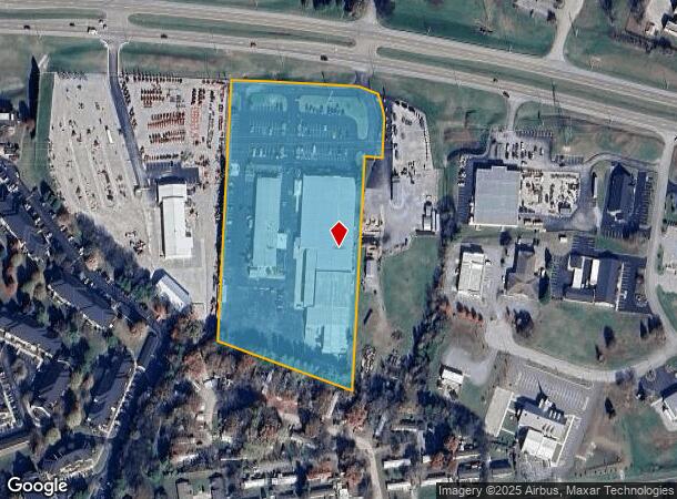
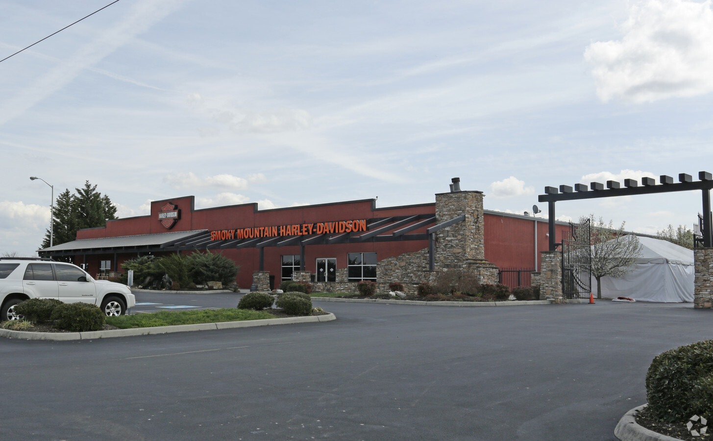
1820 W Lamar Alexander Pky
057-022.02
DISTRICT: 19, COUNTY AREA: Q95
Departmentstore
Blount
X
Tennessee
47009C0119C
7.20 AC
2023
Blount County
2024
Knoxville
011201
Knoxville, TN
64,798 SF
DEMOGRAPHICS near 1820 W Lamar Alexander Pky
1 Mile
3 Mile
5 Mile
2024 Total Population
4,183
31,277
70,529
2029 Population
4,592
34,119
76,672
Pop Growth 2024-2029
+ 9.78%
+ 9.09%
+ 8.71%
Average Age
39
41
42
2024 Total Households
1,747
12,877
28,268
HH Growth 2024-2029
+ 9.73%
+ 9.12%
+ 8.77%
Median Household Inc
$58,761
$58,916
$62,384
Avg Household Size
2.40
2.40
2.40
2024 Avg HH Vehicles
2.00
2.00
2.00
Median Home Value
$183,729
$243,711
$240,109
Median Year Built
2005
1991
1985
Nearby Places
- Restaurants
- Banks
- Shops
- Fitness
- Groceries
PUBLIC TRANSPORTATION
AIRPORT
McGhee Tyson
DRIVE
WALK
Distance
McGhee Tyson
16 min
9.6 mi
Freight Ports
Georgia Ports - Savannah
DRIVE
WALK
Distance
Georgia Ports - Savannah
494 min
421.8 mi
Nearby Properties
Address
Land Use
TOTAL SIZE
Lot Size
Zoning
Address
Land Use
TOTAL SIZE
Lot Size
Zoning
635,728 SF
234.46 AC
I
Address
Land Use
TOTAL SIZE
Lot Size
Zoning
325,748 SF
IND
Address
Land Use
TOTAL SIZE
Lot Size
Zoning
558,604 SF
83.49 AC
IND
Address
Land Use
TOTAL SIZE
Lot Size
Zoning
10,061 SF
22.74 AC
SPLIT
Address
Land Use
TOTAL SIZE
Lot Size
Zoning
101,640 SF
7.41 AC
SPLIT
Address
Land Use
TOTAL SIZE
Lot Size
Zoning
88,949 SF
6.83 AC
CBDS
Address
Land Use
TOTAL SIZE
Lot Size
Zoning
194,268 SF
33.99 AC
IND
Address
Land Use
TOTAL SIZE
Lot Size
Zoning
78,099 SF
20 AC
S
Address
Land Use
TOTAL SIZE
Lot Size
Zoning
64,033 SF
5.65 AC
O-3
Address
Land Use
TOTAL SIZE
Lot Size
Zoning
279,826 SF
50.95 AC
IND
Address
Land Use
TOTAL SIZE
Lot Size
Zoning
23,916 SF
9.94 AC
Address
Land Use
TOTAL SIZE
Lot Size
Zoning
33,912 SF
19.91 AC
HDR
Address
Land Use
TOTAL SIZE
Lot Size
Zoning
74,071 SF
5.19 AC
HIC
Address
Land Use
TOTAL SIZE
Lot Size
Zoning
158,466 SF
14.78 AC
E1
Address
Land Use
TOTAL SIZE
Lot Size
Zoning
41,938 SF
7.42 AC
BT
Address
Land Use
TOTAL SIZE
Lot Size
Zoning
122,648 SF
0.10 AC
CBD
Address
Land Use
TOTAL SIZE
Lot Size
Zoning
323,040 SF
87.30 AC
IND
Address
Land Use
TOTAL SIZE
Lot Size
Zoning
55,708 SF
6.95 AC
BT
Address
Land Use
TOTAL SIZE
Lot Size
Zoning
161,251 SF
Address
Land Use
TOTAL SIZE
Lot Size
Zoning
104,327 SF
26.19 AC
CC
Address
Land Use
TOTAL SIZE
Lot Size
Zoning
533,928 SF
97.90 AC
IND
Address
Land Use
TOTAL SIZE
Lot Size
Zoning
172.05 AC
G
Address
Land Use
TOTAL SIZE
Lot Size
Zoning
15,340 SF
5 AC
Address
Land Use
TOTAL SIZE
Lot Size
Zoning
236,656 SF
24.69 AC
E1
Address
Land Use
TOTAL SIZE
Lot Size
Zoning
295,555 SF
IND
Address
Land Use
TOTAL SIZE
Lot Size
Zoning
60,328 SF
4.41 AC
F
Address
Land Use
TOTAL SIZE
Lot Size
Zoning
223,912 SF
25.83 AC
BT
Address
Land Use
TOTAL SIZE
Lot Size
Zoning
129,809 SF
11.37 AC
BT
Address
Land Use
TOTAL SIZE
Lot Size
Zoning
21,350 SF
7.89 AC
E1
Address
Land Use
TOTAL SIZE
Lot Size
Zoning
103,689 SF
5.12 AC
R
The World's #1 Commercial Real Estate Marketplace
Connect with us
© 2025 CoStar Group
The information above has been obtained from sources believed reliable. While we do not doubt its accuracy we have not verified it and make no guarantee, warranty or representation about it. It is your responsibility to independently confirm its accuracy and completeness. Any projections, opinions, assumptions, or estimates used are for example only and do not represent the current or future performance of the property. The value of this transaction to you depends on tax and other factors which should be evaluated by your tax, financial, and legal advisors. You and your advisors should conduct a careful, independent investigation of the property to determine to your satisfaction the suitability of the property for your needs.