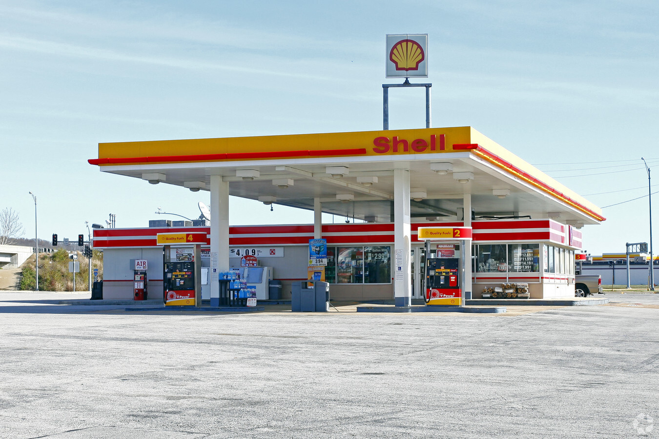
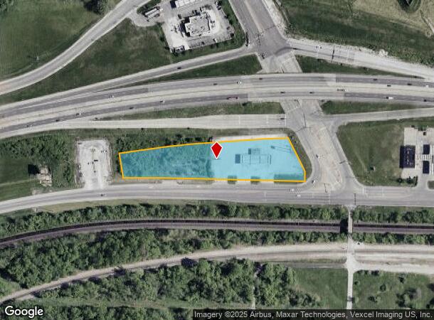
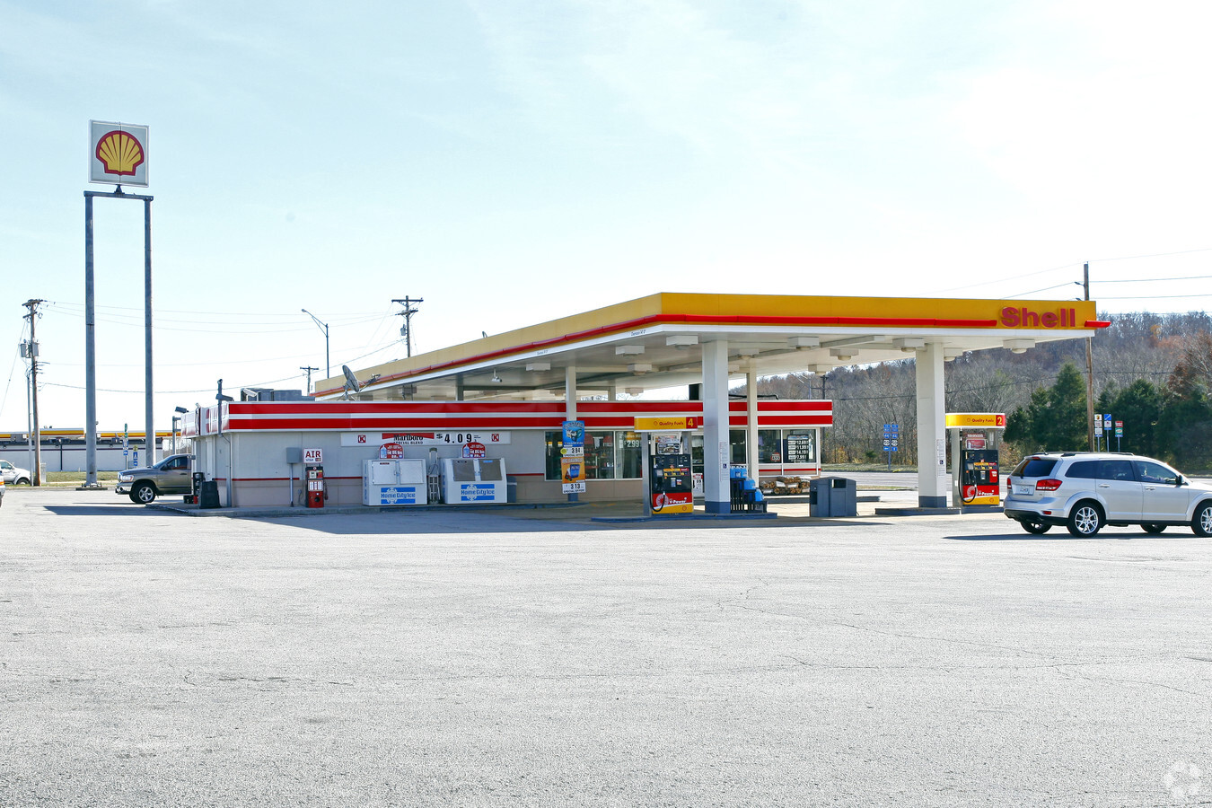
Property Record
18201 Us Highway 66, Eureka, MO 63069
NEARBY LISTINGS FOR SALE OR LEASE
Property Detail
18201 Us Highway 66
29X-62-0114
SECTION 34-44-3
Servicestation
St. Louis
X
Missouri
29071C0225E
2.70 AC
2023
Outer St Louis County
2023
St. Louis
221503
St. Louis, MO-IL
2,340 SF
DEMOGRAPHICS near 18201 Us Highway 66
1 Mile
3 Mile
5 Mile
2024 Total Population
1,653
14,262
28,449
2029 Population
1,671
14,322
28,880
Pop Growth 2024-2029
+ 1.09%
+ 0.42%
+ 1.51%
Average Age
38
39
40
2024 Total Households
469
4,649
9,988
HH Growth 2024-2029
+ 1.71%
+ 0.41%
+ 1.51%
Median Household Inc
$106,756
$127,529
$109,076
Avg Household Size
2.90
2.80
2.70
2024 Avg HH Vehicles
2.00
2.00
2.00
Median Home Value
$340,000
$350,137
$342,912
Median Year Built
1999
1998
1994
Nearby Places
- Restaurants
- Banks
- Shops
- Fitness
- Groceries
PUBLIC TRANSPORTATION
AIRPORT
St Louis Lambert International
DRIVE
WALK
Distance
St Louis Lambert International
46 min
33.2 mi
Freight Ports
Tulsa Port of Inola
DRIVE
WALK
Distance
Tulsa Port of Inola
388 min
354.8 mi
Nearby Properties
Address
Land Use
TOTAL SIZE
Lot Size
Zoning
Address
Land Use
TOTAL SIZE
Lot Size
Zoning
3,373 SF
1,418.57 AC
PS
Address
Land Use
TOTAL SIZE
Lot Size
Zoning
258,378 SF
170.04 AC
44C-1
Address
Land Use
TOTAL SIZE
Lot Size
Zoning
12,274 SF
86.91 AC
R1
Address
Land Use
TOTAL SIZE
Lot Size
Zoning
1,387.09 AC
PS
Address
Land Use
TOTAL SIZE
Lot Size
Zoning
13.12 AC
Address
Land Use
TOTAL SIZE
Lot Size
Zoning
207,499 SF
10.11 AC
98R-5
Address
Land Use
TOTAL SIZE
Lot Size
Zoning
153,647 SF
22.80 AC
98C
Address
Land Use
TOTAL SIZE
Lot Size
Zoning
64,048 SF
15.16 AC
NU
Address
Land Use
TOTAL SIZE
Lot Size
Zoning
250,959 SF
22.13 AC
98M-1
Address
Land Use
TOTAL SIZE
Lot Size
Zoning
351,908 SF
308.90 AC
NU
Address
Land Use
TOTAL SIZE
Lot Size
Zoning
129.45 AC
FPNU
Address
Land Use
TOTAL SIZE
Lot Size
Zoning
203,960 SF
12.88 AC
NU
Address
Land Use
TOTAL SIZE
Lot Size
Zoning
7.48 AC
R4
Address
Land Use
TOTAL SIZE
Lot Size
Zoning
131,963 SF
61.74 AC
NU
Address
Land Use
TOTAL SIZE
Lot Size
Zoning
8.30 AC
Address
Land Use
TOTAL SIZE
Lot Size
Zoning
7.50 AC
98R-1
Address
Land Use
TOTAL SIZE
Lot Size
Zoning
48,797 SF
23.28 AC
R1
Address
Land Use
TOTAL SIZE
Lot Size
Zoning
29,960 SF
14.54 AC
NU
Address
Land Use
TOTAL SIZE
Lot Size
Zoning
46,777 SF
71 AC
107NU
Address
Land Use
TOTAL SIZE
Lot Size
Zoning
7.26 AC
R3
Address
Land Use
TOTAL SIZE
Lot Size
Zoning
5,088 SF
146.21 AC
PS
Address
Land Use
TOTAL SIZE
Lot Size
Zoning
899 SF
1.41 AC
R3
Address
Land Use
TOTAL SIZE
Lot Size
Zoning
26,024 SF
2.65 AC
98PC
Address
Land Use
TOTAL SIZE
Lot Size
Zoning
69,225 SF
2.45 AC
98C
Address
Land Use
TOTAL SIZE
Lot Size
Zoning
43,052 SF
112.19 AC
107NU
Address
Land Use
TOTAL SIZE
Lot Size
Zoning
60,655 SF
2.95 AC
R-5
Address
Land Use
TOTAL SIZE
Lot Size
Zoning
28,200 SF
2.94 AC
98PC
Address
Land Use
TOTAL SIZE
Lot Size
Zoning
24,890 SF
11.70 AC
NU
Address
Land Use
TOTAL SIZE
Lot Size
Zoning
46,615 SF
6.91 AC
98C
Address
Land Use
TOTAL SIZE
Lot Size
Zoning
9.10 AC
98R-1
The World's #1 Commercial Real Estate Marketplace
Connect with us
© 2025 CoStar Group
The information above has been obtained from sources believed reliable. While we do not doubt its accuracy we have not verified it and make no guarantee, warranty or representation about it. It is your responsibility to independently confirm its accuracy and completeness. Any projections, opinions, assumptions, or estimates used are for example only and do not represent the current or future performance of the property. The value of this transaction to you depends on tax and other factors which should be evaluated by your tax, financial, and legal advisors. You and your advisors should conduct a careful, independent investigation of the property to determine to your satisfaction the suitability of the property for your needs.