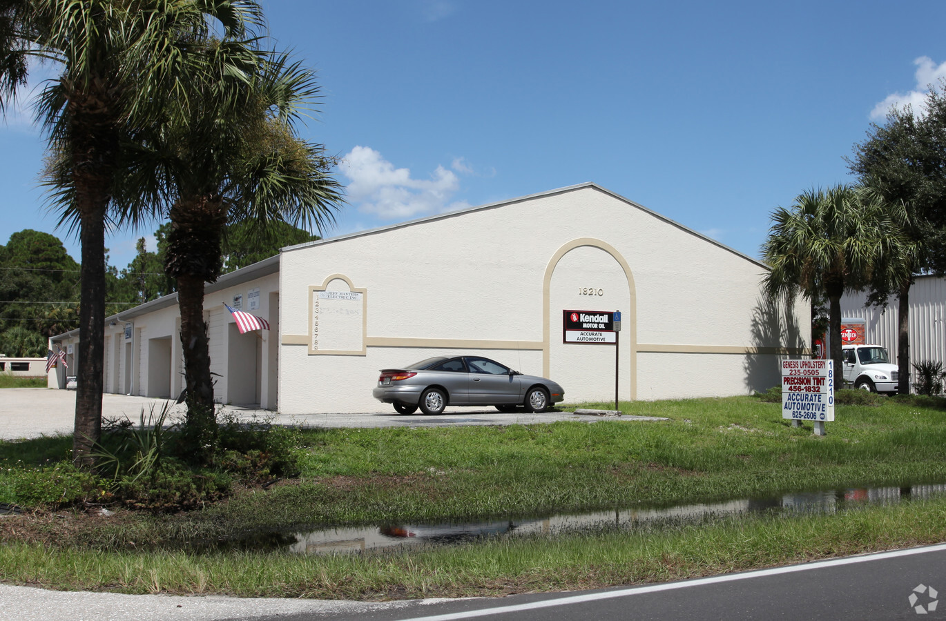
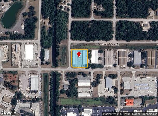
Property Record
18200 Paulson Dr, Port Charlotte, FL 33954
NEARBY LISTINGS FOR SALE OR LEASE
Property Detail
18200 Paulson Dr
Punta Gorda, FL
Port Charlotte
402207203002
PORT CHARLOTTE IND PK UN 2 BLK 8 LT 1 909/2077 923/1029 1083/1945 RES1680/1727 1765/159 3826/1040 4016/954
Warehouse
Charlotte
X
Florida
12015C0044G
1
2023
1.14 AC
2023
Charlotte County
020301
Southwest Florida
19,000 SF
DEMOGRAPHICS near 18200 Paulson Dr
1 Mile
3 Mile
5 Mile
2024 Total Population
1,462
35,482
101,442
2029 Population
1,769
41,760
119,057
Pop Growth 2024-2029
+ 21.00%
+ 17.69%
+ 17.36%
Average Age
44
46
46
2024 Total Households
532
14,515
41,461
HH Growth 2024-2029
+ 21.62%
+ 17.95%
+ 17.62%
Median Household Inc
$39,999
$57,676
$61,222
Avg Household Size
2.40
2.40
2.40
2024 Avg HH Vehicles
1.00
2.00
2.00
Median Home Value
$239,565
$235,158
$239,769
Median Year Built
2003
1992
1991
Nearby Places
- Restaurants
- Banks
- Shops
- Fitness
- Groceries
PUBLIC TRANSPORTATION
AIRPORT
Punta Gorda
DRIVE
WALK
Distance
Punta Gorda
25 min
12.8 mi
Freight Ports
Port Manatee
DRIVE
WALK
Distance
Port Manatee
76 min
62.0 mi
SALE & LEASE HISTORY
LISTING DATE
SALE/LEASE

Mar 22, 2021
For Lease
Jun 10, 2022
For Lease
Jan 30, 2020
For Lease
Jan 27, 2017
For Lease
Apr 10, 2019
For Lease
Nearby Properties
Address
Land Use
TOTAL SIZE
Lot Size
Zoning
Address
Land Use
TOTAL SIZE
Lot Size
Zoning
316,994 SF
40.88 AC
V
Address
Land Use
TOTAL SIZE
Lot Size
Zoning
198,132 SF
17.61 AC
RMF15
Address
Land Use
TOTAL SIZE
Lot Size
Zoning
53,564 SF
22 AC
PD
Address
Land Use
TOTAL SIZE
Lot Size
Zoning
261,557 SF
46.25 AC
OMI
Address
Land Use
TOTAL SIZE
Lot Size
Zoning
132,969 SF
80.28 AC
PKR
Address
Land Use
TOTAL SIZE
Lot Size
Zoning
583,831 SF
54.32 AC
CG
Address
Land Use
TOTAL SIZE
Lot Size
Zoning
196,676 SF
30 AC
OMI
Address
Land Use
TOTAL SIZE
Lot Size
Zoning
122,030 SF
7.43 AC
CG
Address
Land Use
TOTAL SIZE
Lot Size
Zoning
174,965 SF
13.52 AC
CG
Address
Land Use
TOTAL SIZE
Lot Size
Zoning
119,749 SF
12.90 AC
RSF3.5
Address
Land Use
TOTAL SIZE
Lot Size
Zoning
94,423 SF
12.87 AC
V
Address
Land Use
TOTAL SIZE
Lot Size
Zoning
141,619 SF
12.39 AC
II
Address
Land Use
TOTAL SIZE
Lot Size
Zoning
74,447 SF
4.50 AC
CG
Address
Land Use
TOTAL SIZE
Lot Size
Zoning
52,706 SF
4.81 AC
V
Address
Land Use
TOTAL SIZE
Lot Size
Zoning
105,557 SF
20.14 AC
CG
Address
Land Use
TOTAL SIZE
Lot Size
Zoning
208,372 SF
21.98 AC
II
Address
Land Use
TOTAL SIZE
Lot Size
Zoning
52,925 SF
7.49 AC
V
Address
Land Use
TOTAL SIZE
Lot Size
Zoning
98,599 SF
9.75 AC
CG
Address
Land Use
TOTAL SIZE
Lot Size
Zoning
37,045 SF
21.20 AC
PD
Address
Land Use
TOTAL SIZE
Lot Size
Zoning
37,567 SF
36.79 AC
RSF3.5
Address
Land Use
TOTAL SIZE
Lot Size
Zoning
21,809 SF
3.37 AC
CG
Address
Land Use
TOTAL SIZE
Lot Size
Zoning
135,717 SF
10.55 AC
CG
Address
Land Use
TOTAL SIZE
Lot Size
Zoning
116,980 SF
16.23 AC
II
Address
Land Use
TOTAL SIZE
Lot Size
Zoning
96,253 SF
7.89 AC
CG
Address
Land Use
TOTAL SIZE
Lot Size
Zoning
82,800 SF
9.45 AC
CG
Address
Land Use
TOTAL SIZE
Lot Size
Zoning
140,190 SF
18.50 AC
CG
Address
Land Use
TOTAL SIZE
Lot Size
Zoning
4,562 SF
8.08 AC
CG
Address
Land Use
TOTAL SIZE
Lot Size
Zoning
3,652 SF
11.79 AC
IG
Address
Land Use
TOTAL SIZE
Lot Size
Zoning
47,086 SF
3.89 AC
PD
Address
Land Use
TOTAL SIZE
Lot Size
Zoning
36,519 SF
6.70 AC
IG
The World's #1 Commercial Real Estate Marketplace
Connect with us
© 2025 CoStar Group
The information above has been obtained from sources believed reliable. While we do not doubt its accuracy we have not verified it and make no guarantee, warranty or representation about it. It is your responsibility to independently confirm its accuracy and completeness. Any projections, opinions, assumptions, or estimates used are for example only and do not represent the current or future performance of the property. The value of this transaction to you depends on tax and other factors which should be evaluated by your tax, financial, and legal advisors. You and your advisors should conduct a careful, independent investigation of the property to determine to your satisfaction the suitability of the property for your needs.