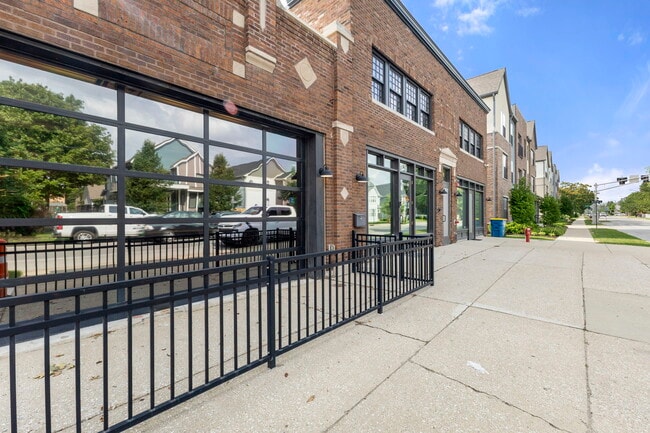
Property Record
1828 Central Ave, Indianapolis, IN 46202


NEARBY LISTINGS FOR SALE OR LEASE
Property Detail
1828 Central Ave
Indianapolis-Carmel-Anderson, IN
Allen & Roots North Add
49-06-36-158-240.000-101
ALLEN & ROOTS NORTH ADD L233 & 25FT EL X 26FT WLS SIDE L234
Officebuilding
Marion
X
Indiana
18097C0142F
233
2023
0.26 AC
2024
Midtown
390900
Indianapolis
10,490 SF
DEMOGRAPHICS near 1828 Central Ave
1 Mile
3 Mile
5 Mile
2024 Total Population
16,265
130,830
296,637
2029 Population
16,543
134,056
299,453
Pop Growth 2024-2029
+ 1.71%
+ 2.47%
+ 0.95%
Average Age
36
35
36
2024 Total Households
8,687
59,212
126,021
HH Growth 2024-2029
+ 1.59%
+ 2.40%
+ 0.92%
Median Household Inc
$65,109
$51,596
$51,388
Avg Household Size
1.80
2.10
2.20
2024 Avg HH Vehicles
1.00
1.00
1.00
Median Home Value
$376,572
$209,054
$174,082
Median Year Built
1950
1949
1951
Nearby Places
Map Layers
Map Styles
 Street
 Aerial
- Restaurants
- Banks
- Shops
- Fitness
- Groceries
PUBLIC TRANSPORTATION
COMMUTER RAIL
DRIVE
WALK
Distance
6 min
2.7 mi
AIRPORT
Indianapolis International
DRIVE
WALK
Distance
Indianapolis International
30 min
15.8 mi
SALE & LEASE HISTORY
LISTING DATE
SALE/LEASE

Jul 19, 2024
For Sale
Jul 01, 2022
For Sale
Feb 02, 2023
For Lease
Nearby Properties
Address
Land Use
TOTAL SIZE
Lot Size
Zoning
Address
Land Use
TOTAL SIZE
Lot Size
Zoning
33.61 AC
ZO01
Address
Land Use
TOTAL SIZE
Lot Size
Zoning
1,381,492 SF
15.08 AC
ZO01
Address
Land Use
TOTAL SIZE
Lot Size
Zoning
546,391 SF
4.38 AC
ZO01
Address
Land Use
TOTAL SIZE
Lot Size
Zoning
5.59 AC
ZO01
Address
Land Use
TOTAL SIZE
Lot Size
Zoning
23,200 SF
1.71 AC
Address
Land Use
TOTAL SIZE
Lot Size
Zoning
302,187 SF
1.97 AC
ZO01
Address
Land Use
TOTAL SIZE
Lot Size
Zoning
19,176 SF
28.36 AC
ZO01
Address
Land Use
TOTAL SIZE
Lot Size
Zoning
19,536 SF
4.05 AC
ZO01
Address
Land Use
TOTAL SIZE
Lot Size
Zoning
83,966 SF
2.30 AC
ZO01
Address
Land Use
TOTAL SIZE
Lot Size
Zoning
2,273 SF
1.52 AC
ZO01
Address
Land Use
TOTAL SIZE
Lot Size
Zoning
12,392 SF
0.99 AC
ZO01
Address
Land Use
TOTAL SIZE
Lot Size
Zoning
44,485 SF
0.76 AC
ZO01
Address
Land Use
TOTAL SIZE
Lot Size
Zoning
500,908 SF
10.36 AC
ZO01
Address
Land Use
TOTAL SIZE
Lot Size
Zoning
19,896 SF
32.59 AC
ZO01
Address
Land Use
TOTAL SIZE
Lot Size
Zoning
170,000 SF
4.05 AC
ZO01
Address
Land Use
TOTAL SIZE
Lot Size
Zoning
20,422 SF
0.42 AC
ZO01
Address
Land Use
TOTAL SIZE
Lot Size
Zoning
12.63 AC
ZO01
Address
Land Use
TOTAL SIZE
Lot Size
Zoning
384,520 SF
1.93 AC
ZO01
Address
Land Use
TOTAL SIZE
Lot Size
Zoning
123,373 SF
2.14 AC
ZO01
Address
Land Use
TOTAL SIZE
Lot Size
Zoning
5,200 SF
2.43 AC
ZO01
Address
Land Use
TOTAL SIZE
Lot Size
Zoning
6,000 SF
0.47 AC
ZO01
Address
Land Use
TOTAL SIZE
Lot Size
Zoning
21,809 SF
1.57 AC
ZO01
Address
Land Use
TOTAL SIZE
Lot Size
Zoning
36,000 SF
0.94 AC
ZO01
Address
Land Use
TOTAL SIZE
Lot Size
Zoning
40,205 SF
1.58 AC
Address
Land Use
TOTAL SIZE
Lot Size
Zoning
11,775 SF
0.44 AC
ZO01
Address
Land Use
TOTAL SIZE
Lot Size
Zoning
309,006 SF
1.48 AC
ZO01
Address
Land Use
TOTAL SIZE
Lot Size
Zoning
2,674 SF
3.05 AC
ZO01
Address
Land Use
TOTAL SIZE
Lot Size
Zoning
217,895 SF
3.43 AC
ZO01
Address
Land Use
TOTAL SIZE
Lot Size
Zoning
245,608 SF
0.90 AC
Address
Land Use
TOTAL SIZE
Lot Size
Zoning
11,230 SF
0.53 AC
ZO02
The World's #1 Commercial Real Estate Marketplace
Connect with us
© 2026 CoStar Group
The information above has been obtained from sources believed reliable. While we do not doubt its accuracy we have not verified it and make no guarantee, warranty or representation about it. It is your responsibility to independently confirm its accuracy and completeness. Any projections, opinions, assumptions, or estimates used are for example only and do not represent the current or future performance of the property. The value of this transaction to you depends on tax and other factors which should be evaluated by your tax, financial, and legal advisors. You and your advisors should conduct a careful, independent investigation of the property to determine to your satisfaction the suitability of the property for your needs.