Property Record
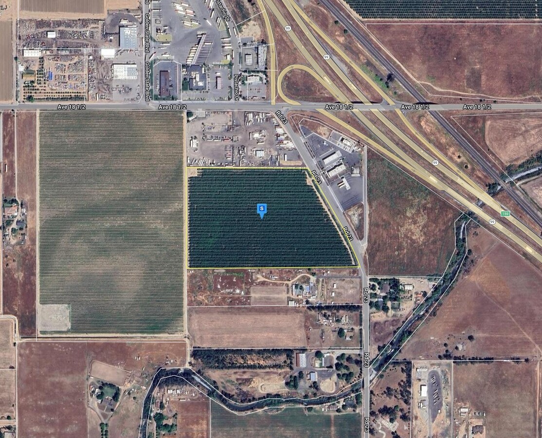
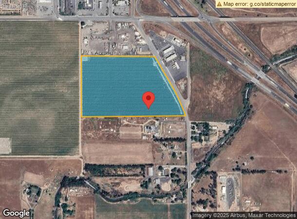
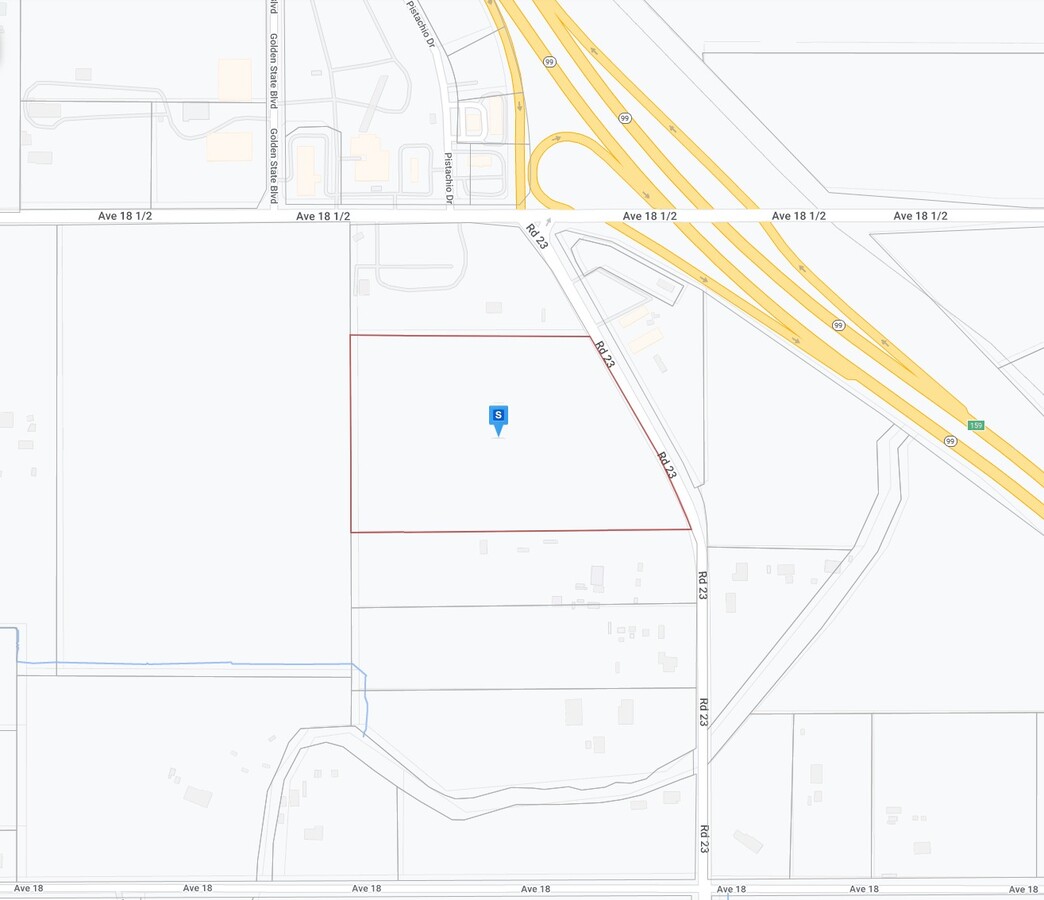
18338 Road 23, Madera, CA 93637
NEARBY LISTINGS FOR SALE OR LEASE
Property Detail
18338 Road 23
Madera, CA
Parcel Map No 526
029-260-036
MILLER & LUX SEC 32 10/17
Orchard
Madera
AO
California
06039C0900E
8
2023
20.70 AC
2023
Suburban Madera
000702
Fresno
DEMOGRAPHICS near 18338 Road 23
1 Mile
3 Mile
5 Mile
2024 Total Population
199
4,982
40,257
2029 Population
194
5,171
42,258
Pop Growth 2024-2029
(2.51%)
+ 3.79%
+ 4.97%
Average Age
37
37
36
2024 Total Households
56
1,269
10,986
HH Growth 2024-2029
(3.57%)
+ 3.47%
+ 4.66%
Median Household Inc
$56,999
$91,271
$64,785
Avg Household Size
3.30
3.50
3.50
2024 Avg HH Vehicles
3.00
3.00
2.00
Median Home Value
$865,384
$321,600
$323,200
Median Year Built
1961
1983
1987
Nearby Places
- Restaurants
- Banks
- Shops
- Fitness
- Groceries
PUBLIC TRANSPORTATION
COMMUTER RAIL
Madera Amtrak (San Joaquins - Amtrak)
DRIVE
WALK
Distance
Madera Amtrak (San Joaquins - Amtrak)
11 min
6.0 mi
AIRPORT
Fresno Yosemite International
DRIVE
WALK
Distance
Fresno Yosemite International
41 min
30.6 mi
Freight Ports
Port of Stockton
DRIVE
WALK
Distance
Port of Stockton
120 min
100.3 mi
SALE & LEASE HISTORY
LISTING DATE
SALE/LEASE

Aug 19, 2024
For Sale
Nearby Properties
Address
Land Use
TOTAL SIZE
Lot Size
Zoning
Address
Land Use
TOTAL SIZE
Lot Size
Zoning
144,050 SF
7.61 AC
Address
Land Use
TOTAL SIZE
Lot Size
Zoning
29,000 SF
37.32 AC
IL
Address
Land Use
TOTAL SIZE
Lot Size
Zoning
14,400 SF
181.61 AC
IL
Address
Land Use
TOTAL SIZE
Lot Size
Zoning
13.06 AC
Address
Land Use
TOTAL SIZE
Lot Size
Zoning
12.79 AC
Address
Land Use
TOTAL SIZE
Lot Size
Zoning
17,998 SF
11.24 AC
CRG
Address
Land Use
TOTAL SIZE
Lot Size
Zoning
1,104 SF
189.04 AC
ARE-40
Address
Land Use
TOTAL SIZE
Lot Size
Zoning
123,750 SF
15 AC
Address
Land Use
TOTAL SIZE
Lot Size
Zoning
8.29 AC
Address
Land Use
TOTAL SIZE
Lot Size
Zoning
27,500 SF
0.63 AC
Address
Land Use
TOTAL SIZE
Lot Size
Zoning
1,575 SF
40.68 AC
ARE-40
Address
Land Use
TOTAL SIZE
Lot Size
Zoning
2,018 SF
76.29 AC
ARE-40
Address
Land Use
TOTAL SIZE
Lot Size
Zoning
571.96 AC
ARE-40
Address
Land Use
TOTAL SIZE
Lot Size
Zoning
4,500 SF
3.35 AC
CRG
Address
Land Use
TOTAL SIZE
Lot Size
Zoning
19,250 SF
13.95 AC
IL
Address
Land Use
TOTAL SIZE
Lot Size
Zoning
13,725 SF
3.26 AC
Address
Land Use
TOTAL SIZE
Lot Size
Zoning
176.08 AC
Address
Land Use
TOTAL SIZE
Lot Size
Zoning
21,967 SF
1.36 AC
CRG
Address
Land Use
TOTAL SIZE
Lot Size
Zoning
12,800 SF
18 AC
ARE-20
Address
Land Use
TOTAL SIZE
Lot Size
Zoning
40,000 SF
9.81 AC
IL
Address
Land Use
TOTAL SIZE
Lot Size
Zoning
133.70 AC
ARE-40
Address
Land Use
TOTAL SIZE
Lot Size
Zoning
960 SF
79.10 AC
AR-5
Address
Land Use
TOTAL SIZE
Lot Size
Zoning
23,880 SF
3.77 AC
CRG
Address
Land Use
TOTAL SIZE
Lot Size
Zoning
1,492 SF
172.67 AC
ARE-40
Address
Land Use
TOTAL SIZE
Lot Size
Zoning
186.29 AC
IL
Address
Land Use
TOTAL SIZE
Lot Size
Zoning
1,248 SF
55.39 AC
ARE-20
Address
Land Use
TOTAL SIZE
Lot Size
Zoning
15.70 AC
AR-5
Address
Land Use
TOTAL SIZE
Lot Size
Zoning
1.50 AC
CRG
Address
Land Use
TOTAL SIZE
Lot Size
Zoning
11,096 SF
2.29 AC
The World's #1 Commercial Real Estate Marketplace
Connect with us
© 2025 CoStar Group
The information above has been obtained from sources believed reliable. While we do not doubt its accuracy we have not verified it and make no guarantee, warranty or representation about it. It is your responsibility to independently confirm its accuracy and completeness. Any projections, opinions, assumptions, or estimates used are for example only and do not represent the current or future performance of the property. The value of this transaction to you depends on tax and other factors which should be evaluated by your tax, financial, and legal advisors. You and your advisors should conduct a careful, independent investigation of the property to determine to your satisfaction the suitability of the property for your needs.