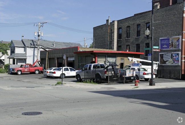
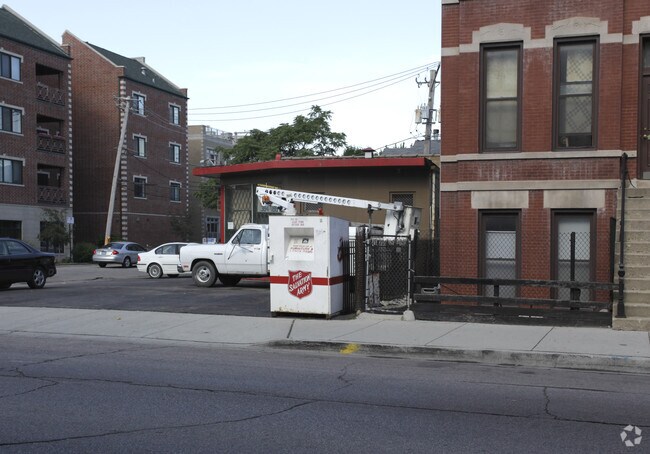
Property Record
1834 N Damen Ave, Chicago, IL 60647

NEARBY LISTINGS FOR SALE OR LEASE
Property Detail
1834 N Damen Ave
Chicago-Naperville-Elgin, IL-IN-WI
Pierces Add To Holstein
14-31-317-045-0000
(PIERCES) ADD TO (HOLSTEIN) IN NH SW SEC 31-40-14
Parkingstructure
Cook
X
Illinois
17031C0416J
33,32
2023
0.11 AC
2024
Northwest City
832200
Chicago
1,799 SF
DEMOGRAPHICS near 1834 N Damen Ave
1 Mile
3 Mile
5 Mile
2024 Total Population
55,332
563,950
1,161,843
2029 Population
53,452
544,538
1,115,371
Pop Growth 2024-2029
(3.40%)
(3.44%)
(4.00%)
Average Age
34
36
37
2024 Total Households
26,146
280,263
544,114
HH Growth 2024-2029
(3.73%)
(3.32%)
(3.76%)
Median Household Inc
$128,472
$103,308
$87,806
Avg Household Size
2.10
2.00
2.00
2024 Avg HH Vehicles
1.00
1.00
1.00
Median Home Value
$624,212
$524,456
$433,717
Median Year Built
1950
1965
1958
Nearby Places
Map Layers
Map Styles
 Street
 Aerial
- Restaurants
- Banks
- Shops
- Fitness
- Groceries
PUBLIC TRANSPORTATION
COMMUTER RAIL
Clybourn Station (Union Pacific North Line - Northeast Illinois Regional Commuter Railroad (Metra), Union Pacific Northwest Line - Northeast Illinois Regional Commuter Railroad (Metra))
DRIVE
WALK
Distance
Clybourn Station (Union Pacific North Line - Northeast Illinois Regional Commuter Railroad (Metra), Union Pacific Northwest Line - Northeast Illinois Regional Commuter Railroad (Metra))
2 min
13 min
0.7 mi
Western Avenue Station (MD-N/MD-W/NCS) (Milwaukee District North Line - Northeast Illinois Regional Commuter Railroad (Metra), Milwaukee District West Line - Northeast Illinois Regional Commuter Railroad (Metra), North Central Service - Northeast Illinois Regional Commuter Railroad (Metra))
DRIVE
WALK
Distance
Western Avenue Station (MD-N/MD-W/NCS) (Milwaukee District North Line - Northeast Illinois Regional Commuter Railroad (Metra), Milwaukee District West Line - Northeast Illinois Regional Commuter Railroad (Metra), North Central Service - Northeast Illinois Regional Commuter Railroad (Metra))
6 min
2.4 mi
AIRPORT
Chicago Midway International
DRIVE
WALK
Distance
Chicago Midway International
24 min
12.1 mi
Chicago O'Hare International
DRIVE
WALK
Distance
Chicago O'Hare International
46 min
17.3 mi
Nearby Properties
Address
Land Use
TOTAL SIZE
Lot Size
Zoning
Address
Land Use
TOTAL SIZE
Lot Size
Zoning
1,362,475 SF
1.97 AC
PD 1226
Address
Land Use
TOTAL SIZE
Lot Size
Zoning
1,396,750 SF
4.09 AC
PD 98
Address
Land Use
TOTAL SIZE
Lot Size
Zoning
0.82 AC
PD 1115
Address
Land Use
TOTAL SIZE
Lot Size
Zoning
0.88 AC
DC-16,PD 9
Address
Land Use
TOTAL SIZE
Lot Size
Zoning
1,888,207 SF
2.03 AC
PD 264
Address
Land Use
TOTAL SIZE
Lot Size
Zoning
4,296,046 SF
6.15 AC
DC-16
Address
Land Use
TOTAL SIZE
Lot Size
Zoning
3,914,400 SF
5.70 AC
DC-16
Address
Land Use
TOTAL SIZE
Lot Size
Zoning
831,084 SF
2.05 AC
PD 316
Address
Land Use
TOTAL SIZE
Lot Size
Zoning
1,502,279 SF
3.79 AC
PD 98
Address
Land Use
TOTAL SIZE
Lot Size
Zoning
1.09 AC
B1-3
Address
Land Use
TOTAL SIZE
Lot Size
Zoning
1,376,978 SF
0.59 AC
PD 1060
Address
Land Use
TOTAL SIZE
Lot Size
Zoning
959,129 SF
1.32 AC
DC-16
Address
Land Use
TOTAL SIZE
Lot Size
Zoning
559,589 SF
1.72 AC
C3-5
Address
Land Use
TOTAL SIZE
Lot Size
Zoning
0.72 AC
PD 1403
Address
Land Use
TOTAL SIZE
Lot Size
Zoning
1,857,394 SF
3.13 AC
PD 447
Address
Land Use
TOTAL SIZE
Lot Size
Zoning
491,382 SF
2.05 AC
PD 316
Address
Land Use
TOTAL SIZE
Lot Size
Zoning
1,284,706 SF
4.40 AC
Address
Land Use
TOTAL SIZE
Lot Size
Zoning
835,475 SF
0.58 AC
PD 486
Address
Land Use
TOTAL SIZE
Lot Size
Zoning
1.44 AC
PD 30
Address
Land Use
TOTAL SIZE
Lot Size
Zoning
948,900 SF
0.74 AC
DC-16
Address
Land Use
TOTAL SIZE
Lot Size
Zoning
73,700 SF
0.48 AC
RM-6.5
Address
Land Use
TOTAL SIZE
Lot Size
Zoning
0.47 AC
PD 779
Address
Land Use
TOTAL SIZE
Lot Size
Zoning
1,587,810 SF
0.33 AC
PD 996,DC-
Address
Land Use
TOTAL SIZE
Lot Size
Zoning
1,232,426 SF
0.42 AC
PD 779
Address
Land Use
TOTAL SIZE
Lot Size
Zoning
781,284 SF
4.09 AC
PD 98
Address
Land Use
TOTAL SIZE
Lot Size
Zoning
0.34 AC
PD 1060
Address
Land Use
TOTAL SIZE
Lot Size
Zoning
737,500 SF
0.67 AC
PD 431
Address
Land Use
TOTAL SIZE
Lot Size
Zoning
1,061,587 SF
0.56 AC
PD 431
Address
Land Use
TOTAL SIZE
Lot Size
Zoning
228,018 SF
8.72 AC
PD 958
Address
Land Use
TOTAL SIZE
Lot Size
Zoning
117,600 SF
2.14 AC
PD 233
The World's #1 Commercial Real Estate Marketplace
Connect with us
© 2025 CoStar Group
The information above has been obtained from sources believed reliable. While we do not doubt its accuracy we have not verified it and make no guarantee, warranty or representation about it. It is your responsibility to independently confirm its accuracy and completeness. Any projections, opinions, assumptions, or estimates used are for example only and do not represent the current or future performance of the property. The value of this transaction to you depends on tax and other factors which should be evaluated by your tax, financial, and legal advisors. You and your advisors should conduct a careful, independent investigation of the property to determine to your satisfaction the suitability of the property for your needs.