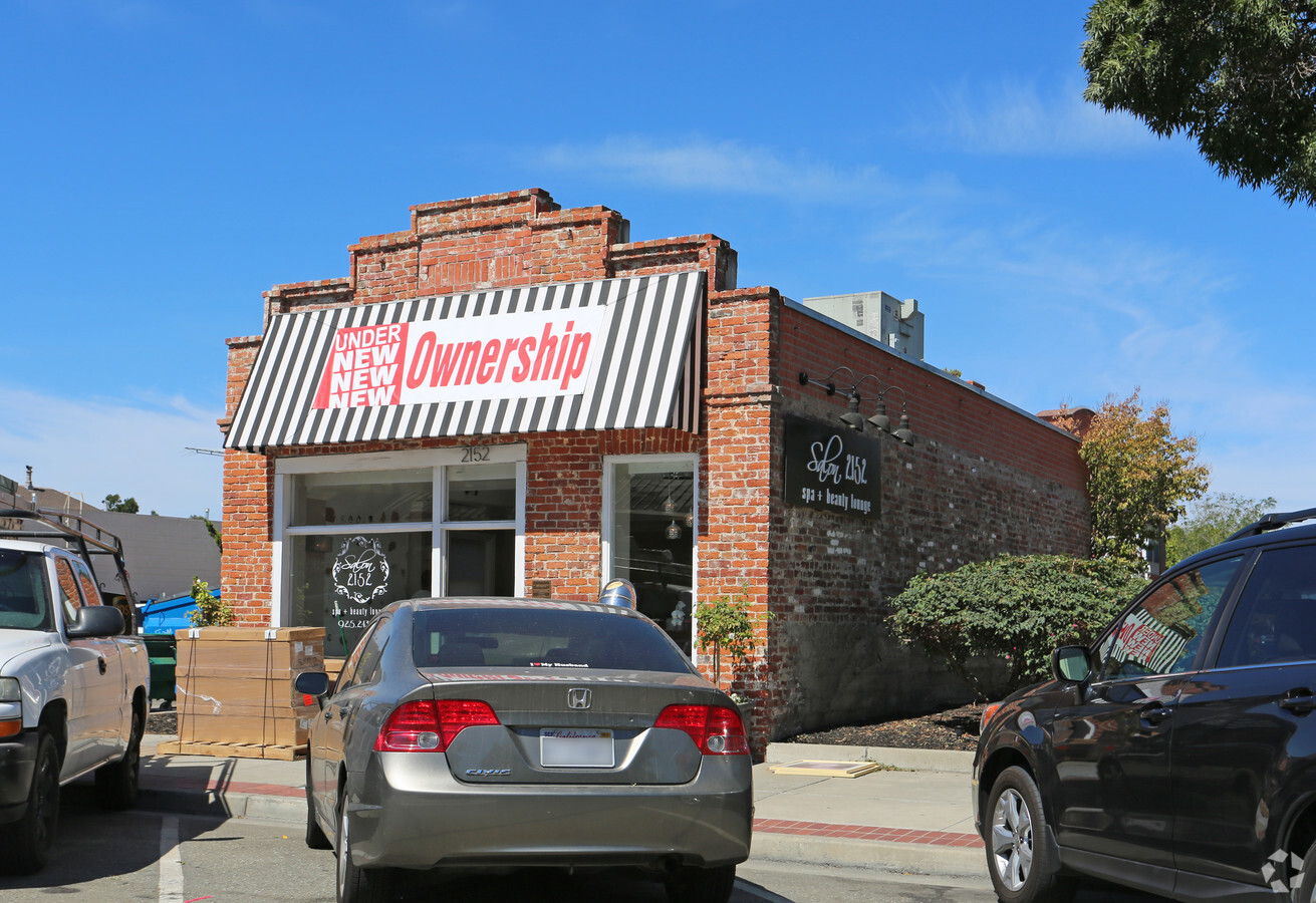
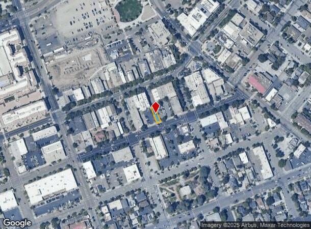
Property Record
2152 2Nd St, Livermore, CA 94550

NEARBY LISTINGS FOR SALE OR LEASE
Property Detail
2152 2Nd St
Oakland-Hayward-Berkeley, CA
Livermore
097-0014-005-02
LOT: 00002 BLK: 0005 AR: 0097 PAGE: 0014
Storebuilding
Alameda
X
California
06001C0342G
9
2024
0.06 AC
2024
Livermore
451601
East Bay/Oakland
800 SF
DEMOGRAPHICS near 2152 2Nd St
1 Mile
3 Mile
5 Mile
2024 Total Population
20,490
74,189
100,360
2029 Population
19,862
71,679
96,928
Pop Growth 2024-2029
(3.06%)
(3.38%)
(3.42%)
Average Age
42
42
42
2024 Total Households
7,768
26,777
35,489
HH Growth 2024-2029
(3.18%)
(3.56%)
(3.62%)
Median Household Inc
$108,125
$139,767
$152,864
Avg Household Size
2.50
2.70
2.80
2024 Avg HH Vehicles
2.00
2.00
2.00
Median Home Value
$823,880
$915,597
$962,992
Median Year Built
1973
1977
1982
Nearby Places
- Restaurants
- Banks
- Shops
- Fitness
- Groceries
PUBLIC TRANSPORTATION
COMMUTER RAIL
Livermore (Altamont Corridor Express - Altamont Commuter Express (ACE))
DRIVE
WALK
Distance
Livermore (Altamont Corridor Express - Altamont Commuter Express (ACE))
2 min
7 min
0.4 mi
Vasco (Altamont Corridor Express - Altamont Commuter Express (ACE))
DRIVE
WALK
Distance
Vasco (Altamont Corridor Express - Altamont Commuter Express (ACE))
8 min
4.0 mi
AIRPORT
Metro Oakland International
DRIVE
WALK
Distance
Metro Oakland International
37 min
28.5 mi
Norman Y Mineta San Jose International
DRIVE
WALK
Distance
Norman Y Mineta San Jose International
43 min
30.5 mi
Freight Ports
Port of Redwood City
DRIVE
WALK
Distance
Port of Redwood City
55 min
37.4 mi
Nearby Properties
Address
Land Use
TOTAL SIZE
Lot Size
Zoning
Address
Land Use
TOTAL SIZE
Lot Size
Zoning
635,533 SF
32.55 AC
Address
Land Use
TOTAL SIZE
Lot Size
Zoning
646,841 SF
38.83 AC
Address
Land Use
TOTAL SIZE
Lot Size
Zoning
25,866 SF
4.04 AC
Address
Land Use
TOTAL SIZE
Lot Size
Zoning
367,734 SF
18.81 AC
Address
Land Use
TOTAL SIZE
Lot Size
Zoning
372,220 SF
19.11 AC
Address
Land Use
TOTAL SIZE
Lot Size
Zoning
294,940 SF
16.54 AC
Address
Land Use
TOTAL SIZE
Lot Size
Zoning
183,774 SF
15.21 AC
Address
Land Use
TOTAL SIZE
Lot Size
Zoning
178,938 SF
7 AC
Address
Land Use
TOTAL SIZE
Lot Size
Zoning
144,058 SF
11.52 AC
Address
Land Use
TOTAL SIZE
Lot Size
Zoning
116,167 SF
11.53 AC
Address
Land Use
TOTAL SIZE
Lot Size
Zoning
94,332 SF
8.89 AC
Address
Land Use
TOTAL SIZE
Lot Size
Zoning
75,236 SF
6.42 AC
Address
Land Use
TOTAL SIZE
Lot Size
Zoning
83,821 SF
5.20 AC
Address
Land Use
TOTAL SIZE
Lot Size
Zoning
88,789 SF
5.63 AC
Address
Land Use
TOTAL SIZE
Lot Size
Zoning
178,145 SF
15.32 AC
Address
Land Use
TOTAL SIZE
Lot Size
Zoning
166,692 SF
8.24 AC
Address
Land Use
TOTAL SIZE
Lot Size
Zoning
99,280 SF
6.11 AC
Address
Land Use
TOTAL SIZE
Lot Size
Zoning
105,596 SF
7.89 AC
Address
Land Use
TOTAL SIZE
Lot Size
Zoning
70,472 SF
7.13 AC
Address
Land Use
TOTAL SIZE
Lot Size
Zoning
121,735 SF
7.03 AC
Address
Land Use
TOTAL SIZE
Lot Size
Zoning
135,039 SF
13.45 AC
Address
Land Use
TOTAL SIZE
Lot Size
Zoning
244,337 SF
8.27 AC
Address
Land Use
TOTAL SIZE
Lot Size
Zoning
157,610 SF
12.84 AC
Address
Land Use
TOTAL SIZE
Lot Size
Zoning
88,633 SF
9.54 AC
Address
Land Use
TOTAL SIZE
Lot Size
Zoning
51,178 SF
2.09 AC
CO
Address
Land Use
TOTAL SIZE
Lot Size
Zoning
Address
Land Use
TOTAL SIZE
Lot Size
Zoning
119,184 SF
13.19 AC
Address
Land Use
TOTAL SIZE
Lot Size
Zoning
14.06 AC
Address
Land Use
TOTAL SIZE
Lot Size
Zoning
124,735 SF
8.14 AC
Address
Land Use
TOTAL SIZE
Lot Size
Zoning
The World's #1 Commercial Real Estate Marketplace
Connect with us
© 2025 CoStar Group
The information above has been obtained from sources believed reliable. While we do not doubt its accuracy we have not verified it and make no guarantee, warranty or representation about it. It is your responsibility to independently confirm its accuracy and completeness. Any projections, opinions, assumptions, or estimates used are for example only and do not represent the current or future performance of the property. The value of this transaction to you depends on tax and other factors which should be evaluated by your tax, financial, and legal advisors. You and your advisors should conduct a careful, independent investigation of the property to determine to your satisfaction the suitability of the property for your needs.