Property Record
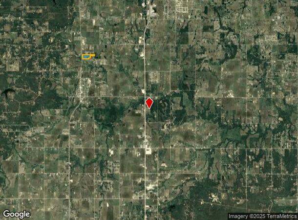
18486 S 49Th West Ave W, Mounds, OK 74047
NEARBY LISTINGS FOR SALE OR LEASE
-
-
View all Mounds listings for sale on LoopNet.com
Property Detail
18486 S 49Th West Ave W
Tulsa, OK
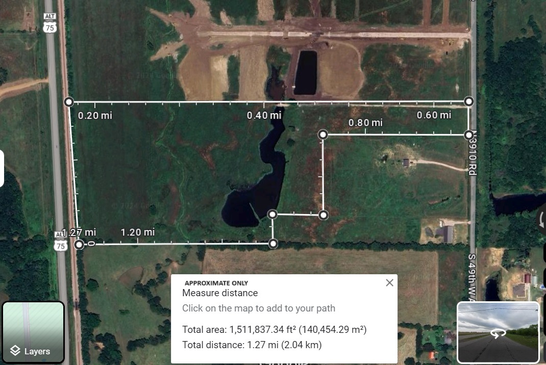
05-16N-12E A CORNER IN NE/4 BEGINNING AT NE/C THEN S01?12'45"E A DISTANCE OF 1971.72 FT AS POB THEN S01?12'45"E A DISTANCE OF
0000-05-016-012-0-027-00
Creek
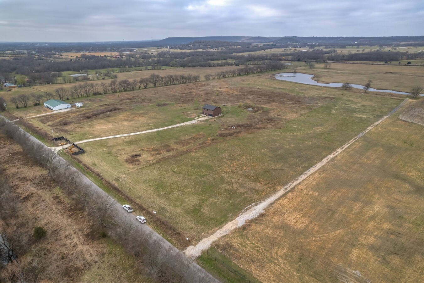
Agriculturalland
Oklahoma
2024
34.27 AC
2024
Creek County
007703
Tulsa
DEMOGRAPHICS near 18486 S 49Th West Ave W
1 Mile
3 Mile
5 Mile
2024 Total Population
204
2,462
12,710
2029 Population
203
2,474
12,967
Pop Growth 2024-2029
(0.49%)
+ 0.49%
+ 2.02%
Average Age
40
39
38
2024 Total Households
74
883
4,510
HH Growth 2024-2029
(1.35%)
+ 0.45%
+ 2.00%
Median Household Inc
$49,999
$63,643
$71,608
Avg Household Size
2.80
2.80
2.80
2024 Avg HH Vehicles
2.00
2.00
2.00
Median Home Value
$192,499
$213,089
$203,835
Median Year Built
1992
1992
1993
Nearby Places
- Restaurants
- Banks
- Shops
- Fitness
- Groceries
PUBLIC TRANSPORTATION
AIRPORT
Tulsa International
DRIVE
WALK
Distance
Tulsa International
40 min
29.8 mi
Freight Ports
Tulsa Port Of Catoosa
DRIVE
WALK
Distance
Tulsa Port Of Catoosa
48 min
38.5 mi
SALE & LEASE HISTORY
LISTING DATE
SALE/LEASE

Mar 18, 2024
For Sale
Nearby Properties
Address
Land Use
TOTAL SIZE
Lot Size
Zoning
Address
Land Use
TOTAL SIZE
Lot Size
Zoning
18,078 SF
14.73 AC
IL
Address
Land Use
TOTAL SIZE
Lot Size
Zoning
83,598 SF
19.93 AC
IL
Address
Land Use
TOTAL SIZE
Lot Size
Zoning
2,176 SF
0.41 AC
Address
Land Use
TOTAL SIZE
Lot Size
Zoning
600 SF
19.60 AC
AG
Address
Land Use
TOTAL SIZE
Lot Size
Zoning
5,100 SF
0.87 AC
Address
Land Use
TOTAL SIZE
Lot Size
Zoning
7,500 SF
13.03 AC
AG
Address
Land Use
TOTAL SIZE
Lot Size
Zoning
54,200 SF
9.04 AC
AG
Address
Land Use
TOTAL SIZE
Lot Size
Zoning
3,812 SF
1.01 AC
AG
Address
Land Use
TOTAL SIZE
Lot Size
Zoning
23,752 SF
8.56 AC
AG
Address
Land Use
TOTAL SIZE
Lot Size
Zoning
1,600 SF
0.34 AC
Address
Land Use
TOTAL SIZE
Lot Size
Zoning
24,000 SF
9.26 AC
CN
Address
Land Use
TOTAL SIZE
Lot Size
Zoning
9,020 SF
0.96 AC
C1
Address
Land Use
TOTAL SIZE
Lot Size
Zoning
7,838 SF
144.07 AC
AG
Address
Land Use
TOTAL SIZE
Lot Size
Zoning
96 SF
6.12 AC
Address
Land Use
TOTAL SIZE
Lot Size
Zoning
4,800 SF
9.26 AC
Address
Land Use
TOTAL SIZE
Lot Size
Zoning
480 SF
37.12 AC
NP
Address
Land Use
TOTAL SIZE
Lot Size
Zoning
3,600 SF
6.63 AC
Address
Land Use
TOTAL SIZE
Lot Size
Zoning
14.47 AC
Address
Land Use
TOTAL SIZE
Lot Size
Zoning
49.99 AC
Address
Land Use
TOTAL SIZE
Lot Size
Zoning
3,060 SF
1.61 AC
Address
Land Use
TOTAL SIZE
Lot Size
Zoning
1,025 SF
0.16 AC
Address
Land Use
TOTAL SIZE
Lot Size
Zoning
30 AC
IP
Address
Land Use
TOTAL SIZE
Lot Size
Zoning
19.07 AC
IP
Address
Land Use
TOTAL SIZE
Lot Size
Zoning
19.60 AC
NP
Address
Land Use
TOTAL SIZE
Lot Size
Zoning
3,500 SF
1.34 AC
CS
Address
Land Use
TOTAL SIZE
Lot Size
Zoning
1.24 AC
AG
Address
Land Use
TOTAL SIZE
Lot Size
Zoning
4,080 SF
45.95 AC
TM
Address
Land Use
TOTAL SIZE
Lot Size
Zoning
3,280 SF
0.32 AC
Address
Land Use
TOTAL SIZE
Lot Size
Zoning
5,204 SF
1.70 AC
The World's #1 Commercial Real Estate Marketplace
Connect with us
© 2025 CoStar Group
The information above has been obtained from sources believed reliable. While we do not doubt its accuracy we have not verified it and make no guarantee, warranty or representation about it. It is your responsibility to independently confirm its accuracy and completeness. Any projections, opinions, assumptions, or estimates used are for example only and do not represent the current or future performance of the property. The value of this transaction to you depends on tax and other factors which should be evaluated by your tax, financial, and legal advisors. You and your advisors should conduct a careful, independent investigation of the property to determine to your satisfaction the suitability of the property for your needs.