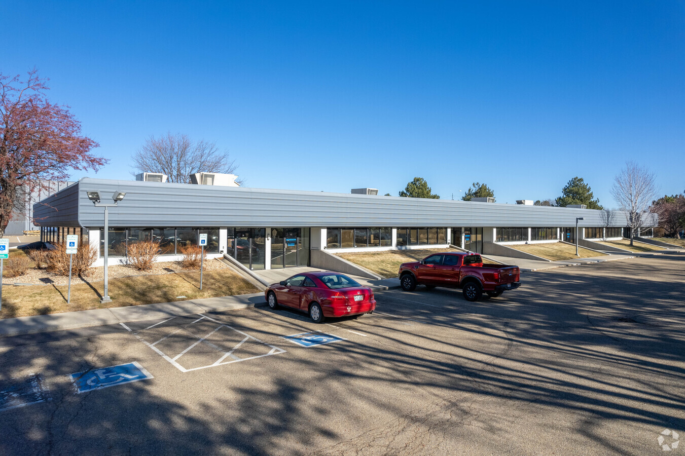
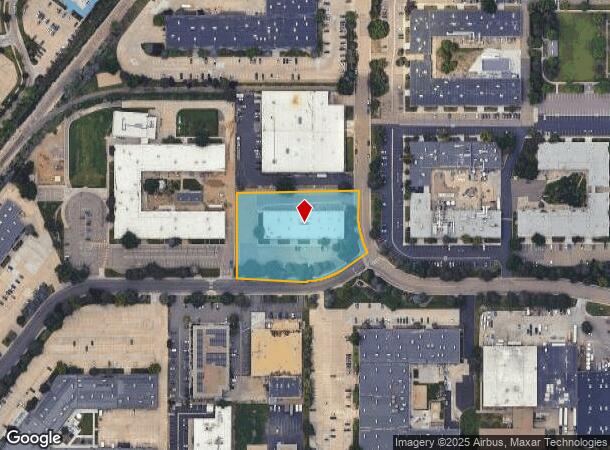
Property Record
1860 Lefthand Cir, Longmont, CO 80501


Current Lease Availabilities
NEARBY LISTINGS FOR SALE OR LEASE
Property Detail
1860 Lefthand Cir
Boulder, CO
Longs Peak Indust Pk Minor Sub B Lg
1315162-01-003
LOT 3 LONGS PEAK INDUSTRIAL PARK MINOR SUB B
Industrialgeneral
Boulder
X
Colorado
08013C0269K
3
2023
2.17 AC
2024
Longmont
013210
Denver
20,400 SF
DEMOGRAPHICS near 1860 Lefthand Cir
1 Mile
3 Mile
5 Mile
2024 Total Population
7,306
47,827
105,482
2029 Population
7,399
47,688
105,220
Pop Growth 2024-2029
+ 1.27%
(0.29%)
(0.25%)
Average Age
40
40
41
2024 Total Households
2,829
19,296
42,030
HH Growth 2024-2029
+ 1.45%
(0.33%)
(0.31%)
Median Household Inc
$89,372
$87,315
$87,927
Avg Household Size
2.40
2.40
2.40
2024 Avg HH Vehicles
2.00
2.00
2.00
Median Home Value
$466,384
$517,229
$480,245
Median Year Built
1994
1990
1988
Nearby Places
- Restaurants
- Banks
- Shops
- Fitness
- Groceries
Nearby Properties
Address
Land Use
TOTAL SIZE
Lot Size
Zoning
Address
Land Use
TOTAL SIZE
Lot Size
Zoning
556,104 SF
44.13 AC
Address
Land Use
TOTAL SIZE
Lot Size
Zoning
304,151 SF
45.04 AC
Address
Land Use
TOTAL SIZE
Lot Size
Zoning
540,109 SF
40.51 AC
Address
Land Use
TOTAL SIZE
Lot Size
Zoning
750,908 SF
64.12 AC
Address
Land Use
TOTAL SIZE
Lot Size
Zoning
621 SF
118.25 AC
A
Address
Land Use
TOTAL SIZE
Lot Size
Zoning
167,821 SF
14.26 AC
Address
Land Use
TOTAL SIZE
Lot Size
Zoning
38.30 AC
Address
Land Use
TOTAL SIZE
Lot Size
Zoning
152,160 SF
9.02 AC
Address
Land Use
TOTAL SIZE
Lot Size
Zoning
146,153 SF
13.60 AC
Address
Land Use
TOTAL SIZE
Lot Size
Zoning
197,659 SF
34.12 AC
Address
Land Use
TOTAL SIZE
Lot Size
Zoning
123,520 SF
11.06 AC
Address
Land Use
TOTAL SIZE
Lot Size
Zoning
133,569 SF
14.67 AC
Address
Land Use
TOTAL SIZE
Lot Size
Zoning
277,321 SF
14.96 AC
Address
Land Use
TOTAL SIZE
Lot Size
Zoning
339,682 SF
11.81 AC
Address
Land Use
TOTAL SIZE
Lot Size
Zoning
147.27 AC
A
Address
Land Use
TOTAL SIZE
Lot Size
Zoning
1,092 SF
150.73 AC
A
Address
Land Use
TOTAL SIZE
Lot Size
Zoning
126,408 SF
9.11 AC
Address
Land Use
TOTAL SIZE
Lot Size
Zoning
90,000 SF
8.38 AC
Address
Land Use
TOTAL SIZE
Lot Size
Zoning
152,160 SF
10.48 AC
Address
Land Use
TOTAL SIZE
Lot Size
Zoning
73.36 AC
A
Address
Land Use
TOTAL SIZE
Lot Size
Zoning
465,094 SF
23.57 AC
Address
Land Use
TOTAL SIZE
Lot Size
Zoning
122,698 SF
19.89 AC
Address
Land Use
TOTAL SIZE
Lot Size
Zoning
267,724 SF
5.85 AC
Address
Land Use
TOTAL SIZE
Lot Size
Zoning
271,536 SF
13.28 AC
Address
Land Use
TOTAL SIZE
Lot Size
Zoning
135,601 SF
17.30 AC
Address
Land Use
TOTAL SIZE
Lot Size
Zoning
146.34 AC
A
Address
Land Use
TOTAL SIZE
Lot Size
Zoning
140.16 AC
A
Address
Land Use
TOTAL SIZE
Lot Size
Zoning
56,673 SF
35.16 AC
A
Address
Land Use
TOTAL SIZE
Lot Size
Zoning
34.29 AC
A
Address
Land Use
TOTAL SIZE
Lot Size
Zoning
75.02 AC
A
The World's #1 Commercial Real Estate Marketplace
Connect with us
© 2025 CoStar Group
The information above has been obtained from sources believed reliable. While we do not doubt its accuracy we have not verified it and make no guarantee, warranty or representation about it. It is your responsibility to independently confirm its accuracy and completeness. Any projections, opinions, assumptions, or estimates used are for example only and do not represent the current or future performance of the property. The value of this transaction to you depends on tax and other factors which should be evaluated by your tax, financial, and legal advisors. You and your advisors should conduct a careful, independent investigation of the property to determine to your satisfaction the suitability of the property for your needs.