Property Record
18610 Wedge Pkwy, Reno, NV 89511
NEARBY LISTINGS FOR SALE OR LEASE
Property Detail
18610 Wedge Pkwy
Reno, NV
_Unspecified
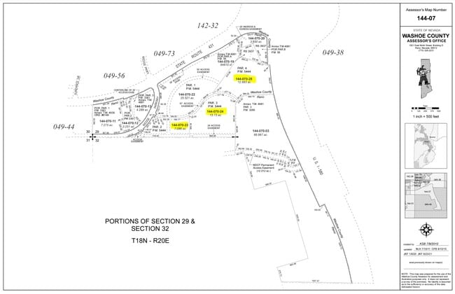
144-070-25
ROS 6449 PAR 3-A
Commercialacreage
Washoe
X
Nevada
32031C3245G
par. 3
2025
12.89 AC
2026
S Outlying Washoe County
003203
Reno/Sparks
DEMOGRAPHICS near 18610 Wedge Pkwy
1 Mile
3 Mile
5 Mile
2024 Total Population
2,690
33,584
70,497
2029 Population
2,851
35,917
75,084
Pop Growth 2024-2029
+ 5.99%
+ 6.95%
+ 6.51%
Average Age
45
43
43
2024 Total Households
1,084
13,455
28,376
HH Growth 2024-2029
+ 6.09%
+ 7.03%
+ 6.65%
Median Household Inc
$136,458
$116,621
$115,084
Avg Household Size
2.50
2.50
2.40
2024 Avg HH Vehicles
2.00
2.00
2.00
Median Home Value
$707,894
$671,601
$672,170
Median Year Built
2001
2003
2003
Nearby Places
Map Layers
Map Styles
 Street
 Aerial
- Restaurants
- Banks
- Shops
- Fitness
- Groceries
PUBLIC TRANSPORTATION
AIRPORT
Reno/Tahoe International
DRIVE
WALK
Distance
Reno/Tahoe International
34 min
13.3 mi
Freight Ports
Port of Stockton
DRIVE
WALK
Distance
Port of Stockton
225 min
192.6 mi
Nearby Properties
Address
Land Use
TOTAL SIZE
Lot Size
Zoning
Address
Land Use
TOTAL SIZE
Lot Size
Zoning
271,546 SF
20.62 AC
PD
Address
Land Use
TOTAL SIZE
Lot Size
Zoning
476,624 SF
19.33 AC
PD
Address
Land Use
TOTAL SIZE
Lot Size
Zoning
418,177 SF
16.59 AC
MS
Address
Land Use
TOTAL SIZE
Lot Size
Zoning
430,526 SF
14.79 AC
MS
Address
Land Use
TOTAL SIZE
Lot Size
Zoning
191,762 SF
51.49 AC
LDS
Address
Land Use
TOTAL SIZE
Lot Size
Zoning
410,834 SF
11.58 AC
MS
Address
Land Use
TOTAL SIZE
Lot Size
Zoning
308,769 SF
17.53 AC
PD
Address
Land Use
TOTAL SIZE
Lot Size
Zoning
389,745 SF
15.17 AC
MS
Address
Land Use
TOTAL SIZE
Lot Size
Zoning
181,150 SF
27.71 AC
PD
Address
Land Use
TOTAL SIZE
Lot Size
Zoning
379,347 SF
18.42 AC
MS
Address
Land Use
TOTAL SIZE
Lot Size
Zoning
327,867 SF
12.11 AC
PD
Address
Land Use
TOTAL SIZE
Lot Size
Zoning
476,624 SF
19.50 AC
PD
Address
Land Use
TOTAL SIZE
Lot Size
Zoning
257,652 SF
23.36 AC
MS
Address
Land Use
TOTAL SIZE
Lot Size
Zoning
310,004 SF
11.77 AC
PD
Address
Land Use
TOTAL SIZE
Lot Size
Zoning
283,103 SF
10.02 AC
PD
Address
Land Use
TOTAL SIZE
Lot Size
Zoning
296,169 SF
15.33 AC
MS
Address
Land Use
TOTAL SIZE
Lot Size
Zoning
392,820 SF
24.82 AC
MS
Address
Land Use
TOTAL SIZE
Lot Size
Zoning
151,254 SF
48.11 AC
MDS
Address
Land Use
TOTAL SIZE
Lot Size
Zoning
389,667 SF
19.52 AC
MS
Address
Land Use
TOTAL SIZE
Lot Size
Zoning
240,094 SF
8.16 AC
MS
Address
Land Use
TOTAL SIZE
Lot Size
Zoning
209,359 SF
10.98 AC
PD
Address
Land Use
TOTAL SIZE
Lot Size
Zoning
601,250 SF
27.39 AC
MS
Address
Land Use
TOTAL SIZE
Lot Size
Zoning
212,660 SF
5.21 AC
MS
Address
Land Use
TOTAL SIZE
Lot Size
Zoning
110,100 SF
22.88 AC
MS
Address
Land Use
TOTAL SIZE
Lot Size
Zoning
284,689 SF
10.63 AC
MS
Address
Land Use
TOTAL SIZE
Lot Size
Zoning
167,612 SF
7.88 AC
PD
Address
Land Use
TOTAL SIZE
Lot Size
Zoning
225,634 SF
66.85 AC
PSP
Address
Land Use
TOTAL SIZE
Lot Size
Zoning
25.52 AC
MS
Address
Land Use
TOTAL SIZE
Lot Size
Zoning
47,743 SF
7.27 AC
MS
Address
Land Use
TOTAL SIZE
Lot Size
Zoning
53,394 SF
13.83 AC
MS
The World's #1 Commercial Real Estate Marketplace
Connect with us
© 2025 CoStar Group
The information above has been obtained from sources believed reliable. While we do not doubt its accuracy we have not verified it and make no guarantee, warranty or representation about it. It is your responsibility to independently confirm its accuracy and completeness. Any projections, opinions, assumptions, or estimates used are for example only and do not represent the current or future performance of the property. The value of this transaction to you depends on tax and other factors which should be evaluated by your tax, financial, and legal advisors. You and your advisors should conduct a careful, independent investigation of the property to determine to your satisfaction the suitability of the property for your needs.