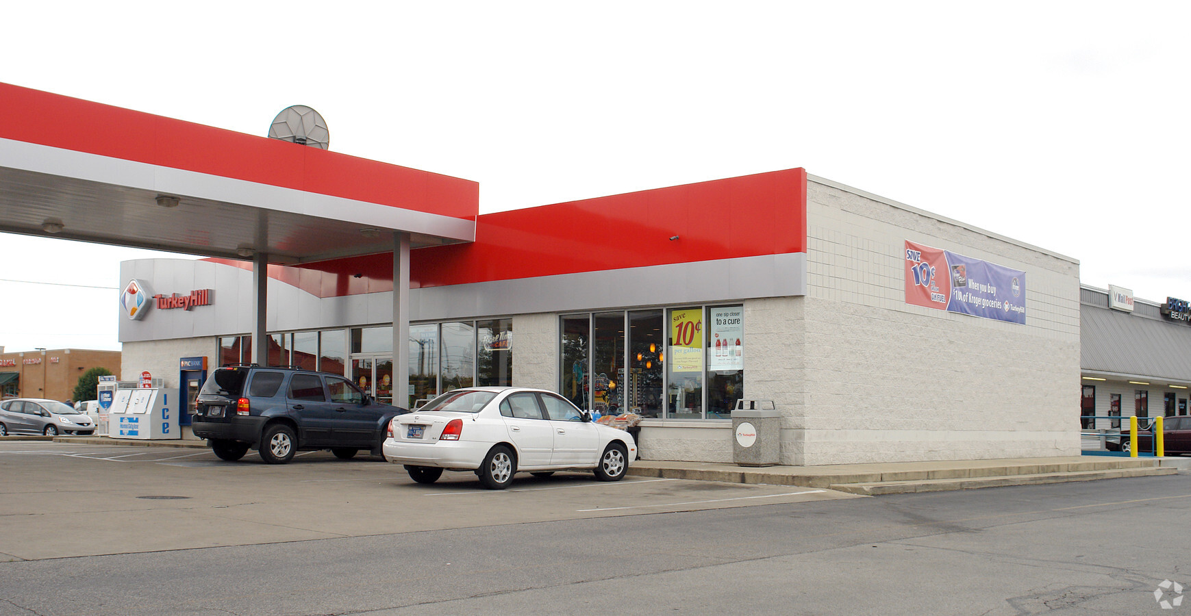
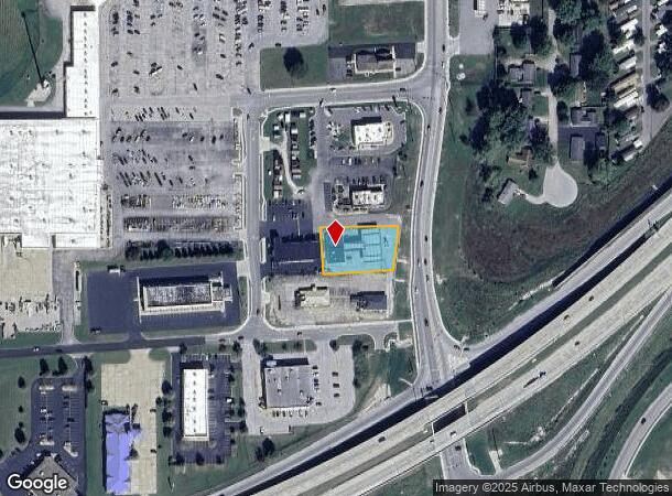
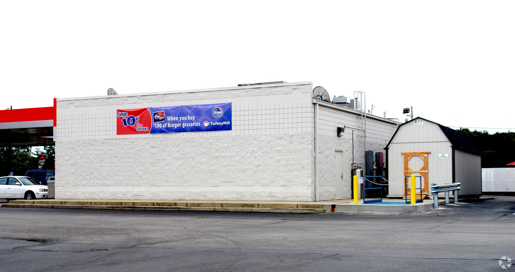
Property Record
1863 S Bobby Helm Blvd, Martinsville, IN 46151
NEARBY LISTINGS FOR SALE OR LEASE
Property Detail
1863 S Bobby Helm Blvd
55-13-09-215-010.001-021
S9 T11 R1E W NE .529 AC
Conveniencestore
Morgan
A
Indiana
18109C0266F
0.53 AC
2023
Morgan County
2024
Indianapolis
510701
Indianapolis-Carmel-Anderson, IN
3,520 SF
DEMOGRAPHICS near 1863 S Bobby Helm Blvd
1 Mile
3 Mile
5 Mile
2024 Total Population
6,226
14,560
20,596
2029 Population
6,325
14,846
20,992
Pop Growth 2024-2029
+ 1.59%
+ 1.96%
+ 1.92%
Average Age
40
41
41
2024 Total Households
2,561
5,933
8,227
HH Growth 2024-2029
+ 1.60%
+ 1.99%
+ 1.92%
Median Household Inc
$49,772
$54,932
$61,046
Avg Household Size
2.30
2.30
2.40
2024 Avg HH Vehicles
2.00
2.00
2.00
Median Home Value
$111,866
$142,453
$173,463
Median Year Built
1966
1966
1972
Nearby Places
- Restaurants
- Banks
- Shops
- Fitness
- Groceries
PUBLIC TRANSPORTATION
AIRPORT
Indianapolis International
DRIVE
WALK
Distance
Indianapolis International
42 min
27.4 mi
Freight Ports
Port of Toledo
DRIVE
WALK
Distance
Port of Toledo
312 min
259.8 mi
Nearby Properties
Address
Land Use
TOTAL SIZE
Lot Size
Zoning
Address
Land Use
TOTAL SIZE
Lot Size
Zoning
165,182 SF
11.70 AC
Address
Land Use
TOTAL SIZE
Lot Size
Zoning
59,126 SF
6.78 AC
Address
Land Use
TOTAL SIZE
Lot Size
Zoning
35,704 SF
9.26 AC
Address
Land Use
TOTAL SIZE
Lot Size
Zoning
86,173 SF
7.59 AC
Address
Land Use
TOTAL SIZE
Lot Size
Zoning
203,634 SF
26.06 AC
Address
Land Use
TOTAL SIZE
Lot Size
Zoning
16,270 SF
7.10 AC
Address
Land Use
TOTAL SIZE
Lot Size
Zoning
44,380 SF
8 AC
Address
Land Use
TOTAL SIZE
Lot Size
Zoning
20,600 SF
13.83 AC
Address
Land Use
TOTAL SIZE
Lot Size
Zoning
41,364 SF
1.82 AC
Address
Land Use
TOTAL SIZE
Lot Size
Zoning
197,739 SF
16.55 AC
Address
Land Use
TOTAL SIZE
Lot Size
Zoning
Address
Land Use
TOTAL SIZE
Lot Size
Zoning
10,650 SF
5.70 AC
Address
Land Use
TOTAL SIZE
Lot Size
Zoning
14,476 SF
2.13 AC
Address
Land Use
TOTAL SIZE
Lot Size
Zoning
Address
Land Use
TOTAL SIZE
Lot Size
Zoning
30,060 SF
5.85 AC
Address
Land Use
TOTAL SIZE
Lot Size
Zoning
34,309 SF
3.39 AC
Address
Land Use
TOTAL SIZE
Lot Size
Zoning
11,272 SF
3.30 AC
Address
Land Use
TOTAL SIZE
Lot Size
Zoning
25,004 SF
0.67 AC
Address
Land Use
TOTAL SIZE
Lot Size
Zoning
3,672 SF
8.10 AC
Address
Land Use
TOTAL SIZE
Lot Size
Zoning
Address
Land Use
TOTAL SIZE
Lot Size
Zoning
9,603 SF
1.83 AC
Address
Land Use
TOTAL SIZE
Lot Size
Zoning
17,545 SF
5.25 AC
Address
Land Use
TOTAL SIZE
Lot Size
Zoning
Address
Land Use
TOTAL SIZE
Lot Size
Zoning
12,119 SF
1.49 AC
Address
Land Use
TOTAL SIZE
Lot Size
Zoning
23,483 SF
6.57 AC
Address
Land Use
TOTAL SIZE
Lot Size
Zoning
42,133 SF
1.10 AC
Address
Land Use
TOTAL SIZE
Lot Size
Zoning
12,237 SF
2.78 AC
Address
Land Use
TOTAL SIZE
Lot Size
Zoning
0.87 AC
Address
Land Use
TOTAL SIZE
Lot Size
Zoning
28,700 SF
2.94 AC
Address
Land Use
TOTAL SIZE
Lot Size
Zoning
7,920 SF
2.11 AC
The World's #1 Commercial Real Estate Marketplace
Connect with us
© 2025 CoStar Group
The information above has been obtained from sources believed reliable. While we do not doubt its accuracy we have not verified it and make no guarantee, warranty or representation about it. It is your responsibility to independently confirm its accuracy and completeness. Any projections, opinions, assumptions, or estimates used are for example only and do not represent the current or future performance of the property. The value of this transaction to you depends on tax and other factors which should be evaluated by your tax, financial, and legal advisors. You and your advisors should conduct a careful, independent investigation of the property to determine to your satisfaction the suitability of the property for your needs.