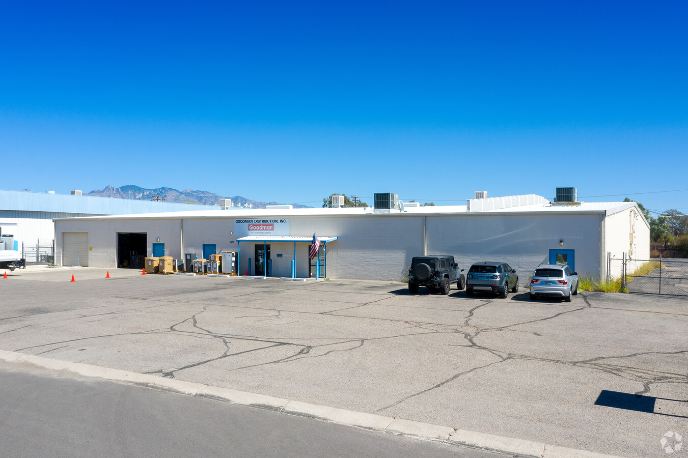
Property Record
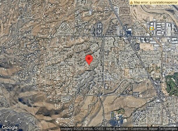
1866 W Grant Rd, Tucson, AZ 85745
NEARBY LISTINGS FOR SALE OR LEASE
Property Detail
1866 W Grant Rd
107-03-1860
E285 W568 M/L N195 S852.57 M/L SE4 SW4 1.28 AC SEC 34-13-13
Warehouse
Pima
X
Arizona
04019C1669L
37
2021
1.28 AC
2024
NW Tucson/Oro Valley
004413
Tucson
18,000 SF
Tucson, AZ
DEMOGRAPHICS near 1866 W Grant Rd
1 Mile
3 Mile
5 Mile
2024 Total Population
9,435
88,055
205,964
2029 Population
9,951
91,642
213,533
Pop Growth 2024-2029
+ 5.47%
+ 4.07%
+ 3.67%
Average Age
37
38
38
2024 Total Households
3,840
39,693
91,832
HH Growth 2024-2029
+ 5.52%
+ 4.15%
+ 3.77%
Median Household Inc
$53,073
$38,149
$43,905
Avg Household Size
2.40
2.10
2.10
2024 Avg HH Vehicles
2.00
1.00
2.00
Median Home Value
$205,639
$179,301
$236,596
Median Year Built
1990
1980
1978
Nearby Places
- Restaurants
- Banks
- Shops
- Fitness
- Groceries
PUBLIC TRANSPORTATION
COMMUTER RAIL
Tucson Amtrak Station (Sunset Limited - Amtrak, Texas Eagle - Amtrak)
DRIVE
WALK
Distance
Tucson Amtrak Station (Sunset Limited - Amtrak, Texas Eagle - Amtrak)
11 min
4.6 mi
AIRPORT
Tucson International
DRIVE
WALK
Distance
Tucson International
24 min
13.2 mi
Freight Ports
Port of San Diego
DRIVE
WALK
Distance
Port of San Diego
436 min
408.3 mi
SALE & LEASE HISTORY
LISTING DATE
SALE/LEASE

Jul 22, 2019
For Sale
Nearby Properties
Address
Land Use
TOTAL SIZE
Lot Size
Zoning
Address
Land Use
TOTAL SIZE
Lot Size
Zoning
134,710 SF
9.59 AC
I1
Address
Land Use
TOTAL SIZE
Lot Size
Zoning
819,879 SF
44.77 AC
SP
Address
Land Use
TOTAL SIZE
Lot Size
Zoning
655,604 SF
233.08 AC
RX2
Address
Land Use
TOTAL SIZE
Lot Size
Zoning
868,743 SF
17.17 AC
O3
Address
Land Use
TOTAL SIZE
Lot Size
Zoning
106,852 SF
19.50 AC
I1
Address
Land Use
TOTAL SIZE
Lot Size
Zoning
52,531 SF
11.37 AC
SR
Address
Land Use
TOTAL SIZE
Lot Size
Zoning
54,198 SF
5.05 AC
I1
Address
Land Use
TOTAL SIZE
Lot Size
Zoning
301,286 SF
28.73 AC
Address
Land Use
TOTAL SIZE
Lot Size
Zoning
74,783 SF
12.71 AC
I1
Address
Land Use
TOTAL SIZE
Lot Size
Zoning
122,413 SF
21.85 AC
I1
Address
Land Use
TOTAL SIZE
Lot Size
Zoning
177,018 SF
16.78 AC
C2
Address
Land Use
TOTAL SIZE
Lot Size
Zoning
248,388 SF
20.45 AC
O3
Address
Land Use
TOTAL SIZE
Lot Size
Zoning
1,171,376 SF
14.96 AC
Address
Land Use
TOTAL SIZE
Lot Size
Zoning
36,100 SF
2.42 AC
I1
Address
Land Use
TOTAL SIZE
Lot Size
Zoning
229,162 SF
35 AC
R1
Address
Land Use
TOTAL SIZE
Lot Size
Zoning
147,258 SF
6.43 AC
Address
Land Use
TOTAL SIZE
Lot Size
Zoning
291,038 SF
16.42 AC
C1
Address
Land Use
TOTAL SIZE
Lot Size
Zoning
214,907 SF
12.03 AC
C1
Address
Land Use
TOTAL SIZE
Lot Size
Zoning
79,546 SF
6.54 AC
Address
Land Use
TOTAL SIZE
Lot Size
Zoning
74,952 SF
5.01 AC
PAD4
Address
Land Use
TOTAL SIZE
Lot Size
Zoning
21,000 SF
9.34 AC
Address
Land Use
TOTAL SIZE
Lot Size
Zoning
176,857 SF
14.20 AC
R2
Address
Land Use
TOTAL SIZE
Lot Size
Zoning
160,456 SF
11.35 AC
Address
Land Use
TOTAL SIZE
Lot Size
Zoning
10.60 AC
Address
Land Use
TOTAL SIZE
Lot Size
Zoning
6,052 SF
64.41 AC
R2
Address
Land Use
TOTAL SIZE
Lot Size
Zoning
55,016 SF
3.63 AC
O3
Address
Land Use
TOTAL SIZE
Lot Size
Zoning
199,949 SF
20.31 AC
Address
Land Use
TOTAL SIZE
Lot Size
Zoning
230,676 SF
14.99 AC
Address
Land Use
TOTAL SIZE
Lot Size
Zoning
199,949 SF
21.87 AC
Address
Land Use
TOTAL SIZE
Lot Size
Zoning
65,872 SF
9.79 AC
R1
The World's #1 Commercial Real Estate Marketplace
Connect with us
© 2025 CoStar Group
The information above has been obtained from sources believed reliable. While we do not doubt its accuracy we have not verified it and make no guarantee, warranty or representation about it. It is your responsibility to independently confirm its accuracy and completeness. Any projections, opinions, assumptions, or estimates used are for example only and do not represent the current or future performance of the property. The value of this transaction to you depends on tax and other factors which should be evaluated by your tax, financial, and legal advisors. You and your advisors should conduct a careful, independent investigation of the property to determine to your satisfaction the suitability of the property for your needs.